Dunstable dates to 1656, and 2 of its places are on the National Register
More historic than 85% of U.S. towns · #187 of 283 in Massachusetts. What drives it
Most of Dunstable was built recently: 9% of its homes predate 1940 and the median home dates from 1987. 2 places in town are on the National Register, among them a historic district with 47 buildings. Below: 4 old photos and papers, maps from 1886 on, and the census since 1790.
Founding year: Wikidata; Wikipedia’s history section gives the same year. First post office: 1829. Name: Wikipedia, licensed CC BY-SA 4.0.The full story ↓
History grade
What drives Dunstable’s History grade
On its age, its old homes and the National Register, Dunstable is more historic than 85% of U.S. towns, #187 of 283 in Massachusetts. Its age holds the grade up; its share of homes from before 1940 pulls it down.
A−
HistoryA character grade: shown, never part of Dunstable’s overall grade.
Massachusetts towns list more on the Register than most of the country (a typical Massachusetts town has 46.0 per 10,000 residents, the U.S. 2.4), so Dunstable’s 141 sits above most of its state (70% of Massachusetts towns have fewer) while its 48 historic buildings outnumber those of 85% of U.S. towns.
How sure. Graded on any two of the three inputs instead, the letter would range from B+ to A+. The pre-1940 share is a Census survey estimate (±3.7 points). Two sources give 1656.
Founding year: Wikidata (other dates in Quick answers). Homes: Census ACS 2020–24. National Register: National Park Service, May 2026 list; each listing counted once (boundary changes and added documentation belong to their listing), and a historic district counts its contributing buildings. How TownRatings grades history →
What stands out about Dunstable’s past
Read from the archive, the National Register and the record. The page puts what stands out first.
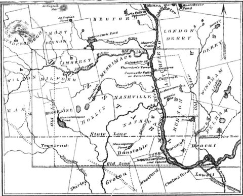
Dunstable was first settled by Europeans in 1656 and was officially incorporated in 1673. It is likely named after the town of Dunstable in Bedfordshire, England, home of Edward Tyng, the town's first settler. The original township of Dunstable, granted in 1661, consisted of two hundred square miles, including the Massachusetts towns of Dunstable, Pepperell, Townsend and Tyngsborough, the New Hampshire towns of Hudson, Nashua and Hollis, and parts of other towns as well. Increases in population leading to subsections becoming independent towns and the delineation of the northern boundary of Massachusetts in 1740 placed the northern part of Dunstable (present day Nashua) in New Hampshire, so the southern part remains the Dunstable of today.
Passages that mention Dunstable, cut from the printed page as they were published.
History of the town of Townsend, Middlesex County, Massachusetts1878 · page 48Read the page →
Read the text
gave in the following report, viz : "The committee appointed bv the Great and general court on the 26th of Feb. 1730 to take a survey of a line between the North Town in Turkey Hills and Dunstable and to make a report whether the plan of the said North Town encroaches upon the town of Dunstable according to its true and allowed bounds, and what quantity of land it takes off from it, and also to make enquiry how tar the
Text read by machine from the scan; it may contain errors.
History of the town of Townsend, Middlesex County, Massachusetts1878 · page 51Read the page →
Read the text
forty rods to a heap of stones at Groton north west corner ; iVom thence running due north, leaving eighty acres out of the plan, to the town of Dunstable : then running from Dunstable west line on province land, west thirty-one degrees and an half north, two thousand two hundred and forty rods, to a tree marked ; then running south, thirtysix degrees west, to the northwest corner of Lunenburg, where the bounds first began, one thousand nine hundred
Text read by machine from the scan; it may contain errors.
Scans and text from the Internet Archive. Books published in 1930 or earlier, which are in the public domain.
By decade
Dunstable, decade by decade
4 decades in the archive, from the 1840s to the 1930s. Scroll each row; tap a photo for its story.
Nothing in the archives for these yearsWeddings on Main Street, storms, parades, school pictures, the old store. If it’s in your family album, it belongs here.
In 1656, according to Wikidata and Wikipedia’s history of the town. Dunstable’s post office opened in 1829, and the first U.S. census counted 380 people here in 1790.
How does Dunstable rank for history?
Dunstable is more historic than 85% of U.S. towns, #187 of 283 in Massachusetts. The History grade combines the town’s founding era, the share of homes built before 1940 and its National Register listings. It’s a character grade, so it isn’t part of the overall grade. How it works.
What is on the National Register in Dunstable?
Two places: the Dunstable Town Hall (listed 1999) and the Dunstable Center Historic District (2018).
How old are the homes in Dunstable?
9% of Dunstable’s homes were built before 1940 (Census estimate, ±3.7 points), against a typical 21% for a Massachusetts town; the median home was built in 1987.
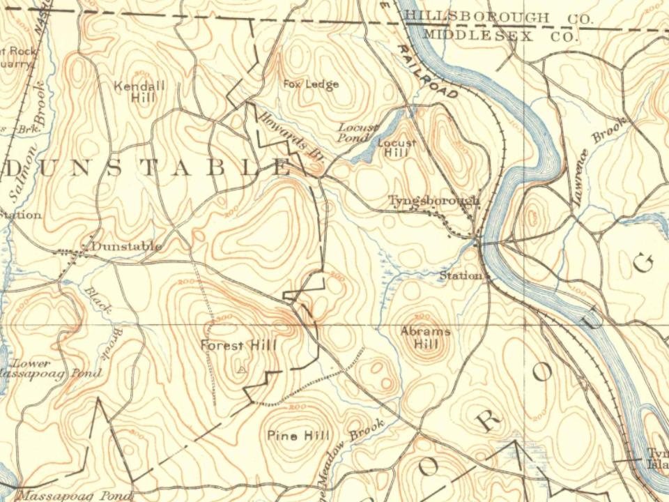
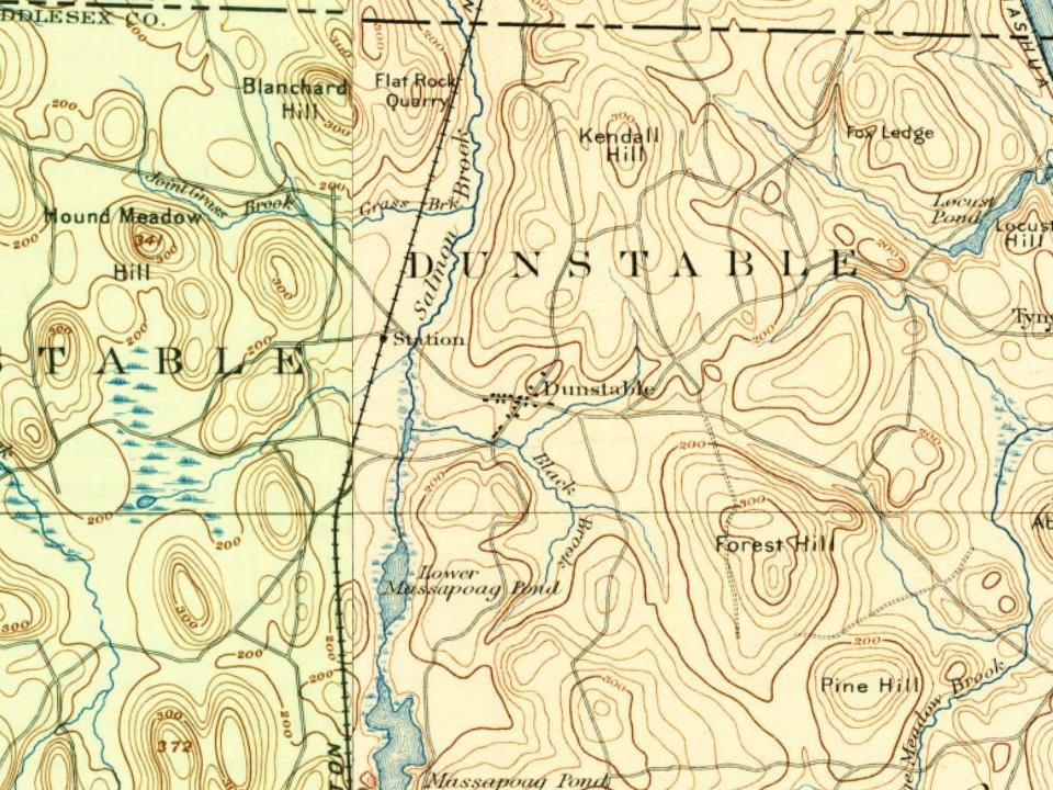
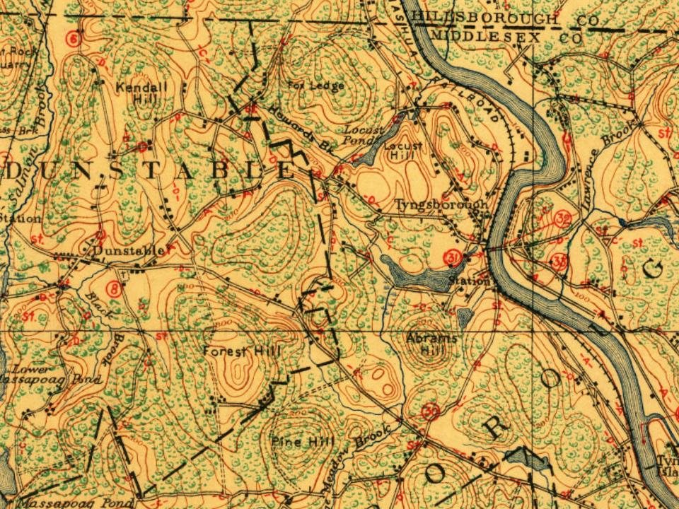
Founding dates: Wikidata, Wikipedia, the U.S. post office records of Blevins & Helbock (CC0) and the Census. Homes by year built: Census ACS 2020–24. National Register of Historic Places: National Park Service (list of May 22, 2026). Old photos, postcards and papers: Wikimedia Commons, the Library of Congress and other public archives, credited on each item’s page. Maps: U.S. Geological Survey historical topographic maps (via Esri) and Sanborn fire-insurance maps (Library of Congress). History text and census tables: Wikipedia (CC BY-SA 4.0). Places that used to be: USGS Geographic Names Information System (2021).
From Wikimedia Commons (5), Wikidata (1), the National Register of Historic Places (2), Wikipedia, Wikidata and Wikipedia for famous people, U.S. Geological Survey historical maps, U.S. Census counts (via Wikipedia), the US Post Offices dataset (Blevins & Helbock), the USGS Geographic Names Information System and old county and town histories (Internet Archive). Archive images are copied here with their credits and licenses, shown on each photo’s page. Refreshed monthly.





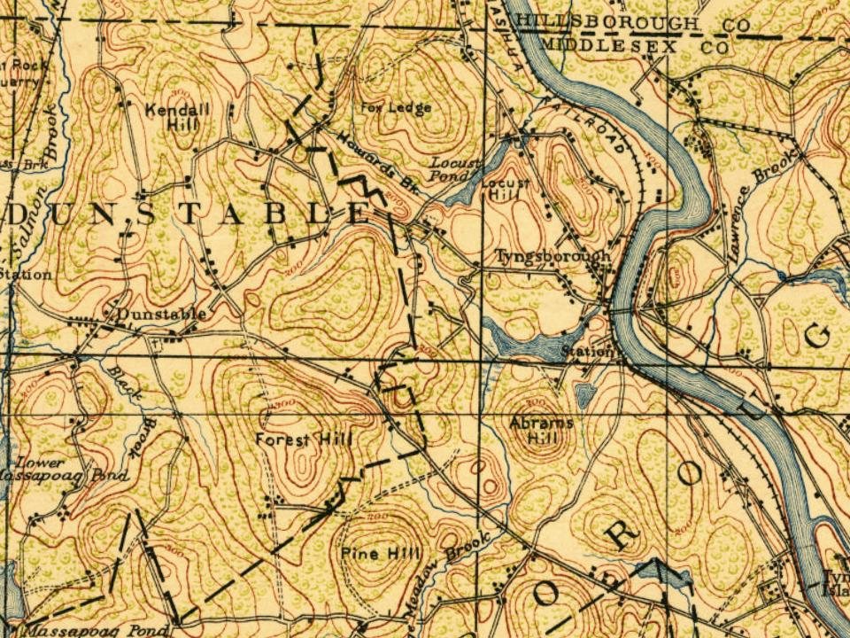
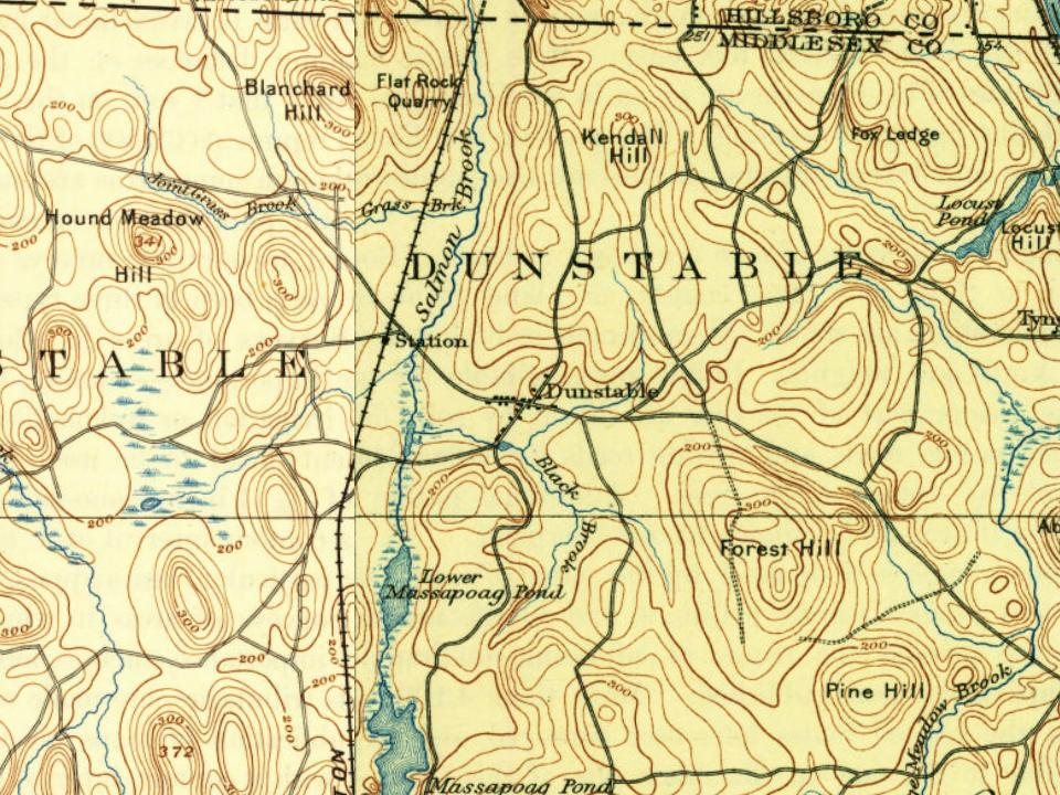
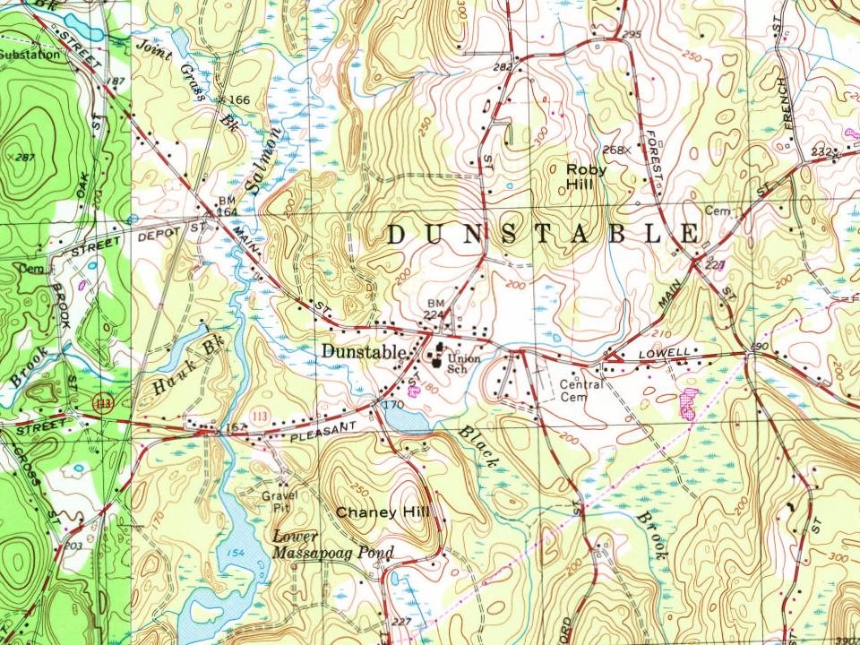
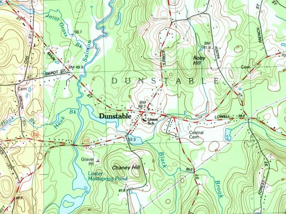


 2007

