180 years in pictures
Census counts: 6,126 in 1980, 6,927 in 2020. The archive holds 6 old photos and papers going back to 1887 and 7 maps from 1886 on.
- 1846Cochituate is settled
Each edition grades its towns against each other only.

77% of adults 25 and older hold a bachelor’s degree or more in Cochituate, against 47% in Massachusetts’ towns and 29% across U.S. towns. No town among the 284 in Massachusetts we compare has a lower share of working residents who work in town than Cochituate. Cochituate’s trail network density is 2.6 miles per square mile, above both the Massachusetts town median (1.8) and the median of U.S. towns (0.4). The biggest park or preserve is Cochituate State Park, at 171 acres. We don’t grade Cochituate yet; the figures below are still real.
Where Cochituate beats most towns.
Where Cochituate’s working residents go each day. Line width shows the share.
Census LEHD 2023
Census counts: 6,126 in 1980, 6,927 in 2020. The archive holds 6 old photos and papers going back to 1887 and 7 maps from 1886 on.
Museums, parks, gardens and other places to visit around Cochituate. Close and well known come first.
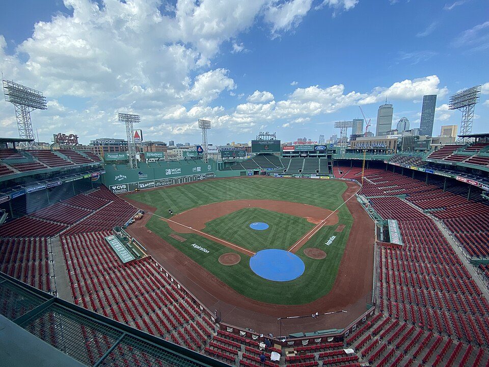
Big draw13 mi Stadium & arenaFenway Park
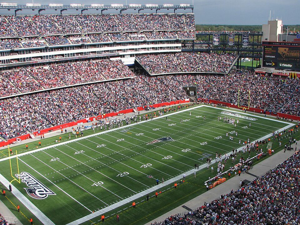
Big draw17 mi Stadium & arenaGillette Stadium
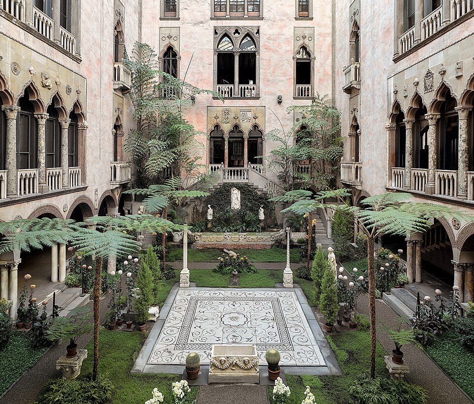
Big draw13 mi MuseumIsabella Stewart Gardner Museum
8 mi LakeWalden Pond
Big draw32 mi LakeLake Chaubunagungamaug
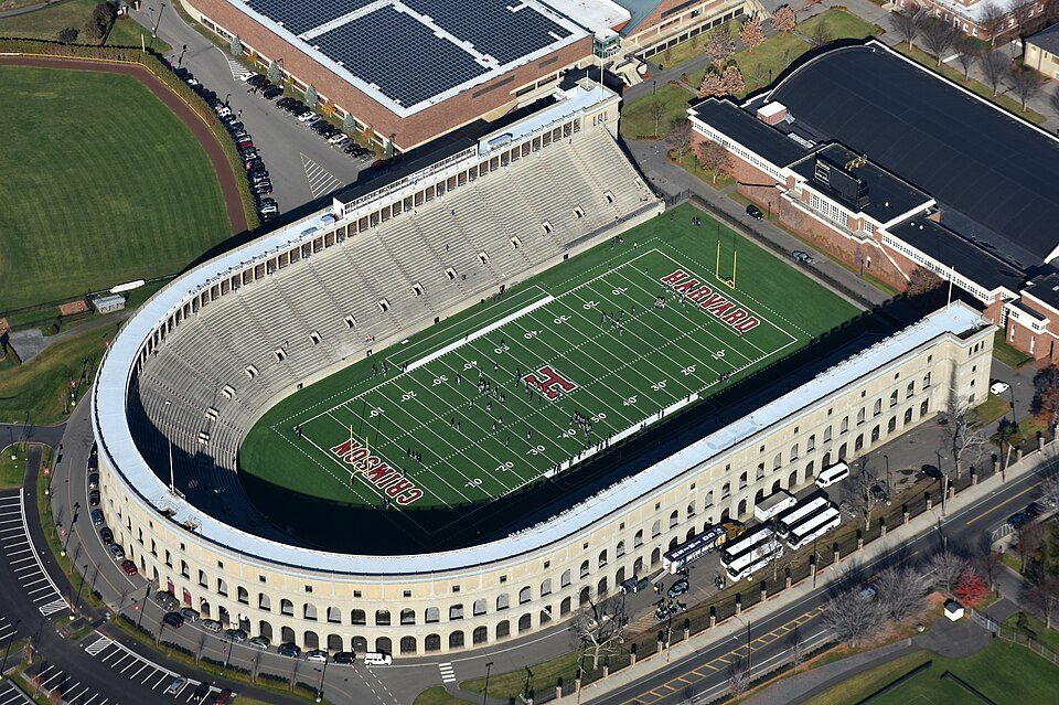
12 mi Stadium & arenaHarvard StadiumFenway Park: Gatorfan252525, CC BY-SA 4.0 · Gillette Stadium: Bernard Gagnon, CC BY-SA 3.0 · Isabella Stewart Gardner Museum: Sean Dungan, CC BY-SA 4.0 · Walden Pond: Victorgrigas, CC BY-SA 3.0 · Lake Chaubunagungamaug: Bree from Worcester, MA, USA, CC BY-SA 2.0 · Harvard Stadium: Nick Allen, CC BY-SA 4.0
Cochituate is unincorporated, so Middlesex County and regional agencies provide most services.
EPA SDWIS (Oct 9, 2026) · HIFLD + EIA-861 2025 · Census 2020 ZCTAs · NCES 2024–25 · registration: vote.gov, updated Nov 18, 2024.
Ordered by what stands out in Cochituate.
Since 1978, 6 flood insurance claims have been paid out in Cochituate. Expected storm and flood damage is lower than in 92% of U.S. communities. FEMA puts 63% of the town’s expected hazard losses down to inland flooding, and 12% to hurricanes.
FEMA flood insurance claims · FEMA National Risk Index · OpenFEMA
The median commute is under 13 miles. Cochituate’s median household income is $192,000. The top destinations are Boston (21%), Cambridge (7%) and Wayland (6%). Among residents in the town, 4.6% live below the poverty line.
| Cochituate | Massachusetts towns | U.S. towns | |
|---|---|---|---|
| Work from home | 37% | 18% | 11% |
| Median household income | $192,000 | $120,000 | $80,000 |
| Below the poverty line | 4.6% | 6% | 9.6% |
| Average trip to work | 28 minutes | 30 minutes | 25 minutes |
Census LEHD 2023 · ACS
A winter brings about 46 inches of snow, with January nights at 17° and July afternoons at 84°.
NOAA U.S. Climate Normals, 1991–2020
Trails run 11 miles in 15 parks and preserves. Parks and preserves in Cochituate: 15, covering 384 acres.
| Biggest places to walk | Trails | Acres |
|---|---|---|
| 1. Town of Wayland | 1.4 mi | 65 |
| 2. Hamlen Woods | 0.9 mi | 33 |
| 3. Timber Lane Conservation Area | 0.3 mi | 9 |
Trails & parks © OpenStreetMap contributors · Conserved land: USGS PAD-US
Cochituate: 7.3% of adults smoke cigarettes. 13% of adults in Cochituate report frequent mental distress; 9.5% report frequent physical distress.
| Cochituate | Massachusetts towns | U.S. towns | |
|---|---|---|---|
| Obesity (CDC PLACES) | 22% | 28% | 35% |
| Frequent mental distress (CDC PLACES) | 13% | 16% | 17% |
| Frequent physical distress (CDC PLACES) | 9.5% | 12% | 14% |
| Smoke cigarettes (CDC PLACES) | 7.3% | 11% | 14% |
| What stands out | Cochituate | MA |
|---|---|---|
| Fewer uninsured adults | 2.5% | 5.2% |
| Fewer adults facing food insecurity | 6.2% | 12.4% |
| More adults who have had cancer | 10.1% | 8.5% |
CDC PLACES 2025 · modeled estimates for adults · CMS · HRSA
Homes sold in Cochituate spent a median 26 days on the market. For households in the town, the share who are owner-occupiers is 86%. The midpoint rent here is $1,582 a month.
| Cochituate | Massachusetts towns | U.S. towns | |
|---|---|---|---|
| Households that own their home | 86% | 79% | 73% |
| Median rent | $1,582 a month | $1,683 a month | $1,185 a month |
Census ACS, 2020–24 · Zillow Home Value Index · Redfin Data Center
47 within 15 miles of the center of Cochituate
About 3 of every 100 Cochituate residents are enrolled in college, against 8 across Massachusetts.
Census-designated place in Massachusetts, United States
Cochituate (; koh-CHIT-choo-it) is a census-designated place (CDP) in the town of Wayland in Middlesex County, Massachusetts, United States. The population was 6,927 at the 2020 census, out of 13,943 in the entire town of Wayland.
From Wikipedia, licensed CC BY-SA 4.0 · facts via Wikidata (CC0)
3 towns share a border with Cochituate.
| Town | MA rank | Overall | Cost | Safety | Schools | Health |
|---|---|---|---|---|---|---|
| Cochituate | — | — | — | — | — | — |
| Wayland | #6 | A+ | C | A | A+ | A+ |
| Natick | #72 | A | D | B− | A | A+ |
| Framingham | #235 | C | D | C+ | D | A− |
Cochituate isn’t graded (fewer than 1,000 residents, or not enough data). Compare Cochituate with a neighbor →
Short answers, built from the data on this page.
We don’t grade Cochituate yet; the figures below are still real.