Guest, Sign inJoin

Post to Carlisle

We’ll email a one-tap link to publish your post. No password, and nothing is public until you click it.
Already a member? Sign in
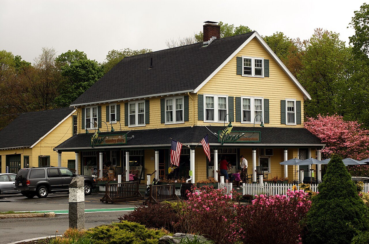
Ferns Country StorePhoto: Tim Pierce · CC BY 3.0
A+Outdoors
Outdoors in Carlisle

Carlisle has 67 miles of mapped trails, 4.4 for every square mile of land

2,275 acres are parks and preserves, 434 per 1,000 residents. 21% of Carlisle’s land is conserved, about 2,052 acres. 96% of residents live within a half mile of a park.

Among the top 1% of U.S. towns · #41 of 283 in Massachusetts. What drives it

Conserved land
21%
2,052 acres · of 15.3 sq mi of land
Trails
67 mi
4.4 per sq mi of land
Park land
2,275 ac
434 acres per 1,000 residents
Near a park
96%
of residents within ½ mile
Bike routes
0.2 mi
0.2 mi paths
Highest peak
344 ft
Hemlock Hill
Lakes & rivers
10

What kind of outdoors town is Carlisle?

Read from the map. The page puts what stands out first.

Outdoors grade

How much outdoors does Carlisle have?

On conserved land, trails, park land and how close residents live to a park, Carlisle is among the top 1% of U.S. towns, #41 of 283 in Massachusetts. All four inputs are above most U.S. towns; trail miles rank highest, the share of residents near a park lowest.

A+
OutdoorsA character grade: shown, never part of Carlisle’s overall grade.
All U.S. towns we grade (21,298)Among the top 1%
LessMore
Massachusetts towns of 2,500+ (283)Ahead of 86%

Massachusetts towns conserve more land than most (a typical one, 21%; the U.S., 4%), so Carlisle’s 21% is ahead of 49% of Massachusetts towns, while its trails per square mile lead 93% of them.

How sure. Graded on any three of the four inputs instead, the letter would still be A+. Trails and many small parks come from OpenStreetMap, mapped by volunteers, so coverage varies from town to town; the half mile is a straight line from each census block, so a river or highway in the way isn’t counted against it.

PAD-US, OpenStreetMap (© OpenStreetMap contributors), Census 2025 Gazetteer and 2020 blocks; details in Sources below. How TownRatings grades the outdoors →

The map

Conserved land, trails & bike routes

Tap a number to zoom to a park. Tap a layer to hide it.

12345678
Easements protect land from building but are usually private.© OpenStreetMap contributors · USGS PAD-US
Places to walk

Pick a walk

The longest trail network is Great Brook Farm State Park, with 21.7 miles. Directions go to the nearest trailhead or public parking.

Great Brook Farm State Park

Nature preserve
912 acres21.7 mi of trail
Pine Point LoopAcorn TrailWoodchuck TrailTophet West+1
Dog rules not recorded
Directionsto the parking lot

Greenough Land

Nature preserve
235 acres4.1 mi of trail
Wood Duck TrailPines LoopBlueberry TrailRiver Trail+1
Dog rules not recorded
Directionsto the parking lot

Towle Land

Nature preserve
109 acres3.2 mi of trail
Towle Field TrailTowle Inner LoopTowle Outer LoopBingham Connector+1
Dog rules not recorded
Directionsto Towle Land Parking

Great Meadows National Wildlife Refuge

Managed by United States Fish and Wildlife Service
310 acres2.9 mi of trail
River TrailBeaver TrailRed Tail TrailRed-Tail Trail+1
No dogs
Directionsto Hunter's Parking

Cranberry Bog Conservation Land

Nature preserve
154 acres2.8 mi of trail
East Bog LoopWest Bog LoopPipeline TrailShoreline West Trail+1
Dog rules not recorded
Directionsto the parking lot

Davis Corridor

Managed by Town of Carlisle Conservation Commission
127 acres2.4 mi of trail
Davis TrailLink TrailWoodhaven TrailBlood Farm Trail+1
Dog rules not recorded
Directionsto the parking lot

Carlisle Town Forest

Nature preserve
70 acres2 mi of trail
Town Forest TrailSandy's PathHurricane AlleyCoyote Rock Trail+1
Dog rules not recorded
Directionsto the parking lot

Foss Farm

Nature preserve
57 acres1.9 mi of trail
Foss Farm Loop TrailSouth Field LoopWoods LoopPitch Pine Path
Dog rules not recorded
Directionsto the parking lot
All 62 parks & preserves
Great Brook Farm State Park912 acres · 21.7 mi of trail
Directions
Greenough Land235 acres · 4.1 mi of trail
Directions
Towle Land109 acres · 3.2 mi of trail
Directions
Great Meadows National Wildlife Refuge310 acres · 2.9 mi of trail · United States Fish and Wildlife Service
Directions
Cranberry Bog Conservation Land154 acres · 2.8 mi of trail
Directions
Davis Corridor127 acres · 2.4 mi of trail · Town of Carlisle Conservation Commission
Directions
Carlisle Town Forest70 acres · 2 mi of trail
Directions
Foss Farm57 acres · 1.9 mi of trail
Directions
Benfield Conservation Land44 acres · 1.1 mi of trail
Directions
Ben's Woods46 acres · 0.9 mi of trail
Directions
Spencer Brook Reservation30 acres · 0.8 mi of trail · Carlisle Conservation Foundation
Directions
Russell Conservation Land22 acres · 0.8 mi of trail
Benfield Hill15 acres · 0.8 mi of trail
Conant Land60 acres · 0.7 mi of trail
Directions
Banta-Davis Recreation Area42 acres · 0.7 mi of trail
Directions
Carlisle Pines State Forest25 acres · 0.7 mi of trail · Division of State Parks and Recreation
Directions
Bisbee Land34 acres · 0.6 mi of trail
Malcolm Preserve11 acres · 0.6 mi of trail · Carlisle Conservation Foundation
Directions
Elliott Concord River Preserve9 acres · 0.6 mi of trail
Directions
Estabrook Woods94 acres · 0.5 mi of trail
Hart Land72 acres · 0.5 mi of trail
Rangeway8 acres · 0.5 mi of trail
Mannis Land30 acres · 0.4 mi of trail
Woodhaven Farm29 acres · 0.4 mi of trail
Malcolm Land23 acres · 0.4 mi of trail · Town of Carlisle Conservation Commission
Directions
Sachs Greenway9 acres · 0.4 mi of trail · Town of Carlisle Conservation Commission
MacAfee Land15 acres · 0.3 mi of trail
Directions
Rockstrom Land7 acres · 0.3 mi of trail · Town of Carlisle Conservation Commission
Carr Land6 acres · 0.3 mi of trail · Town of Carlisle Conservation Commission
Poole's Swamp14 acres · 0.2 mi of trail · Carlisle Conservation Foundation
Fox Hill12 acres · 0.2 mi of trail · Town of Carlisle Conservation Commission
Directions
Wilson Land57 acres · 0.1 mi of trail · Carlisle Conservation Foundation
Ember Lane Cluster21 acres · 0.1 mi of trail
Town DPW Land18 acres · 0.1 mi of trail
Hart Farm Property13 acres · 0.1 mi of trail
Spalding Field10 acres · 0.1 mi of trail
Directions
Deacon Land7 acres · 0.1 mi of trail · Town of Carlisle Conservation Commission
Woodward Conservation Land5 acres · 0.1 mi of trail · Town of Carlisle Conservation Commission
Holmes-Avery Land5 acres · 0.1 mi of trail · Carlisle Conservation Foundation
Moseley Land5 acres · 0.1 mi of trail
Directions
Erickson Land4 acres · 0.1 mi of trail · Carlisle Conservation Foundation
Swanson Family Conservation Land3 acres · 0.1 mi of trail
Directions
Suffolk Ln. Extension2 acres · 0.1 mi of trail
Swanson Land19 acres
Robbins Field19 acres
Hutchins Field17 acres
Buttrick Woods14 acres
Gage Woodland13 acres
Fisk Meadow11 acres
Pannell Land11 acres · Carlisle Conservation Foundation
Pines Woodlot10 acres · Carlisle Conservation Foundation
Ryan Land9 acres
Pages Brook Reservation9 acres · Carlisle Conservation Foundation
Directions
Clark Woodlot8 acres · Carlisle Conservation Foundation
Heidke Parcel8 acres
Fleming Land6 acres · Carlisle Conservation Foundation
Cote-Foster Land5 acres · Carlisle Conservation Foundation
Taylor Land4 acres · Carlisle Conservation Foundation
Swanson Lot3 acres · Carlisle Conservation Foundation
Diment Park2 acres
Directions
Carlisle Development Co.1 acres
Center Park1 acres
Directions
Who protects it

2,052 conserved acres

21% of Carlisle’s land. Who manages Carlisle’s conserved land, from the USGS Protected Areas Database. Approximate, because parcels can overlap.

Land trusts & nonprofits1,376 ac
U.S. Fish and Wildlife Service679 ac
Town or city593 ac
Other state land72 ac
State parks34 ac
Private owners16 ac
Not recorded518 ac
Conservation Easement · 1,578 acNational Wildlife Refuge · 679 acLocal Other or Unknown · 390 acPrivate Conservation · 129 acResearch or Educational Area · 110 ac
Good to know

Conserved doesn’t always mean open to visitors. 920 acres are conservation easements, usually private land. Public access isn’t recorded for 8 of 186 parcels. The walks above are places people visit.

The biggest protected parcels
Parcel (PAD-US)Managed byAcresPublic access
Great Meadows National Wildlife Refuge
National Wildlife Refuge
U.S. Fish and Wildlife Service679Restricted
Cranberry Bog Conservation Land
Local Other or Unknown
Not recorded137Open
Towle Field
Local Other or Unknown
Not recorded109Open
Estabrook Woods
Research or Educational Area
Land trusts & nonprofits93Open
Town Forest
Local Resource Management Area
Town or city70Open
Conant Land
Local Other or Unknown
Not recorded61Open
Great Brook Farm State Park
State Park
Not recorded30Open
Spencer Brook Reservation
Private Conservation
Not recorded30Open
Unknown Park
Local Conservation Area
Town or city27Open
Carlisle State Forest
State Resource Management Area
State parks22Open

5 smaller protected places aren’t shown.

Things to do

11 places to go in Carlisle

Beaches, playgrounds, peaks, falls and more. Pick a kind.

Scenic views in Carlisle
Cranberry BogIn Davis Corridor
Directions
Observation DeckIn Benfield Conservation Land
Directions

Plus 1 scenic view without a name on the map. Tap “Show all on map” to see it.

Trails & water

25 named trails and 10 lakes & rivers

Named trails
Open to bikes · 24.7 miHorses · 5.7 miUnpaved · 30.6 mi
Pine Point Loop1.5 mi
Acorn Trail1.4 mi
River Trail1.3 mi
Woodchuck Trail1.1 mi
Wood Duck Trail1.1 mi
Tophet West1.1 mi
Davis Trail1.0 mi
Lantern Loop1.0 mi
Fern Loop0.9 mi
Litchfield Loop0.9 mi
15 more trails
Russell Trail
0.9 mi
Marion's Trail
0.9 mi
Heartbreak Ridge
0.8 mi
Towle Field Trail
0.8 mi
Tophet East
0.8 mi
Twin Peaks Trail
0.8 mi
Stone Row
0.8 mi
Deer Run
0.7 mi
Towle Inner Loop
0.7 mi
East Bog Loop
0.7 mi
West Bog Loop
0.7 mi
Beaver Trail
0.7 mi
Blood Farm Trail
0.7 mi
Center Pathway
0.6 mi
Bates Farm Trail
0.6 mi
Lakes & rivers tap for directions
Biking & sports

0.2 miles of bike routes

Bike lanes are often missing from the map in smaller towns, so that number is likely low.

0.2 mi
off-road bike paths
Courts & fields
13Tennis
2Baseball
2Equestrian
1Beach volleyball
1Soccer

Includes school and college facilities, which aren’t always open to the public.

History along the way

2 places on the National Register

The country’s official list of places worth saving (National Park Service). The map also marks 4 historic points from OpenStreetMap: plaques, memorials and old buildings.

History →
George Robbins HouseBuilding · listed 1990
About it
Zeb Spaulding HouseBuilding · listed 1990
About it
When to get out

The best walking months in Carlisle: April to September

NOAA’s 1991–2020 normals for the town and the daylight at its latitude. Outlined months have long days, highs of 59 to 86 °F and little rain for the place.

JanFebMarAprMayJunJulAugSepOctNovDec
Daylight (h)9.410.511.813.314.615.315.013.912.411.09.79.1
High (°F)363846597079848275635141
Rain (in)3.43.34.24.13.74.13.63.73.94.83.84.3

February is the driest month (3.3 in) and July the warmest (highs of 84 °F). 4.8 inches fall in October, the wettest month. The climate in Carlisle →

Next door

Carlisle and its neighbors

Tap a town to see its outdoors.

TownConserved
of land
Trail mi
per sq mi
Park acres
per 1,000
Near a park
½ mile
Outdoors
Carlisle21%4.443496%A+
Bedford23%3.58099%+A+
Billerica12%2.13095%A
Chelmsford13%1.62687%A
Acton23%3.18699%A+
Concord37%5.119899%+A+
Westford24%4.610497%A+

The four inputs of the Outdoors grade, from the engine; shares are of land, not water.

Questions about parks and trails in Carlisle

Where can I hike in Carlisle?

The longest trail networks: Great Brook Farm State Park, 21.7 miles; Greenough Land, 4.1 miles; Towle Land, 3.2 miles; Great Meadows National Wildlife Refuge, 2.9 miles. Each one is on the map above, with directions to the nearest trailhead or parking.

How much of Carlisle is conserved land?

21% of its land, against a typical 21% for a Massachusetts town and 4% nationally (PAD-US). Conserved doesn’t always mean open to visitors: easements are usually private land.

Are dogs allowed on Carlisle’s trails?

Great Brook Farm State Park and Greenough Land don’t have dog rules recorded on the map; check the signs at the trailhead.

Where can I bike in Carlisle?

0.2 miles of bike routes are on the map: 0.2 of off-road paths.

Is there public land near Carlisle?

46,101 acres of parks and open public land lie inside Carlisle or within 10 miles of it (PAD-US), 2,449 of them inside the town line.

How much outdoors does Carlisle have?

Among the top 1% of U.S. towns on the Outdoors grade, #41 of 283 in Massachusetts. The grade combines the share of land that is conserved, miles of mapped trail per square mile of land, park acres per 1,000 residents and the share of residents within a half mile of a park. It’s a character grade, so it isn’t part of the overall grade. How it works.

Trail talk

Conditions, parking and favorite walks from Carlisle neighbors.

Town Square →
Share a tip
Sources

Where this page comes from

Conserved and public land: USGS Protected Areas Database of the United States (PAD-US), service updated July 2026. Parks, trails, playgrounds, beaches and other places: OpenStreetMap (© OpenStreetMap contributors, ODbL), map data as of 2026-10-28. Land and water area: Census 2025 Gazetteer. Residents near a park: 2020 Census blocks. National Register: National Park Service. How TownRatings grades the outdoors →