Guest, Sign inJoin

Post to Brookline

We’ll email a one-tap link to publish your post. No password, and nothing is public until you click it.
Already a member? Sign in
A+History
History · Brookline

Brookline dates to 1638, and 52% of its homes were built before 1940

Among the most historic 1% of U.S. towns · #11 of 283 in Massachusetts. What drives it

95 places in town are on the National Register, among them 4 National Historic Landmarks and ten historic districts with 943 buildings between them. Below: 17 old photos and papers, maps from 1893 on, and the census since 1790.

1638founded
95on the National Register
52%homes built before 1940
17old photos & papers
50famous people
From Brookline’s archive · credits on each photo
Quick answers

How Brookline began

When was Brookline founded?

1638

Brookline dates its founding to 1638 (Wikidata). It appears in the first U.S. census, 1790.

First census: 484 in 17902020 census: 63,191388 years

How historic is Brookline?

A+

Among the most historic 1% of U.S. towns, on its age, its old homes and the National Register.

What drives the grade ↓
Founding year: Wikidata. First post office: 1829.The full story ↓
History grade

What drives Brookline’s History grade

On its age, its old homes and the National Register, Brookline is among the most historic 1% of U.S. towns, #11 of 283 in Massachusetts. All 3 inputs put Brookline near the top nationally; its share of homes from before 1940 ranks highest.

A+
HistoryA character grade: shown, never part of Brookline’s overall grade.
All U.S. towns we grade (21,289)Among the top 1%
NewerOlder
Massachusetts towns of 2,500+ (283)Ahead of 96%

Massachusetts towns list more on the Register than most of the country (a typical Massachusetts town has 46.0 per 10,000 residents, the U.S. 2.4), so Brookline’s 184 sits above most of its state (74% of Massachusetts towns have fewer) while its 1,162 historic buildings outnumber those of 99% of U.S. towns.

NoteThe founding year comes from Wikidata alone; no second source gives 1638.
How sure. Graded on any two of the three inputs instead, the letter would still be A+. The pre-1940 share (±2.2 points) is firm at this size.

Founding year: Wikidata (other dates in Quick answers). Homes: Census ACS 2020–24. National Register: National Park Service, May 2026 list; each listing counted once (boundary changes and added documentation belong to their listing), and a historic district counts its contributing buildings. How TownRatings grades history →

What stands out about Brookline’s past

Read from the archive, the National Register and the record. The page puts what stands out first.

★ What stands out · On the National Register

95 listings protect 1,162 historic buildings

The country’s official list of buildings and places worth saving. 4 are National Historic Landmarks, the highest tier. Boundary changes and added documentation are counted with their listing.

places listed
95
National Historic Landmarks
4
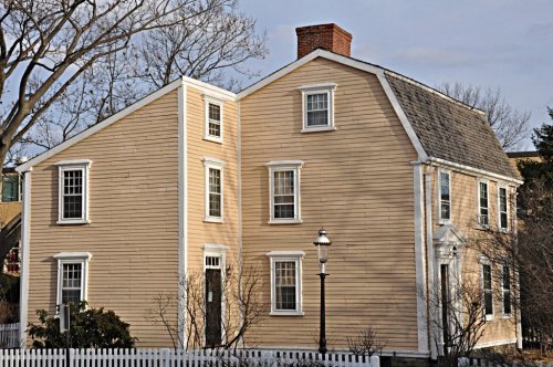
Frederick Law Olmsted House, National Historic …
historic buildings protected
1,162
each building in a district counts
first listed
1966
Frederick Law Olmsted House, National Historic …
St. Mark's Methodist ChurchPill Hill Historic DistrictEdward Devotion HouseCottage Farm Historic DistrictLongwood Historic DistrictBrookline Village Commercial DistrictBrookline Town Green Historic DistrictRichmond CourtAlfred Douglass House, built 1910Anderson, Larz, Park Historic DistrictBeacon Street Historic DistrictBeaconsfield Terraces Historic DistrictBenjamin White HouseBrandegee Estate, built 1894Building at 30-34 Station StreetCandler Cottage, built 1850Charles Heath House, built 1855Chestnut Hill Historic DistricCypress-Emerson Historic DistrictDr. Tappan Eustis Francis HouseEbenezer Heath HouseEliphalet Spurr HouseEmmett CottageFernwoodFire Station No. 7Fisher Hill Historic DistrictGen. Simon Elliot HouseGinery Twitchell HouseGraffam Development Historic DistrictGreen Hill Historic DistrictHolyhood Cemetery, built 1857Hotel AdelaideHotel KempsfordHouse at 105 Marion StreetHouse at 12 Linden Street, built 1844House at 12 Vernon Street, built 1890House at 12-16 Corey RoadHouse at 156 Mason Terrace, built 1889House at 19 Linden Street, built 1846House at 25 Stanton Road, built 1850House at 38-40 Webster PlaceHouse at 4 Perry Street, built 1843House at 44 Linden StreetHouse at 44 Stanton Road, built 1865House at 5 Lincoln Road, built 1852House at 53 Linden StreetHouse at 83 Penniman Place, built 1837House at 89 Rawson Road and 86 Colburne Crescent, built 1900House at 9 Linden Street, built 1846Houses at 76-96 Harvard AvenueIsaac Child House, built 1740James H. Standish HouseJohn Goddard HouseJohn Harris House and FarmKilsyth TerraceLewis Cabot EstateLinden ParkLinden SquareLynch-O'Gorman HousePaine EstatePerkins EstateReservoir ParkRev. John Orrock HouseRitchie BuildingRobert S. Davis HouseRoughwoodSaint Aidan's Church and Rectory, built 1850Saint Mary of the Assumption Church, Rectory, School and Convent, built 1880Saint Paul's Church, Chapel, and Parish HouseSaint Paul's RectorySargent's PondSecond Unitarian ChurchStrathmore Road Historic District, built 1904Thaddeus Jackson HouseThomas Aspinwall Davis HouseTimothy Corey House No. 1Timothy Corey House No. 2Town StableWalnut Hills Cemetery, built 1875White Place Historic DistrictWilliam F. Tuckerman HouseWilliam Ingersoll Bowditch HouseWilliam Murphy HouseWinand Toussaint House, built 1881Dutch House, TheFisher Hill Reservoir and GatehouseHammond Pond ParkwayWest Roxbury Parkway, Metropolitan Park System of Greater BostonArcade Building, built 1926MilestoneMilestoneFrederick Law Olmsted House, National Historic Site★John Fitzgerald Kennedy National Historic Site★George R. Minot House★Brookline Reservoir of the Cochituate Aqueduct★
BuildingsDistrictsSitesStructuresObjects★ landmark

Architectural styles listings

Greek Revival17
Italianate15
Georgian Revival13
Queen Anne11
Colonial Revival8
Federal8
All 95 listings
Brookline Village Commercial DistrictDistrict · listed 1979Brookline Town Green Historic DistrictDistrict · listed 1980Richmond CourtDistrict · listed 1985Alfred Douglass HouseBuilding · listed 1985Anderson, Larz, Park Historic DistrictDistrict · listed 1985Beacon Street Historic DistrictDistrict · listed 1985Beaconsfield Terraces Historic DistrictDistrict · listed 1985Benjamin White HouseBuilding · listed 1985Brandegee EstateBuilding · listed 1985Building at 30-34 Station StreetBuilding · listed 1985Candler CottageBuilding · listed 1985Charles Heath HouseBuilding · listed 1985Chestnut Hill Historic DistricDistrict · listed 1985Cypress-Emerson Historic DistrictDistrict · listed 1985Dr. Tappan Eustis Francis HouseBuilding · listed 1985Ebenezer Heath HouseBuilding · listed 1985Eliphalet Spurr HouseBuilding · listed 1985Emmett CottageBuilding · listed 1985FernwoodBuilding · listed 1985Fire Station No. 7Building · listed 1985Fisher Hill Historic DistrictDistrict · listed 1985Gen. Simon Elliot HouseBuilding · listed 1985Ginery Twitchell HouseBuilding · listed 1985Graffam Development Historic DistrictDistrict · listed 1985Green Hill Historic DistrictDistrict · listed 1985Holyhood CemeterySite · listed 1985Hotel AdelaideBuilding · listed 1985Hotel KempsfordBuilding · listed 1985House at 105 Marion StreetBuilding · listed 1985House at 12 Linden StreetBuilding · listed 1985House at 12 Vernon StreetBuilding · listed 1985House at 12-16 Corey RoadBuilding · listed 1985House at 156 Mason TerraceBuilding · listed 1985House at 19 Linden StreetBuilding · listed 1985House at 25 Stanton RoadBuilding · listed 1985House at 38-40 Webster PlaceBuilding · listed 1985House at 4 Perry StreetBuilding · listed 1985House at 44 Linden StreetBuilding · listed 1985House at 44 Stanton RoadBuilding · listed 1985House at 5 Lincoln RoadBuilding · listed 1985House at 53 Linden StreetBuilding · listed 1985House at 83 Penniman PlaceBuilding · listed 1985House at 89 Rawson Road and 86 Colburne CrescentBuilding · listed 1985House at 9 Linden StreetBuilding · listed 1985Houses at 76-96 Harvard AvenueBuilding · listed 1985Isaac Child HouseBuilding · listed 1985James H. Standish HouseBuilding · listed 1985John Goddard HouseBuilding · listed 1985John Harris House and FarmBuilding · listed 1985Kilsyth TerraceBuilding · listed 1985Lewis Cabot EstateBuilding · listed 1985Linden ParkStructure · listed 1985Linden SquareStructure · listed 1985Lynch-O'Gorman HouseBuilding · listed 1985Paine EstateBuilding · listed 1985Perkins EstateBuilding · listed 1985Reservoir ParkStructure · listed 1985Rev. John Orrock HouseBuilding · listed 1985Ritchie BuildingBuilding · listed 1985Robert S. Davis HouseBuilding · listed 1985RoughwoodBuilding · listed 1985Saint Aidan's Church and RectoryBuilding · listed 1985Saint Mary of the Assumption Church, Rectory, School and ConventBuilding · listed 1985Saint Paul's Church, Chapel, and Parish HouseBuilding · listed 1985Saint Paul's RectoryBuilding · listed 1985Sargent's PondStructure · listed 1985Second Unitarian ChurchBuilding · listed 1985Strathmore Road Historic DistrictDistrict · listed 1985Thaddeus Jackson HouseBuilding · listed 1985Thomas Aspinwall Davis HouseBuilding · listed 1985Timothy Corey House No. 1Building · listed 1985Timothy Corey House No. 2Building · listed 1985Town StableBuilding · listed 1985Walnut Hills CemeterySite · listed 1985White Place Historic DistrictDistrict · listed 1985William F. Tuckerman HouseBuilding · listed 1985William Ingersoll Bowditch HouseBuilding · listed 1985William Murphy HouseBuilding · listed 1985Winand Toussaint HouseBuilding · listed 1985Dutch House, TheBuilding · listed 1986Fisher Hill Reservoir and GatehouseStructure · listed 1990Hammond Pond ParkwayDistrict · listed 2004West Roxbury Parkway, Metropolitan Park System of Greater BostonDistrict · listed 2006Brookline Reservoir of the Cochituate AqueductPlace · listed 2015Arcade BuildingBuilding · listed 1985MilestoneObject · listed 1985MilestoneObject · listed 1985

National Park Service, National Register of Historic Places. Photos from Wikimedia Commons, credited on each place’s page.

Timeline

Brookline, 1638 to 1963

Woven from the archive, old maps, post office records, the National Register and the people born here.

  1. 17th century
  2. 1638
    FoundingBrookline is established
  3. 18th century
  4. 1785In the archive1785 Gridley Brookline MassachusettsCentinel June22
  5. 19th century
  6. 1813In the archiveSusannah Heath - landscape of Boston from
  7. 1829Post officeThe Brookline post office opens
  8. 1850BuiltCandler Cottage is built
  9. 1854In the archiveBrookline, Massachusetts, from above the road, five miles from Boston
  10. 1855BuiltCharles Heath House is built
  11. 1874Born hereAmy Lawrence Lowell is born here
  12. 1883Post officeThe Brookline post office closes
  13. 1890In the archiveBrookline Public Library
  14. 1893On the mapFirst mapped by the U.S. Geological Survey
  15. 1894BuiltBrandegee Estate is built
  16. 20th century
  17. 1900In the archiveChamberlain cottage, Beacon Street near Dean Road, Brookline, Massachusetts, by an unknow…
  18. 1910BuiltAlfred Douglass House is built
  19. 1918Born hereMike Wallace is born here
  20. 1925Born hereRobert F. Kennedy is born here
  21. 1933Born hereMichael Dukakis is born here
  22. 1963LandmarkFrederick Law Olmsted House, National Historic Site named a National Historic Landmark
The story

How Brookline came to be

From Wikipedia’s history of Brookline.

Read it all →

Once part of Algonquian territory, Brookline was first settled by European colonists in the early 17th century. The area was an outlying part of the colonial settlement of Boston and known as the hamlet of Muddy River. In 1705, it was incorporated as the independent town of Brookline. It was bounded by a section of the Charles River between the now covered Smelt Brook in the west and the Muddy River in the east.

In 1843, the town had a history of racial discrimination in zoning and a Black population of 2.5%. A typical racially restrictive covenant was formulated to forbade resale of a given property to "any negro or native of Ireland."

Text from Wikipedia, licensed CC BY-SA 4.0.

By decade

Brookline, decade by decade

5 decades in the archive, from the 1780s to the 1900s. Scroll each row; tap a photo for its story.

On the map

Brookline on the map, 1893 to 1987

Every edition of the U.S. Geological Survey’s map of Brookline. Tap a year, or press play to watch the town change.

Brookline on the 1893 USGS mapBrookline on the 1903 USGS mapBrookline on the 1944 USGS mapBrookline on the 1956 USGS mapBrookline on the 1970 USGS mapBrookline on the 1987 USGS map1893Boston sheet · 1:62,500

U.S. Geological Survey historical topographic maps (public domain), via Esri’s collection of the scans. The red ring marks the center of Brookline.

Then & now

Stand where they stood

No then-and-now pairs yet. Take a photo from the same spot as an old one and they appear here side by side.

Brookline, Massachusetts, from above the road, five miles from Boston
Retake this viewBrookline, Massachusetts, from above the road, five miles from Boston, 1854

Find the spot, match the angle, and add your photo. It becomes the first then-and-now pair on Brookline’s page.

Retake this view · +15
People over time

Brookline, census by census

05,00010,00015,00020,00025,00030,00035,00040,00045,00050,00055,00060,00065,00070,0001800185019001950200063,191

Grew from 484 people in 1790 to 63,191 in 2020, more than tenfold.

24 censuses, 1790–2020.

U.S. Census Bureau decennial counts, from the census table on Brookline’s Wikipedia page.

Famous people

50 famous people were born in Brookline

Writers, athletes, leaders and more, ranked by how widely they’re known.

See all →
Places that used to be

Lost post offices, old corners, places now gone and burying grounds

Brookline had its own post office from 1829 to 1883.

Brookline
1829–1883
18201920today
Hamlets and corners on the map
BeaconsfieldBrookline VillageCoolidge CornerLongwood StationReservoirWestbrook Village
Gone or out of use
Brookline HospitalhospitalBrookline StationlocaleBrooks HospitalhospitalChapet StationlocaleLongwood StationlocalePutterham SchoolschoolSaint Marks Churchchurch
3cemeteries and burying grounds inside Brookline
HolyhoodWalnut HillsWalnut Street

US Post Offices dataset (Blevins & Helbock, CC0). Places and cemeteries from the USGS Geographic Names Information System (2021).

Help out

Finish Brookline’s story

Most archives stop around 1920. The photos from after that are in family albums, not libraries.

Decades since 1900 with photos
00s10s20s30s40s50s60s70s80s90s
1 of 10 decades. The empty ones are waiting for someone’s album.
Stories next door

History across the town line

Each neighbor’s History grade, on the same three inputs.

Questions about Brookline’s history

What year was Brookline founded?

In 1638, according to Wikidata. Brookline’s post office opened in 1829, and the first U.S. census counted 484 people here in 1790.

How does Brookline rank for history?

Brookline is among the most historic 1% of U.S. towns, #11 of 283 in Massachusetts. The History grade combines the town’s founding era, the share of homes built before 1940 and its National Register listings. It’s a character grade, so it isn’t part of the overall grade. How it works.

What is on the National Register in Brookline?

95 listings, 4 of them National Historic Landmarks: 67 buildings, among them the Frederick Law Olmsted House, National Historic Site (a National Historic Landmark since 1963), 18 historic districts with 943 contributing buildings, 2 sites, 5 structures, and 2 objects. 1,162 historic buildings in all.

How old are the homes in Brookline?

52% of Brookline’s homes were built before 1940 (Census estimate, ±2.2 points), against a typical 21% for a Massachusetts town; the median home was built in 1938.

Memory lane

What the archives can’t tell you, neighbors can.

Town Square →
Start a conversation
Sources

Where this page comes from

Founding dates: Wikidata, Wikipedia, the U.S. post office records of Blevins & Helbock (CC0) and the Census. Homes by year built: Census ACS 2020–24. National Register of Historic Places: National Park Service (list of May 22, 2026). Old photos, postcards and papers: Wikimedia Commons, the Library of Congress and other public archives, credited on each item’s page. Maps: U.S. Geological Survey historical topographic maps (via Esri) and Sanborn fire-insurance maps (Library of Congress). History text and census tables: Wikipedia (CC BY-SA 4.0). Places that used to be: USGS Geographic Names Information System (2021).

From Wikimedia Commons (6), the Library of Congress (11), Wikidata (18), the National Register of Historic Places (95), Wikipedia, Wikidata and Wikipedia for famous people, U.S. Geological Survey historical maps, U.S. Census counts (via Wikipedia), the US Post Offices dataset (Blevins & Helbock) and the USGS Geographic Names Information System. Archive images are copied here with their credits and licenses, shown on each photo’s page. Refreshed monthly.