Shreveport’s post office opened in 1838, and 61 of its places are on the National Register
More historic than 80% of U.S. towns · #14 of 161 in Louisiana. What drives it
Most of Shreveport was built recently: 6% of its homes predate 1940 and the median home dates from 1973. 61 places in town are on the National Register, among them 2 National Historic Landmarks and seven historic districts with 2,576 buildings between them. Below: 7 old photos and papers, maps from 1885 on, and the census since 1850.
The Shreveport post office opened in 1838, the earliest record of the town by name. Nine smaller post offices, Summer Grove (1840), Woodlawn (1874) and Lawnwood (1880), opened inside today’s city and later closed.
First census: 1,728 in 18502020 census: 187,593188 years
How historic is Shreveport?
A−
More historic than 80% of U.S. towns, on its age, its old homes and the National Register.
Founding year: the first Shreveport post office (Blevins & Helbock, CC0).The full story ↓
History grade
What drives Shreveport’s History grade
On its age, its old homes and the National Register, Shreveport is more historic than 80% of U.S. towns, #14 of 161 in Louisiana. Its National Register listings hold the grade up; its share of homes from before 1940 pulls it down.
A−
HistoryA character grade: shown, never part of Shreveport’s overall grade.
Among the 400 U.S. cities of 100,000 or more, Shreveport ranks #125 on History.
Louisiana towns list more on the Register than most of the country (a typical Louisiana town has 3.8 per 10,000 residents, the U.S. 2.4), so Shreveport’s 146 sits above most of its state (93% of Louisiana towns have fewer) while its 2,634 historic buildings outnumber those of 100% of U.S. towns.
How sure. Graded on any two of the three inputs instead, the letter would range from B− to A+. The pre-1940 share (±0.7 points) is firm at this size. The founding year is the first post office, not a stated founding date.
Founding year: the first post office (other dates in Quick answers). Homes: Census ACS 2020–24. National Register: National Park Service, May 2026 list; each listing counted once (boundary changes and added documentation belong to their listing), and a historic district counts its contributing buildings. How TownRatings grades history →
What stands out about Shreveport’s past
Read from the archive, the National Register and the record. The page puts what stands out first.
The country’s official list of buildings and places worth saving. 2 are National Historic Landmarks, the highest tier. Boundary changes and added documentation are counted with their listing.
National Park Service, National Register of Historic Places. Photos from Wikimedia Commons, credited on each place’s page.
Places that used to be
Lost post offices, old corners, places now gone and burying grounds
Shreveport’s post office has been open since 1838. Nine other post offices opened and closed inside today’s town.
Shreveport
1838–today
Summer Grove
1840–1860
Woodlawn
1874–1877
Lawnwood
1880–1881
Reisor
1881–1914
Flournoy
1883–1927
Jewella
1884–1904
Hadley
1895–1907
Aulds
1901–1907
Cedar Grove
1912–1924
18301930today
Hamlets and corners on the map
Alpha Mobile Home ParkAudrey ParkAuldsBriarcliffBroadmoor TerraceBroadviewBuncombeCannonCedar GroveCentury ParkChasewoodChateau VillageColquitt EstatesCooper RoadCross Lake Hills SouthCut-off JunctionCynthia ParkDorian TerraceEdgewood VillageElkinsEllerbe Road EstatesFairfieldFairway ForestFive Oaks
Gone or out of use
Bnai Zion TemplechurchDodd CollegeschoolLucien AirportairportShreveport Charity HospitalhospitalShreveport Oil FieldoilfieldThornhill Junior High Schoolschool
18cemeteries and burying grounds inside Shreveport
Agudath AchimCarterCarver MemorialCenturies Memorial ParkForest ParkForest Park WestGreenwoodHebrew RestJewellaLight HillLincoln Memorial ParkMcMillanMount Zion Baptist ChurchOaklandRound GroveSaint JosephStarZion Rest
US Post Offices dataset (Blevins & Helbock, CC0). Places and cemeteries from the USGS Geographic Names Information System (2021).
Shreveport was established to create a town at the meeting point of the Red River and the Texas Trail. The Red River was made navigable by Captain Henry Miller Shreve, who led the United States Army Corps of Engineers efforts to clear it. A 180-mile-long (290 km) stretch of intermittent natural log jam, the Great Raft, had previously obstructed passage to shipping. Shreve used a specially modified riverboat, the Heliopolis, to remove the log jam. The company and the village of Shreve Town were named in Shreve's honor.
Nothing in the archives for these yearsWeddings on Main Street, storms, parades, school pictures, the old store. If it’s in your family album, it belongs here.
U.S. Geological Survey historical topographic maps (public domain), via Esri’s collection of the scans. The red ring marks the center of Shreveport.
Every building
Shreveport, building by building, 1885–1909
Fire insurance maps drew every building, what it was made of and what it was used for, so insurers could price the risk of fire. Pick a year, then a sheet.
The Shreveport post office opened in 1838, the earliest record of the town by name (U.S. post office records).
How does Shreveport rank for history?
Shreveport is more historic than 80% of U.S. towns, #14 of 161 in Louisiana. The History grade combines the town’s founding era, the share of homes built before 1940 and its National Register listings. It’s a character grade, so it isn’t part of the overall grade. How it works.
What is on the National Register in Shreveport?
61 listings, 2 of them National Historic Landmarks: 50 buildings, among them the Shreveport Water Works Company, Pump Station (a National Historic Landmark since 1982), and the Col. Robert H. Lindsay House (listed 1973, the first), 7 historic districts with 2,576 contributing buildings, 2 sites, 1 structure, and 1 object. 2,634 historic buildings in all.
How old are the homes in Shreveport?
6% of Shreveport’s homes were built before 1940 (Census estimate), against a typical 3.4% for a Louisiana town; the median home was built in 1973.
Founding dates: Wikidata, Wikipedia, the U.S. post office records of Blevins & Helbock (CC0) and the Census. Homes by year built: Census ACS 2020–24. National Register of Historic Places: National Park Service (list of May 22, 2026). Old photos, postcards and papers: Wikimedia Commons, the Library of Congress and other public archives, credited on each item’s page. Maps: U.S. Geological Survey historical topographic maps (via Esri) and Sanborn fire-insurance maps (Library of Congress). History text and census tables: Wikipedia (CC BY-SA 4.0). Places that used to be: USGS Geographic Names Information System (2021).
From the Library of Congress (7), Wikidata (5), the National Register of Historic Places (61), Wikipedia, Wikidata and Wikipedia for famous people, U.S. Geological Survey historical maps, U.S. Census counts (via Wikipedia), the US Post Offices dataset (Blevins & Helbock), the USGS Geographic Names Information System and Sanborn fire insurance maps (Library of Congress). Archive images are copied here with their credits and licenses, shown on each photo’s page. Refreshed monthly.


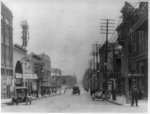

 ★ Landmark
 ★ Landmark
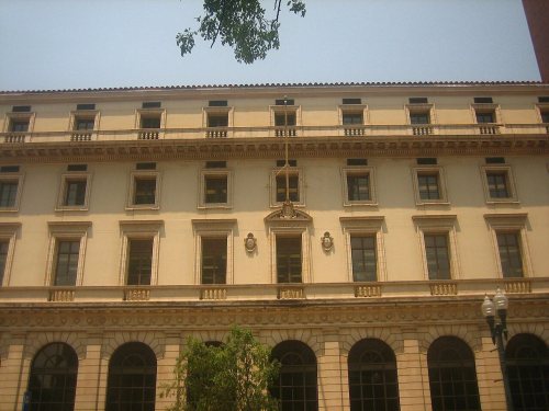

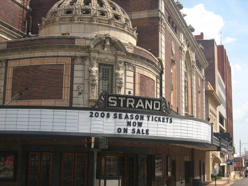


 1910
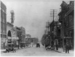 1912
 1913
 1916
 1919


