Wilmore’s post office opened in 1877, and 10 of its places are on the National Register
More historic than 53% of U.S. towns · #78 of 142 in Kentucky. What drives it
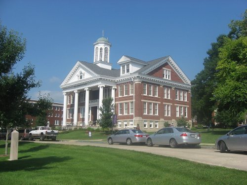
Most of Wilmore was built recently: 8% of its homes predate 1940 and the median home dates from 1989. 10 places in town are on the National Register, among them five historic districts with 64 buildings between them. Below: maps from 1919 on and the census since 1920.
On its age, its old homes and the National Register, Wilmore is more historic than 53% of U.S. towns, #78 of 142 in Kentucky. Its National Register listings hold the grade up; its age pulls it down.
B−
HistoryA character grade: shown, never part of Wilmore’s overall grade.
Kentucky towns list more on the Register than most of the country (a typical Kentucky town has 29.9 per 10,000 residents, the U.S. 2.4), so Wilmore’s 114 sits above most of its state (70% of Kentucky towns have fewer) while its 69 historic buildings outnumber those of 87% of U.S. towns.
How sure. Graded on any two of the three inputs instead, the letter would range from C to B+. The pre-1940 share is a Census survey estimate (±3.6 points). The founding year is the first post office, not a stated founding date.
Founding year: the first post office (other dates in Quick answers). Homes: Census ACS 2020–24. National Register: National Park Service, May 2026 list; each listing counted once (boundary changes and added documentation belong to their listing), and a historic district counts its contributing buildings. How TownRatings grades history →
What stands out about Wilmore’s past
Read from the archive, the National Register and the record. The page puts what stands out first.
A post office called "Wilmore" was established in 1877. It was named for John R. Wilmore, a local landowner and former slave owner.
In 1882, the Southern Railway established a line through the county and located a flag stop at Wilmore which was briefly called "Scott's Station". It was named for John D. Scott, the owner of the site. The station's name was soon changed to Wilmore.
Passages that mention Wilmore, cut from the printed page as they were published.
A history of Jessamine County, Kentucky, from its earliest settlement to 18981898 · page 181Read the page →
Read the text
The following liistory of the ambitious and thriving citv of Wilmore was prepared by A\'m. (i. AV'ilhite, and it is inserted as \vritten by him : The village of Wilmore, the second in population in Tessamine county, is situated on the Cincinnati Southern railwav, five uiiles southwest of Xicholasville and about the saiue distance north of the celebrated High Uridge, where the railway crosses the Ketitucky river. 276 feet above the water. Although bui
Text read by machine from the scan; it may contain errors.
A history of Jessamine County, Kentucky, from its earliest settlement to 18981898 · page 183Read the page →
Read the text
almost coexistent with that of Asbury, and much that has been said of the college in a former paragraph, applies also to the church. It was founded fifteen years ago. and is the oldest and also the largest congregation in Wilmore, with a membership of 225. This church is also in connection with Asbury College,
Text read by machine from the scan; it may contain errors.
Scans and text from the Internet Archive. Books published in 1930 or earlier, which are in the public domain.
Elmwood FarmlocalePleasant View FarmlocaleRose Glade FarmlocaleRose Glade FarmlocaleRose Hill FarmlocaleWalnut Grove FarmlocaleWilmore Railroad Stationlocale
3cemeteries and burying grounds inside Wilmore
LowryPrentice FamilyRussell
US Post Offices dataset (Blevins & Helbock, CC0). Places and cemeteries from the USGS Geographic Names Information System (2021).
Questions about Wilmore’s history
What year was Wilmore founded?
The Wilmore post office opened in 1877, the earliest record of the town by name (U.S. post office records).
How does Wilmore rank for history?
Wilmore is more historic than 53% of U.S. towns, #78 of 142 in Kentucky. The History grade combines the town’s founding era, the share of homes built before 1940 and its National Register listings. It’s a character grade, so it isn’t part of the overall grade. How it works.
What is on the National Register in Wilmore?
10 listings: 4 buildings, among them the Stone House on Brooklyn Hill (listed 1983, the first), 5 historic districts with 64 contributing buildings, and 1 structure. 69 historic buildings in all.
How old are the homes in Wilmore?
8% of Wilmore’s homes were built before 1940 (Census estimate, ±3.6 points), against a typical 5.9% for a Kentucky town; the median home was built in 1989.
Founding dates: Wikidata, Wikipedia, the U.S. post office records of Blevins & Helbock (CC0) and the Census. Homes by year built: Census ACS 2020–24. National Register of Historic Places: National Park Service (list of May 22, 2026). Old photos, postcards and papers: Wikimedia Commons, the Library of Congress and other public archives, credited on each item’s page. Maps: U.S. Geological Survey historical topographic maps (via Esri) and Sanborn fire-insurance maps (Library of Congress). History text and census tables: Wikipedia (CC BY-SA 4.0). Places that used to be: USGS Geographic Names Information System (2021).
From Wikimedia Commons (8), Wikidata (3), the National Register of Historic Places (10), Wikipedia, U.S. Geological Survey historical maps, U.S. Census counts (via Wikipedia), the US Post Offices dataset (Blevins & Helbock), the USGS Geographic Names Information System, Sanborn fire insurance maps (Library of Congress) and old county and town histories (Internet Archive). Archive images are copied here with their credits and licenses, shown on each photo’s page. Refreshed monthly.




 2019
 2009
 2009
 2009
 2009
 2007
 2007
 2004


