Louisville, in brief
Wikipedia doesn’t have a history of Louisville yet. The photos, dates and memories neighbors add here are how it gets written.
Between the 2010 and 2020 censuses its population grew from 741,096 to 782,969 (+6%).
Each edition grades its towns against each other only.
More historic than 87% of U.S. towns · #14 of 142 in Kentucky. What drives it
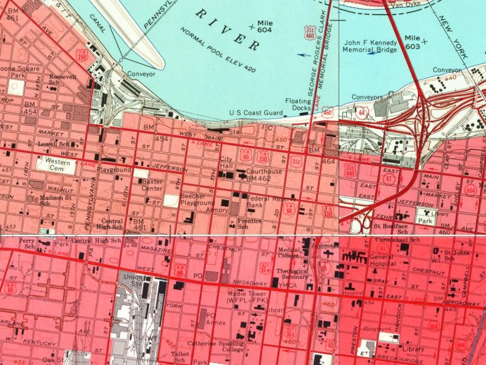
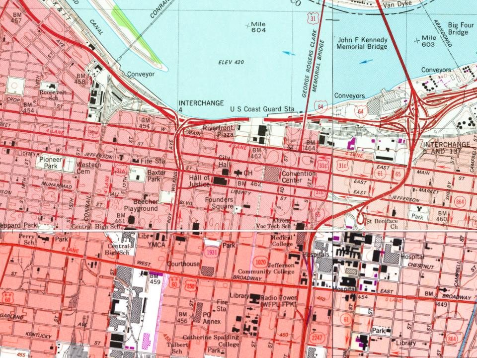
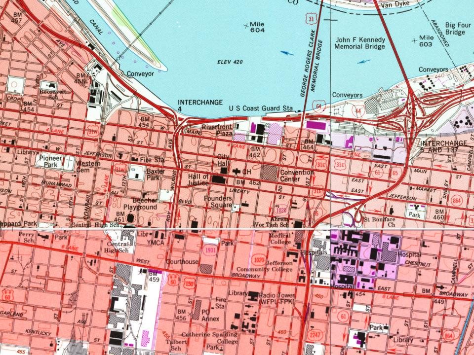
With 14% of its homes built before 1940 and 67 historic districts holding 20,895 contributing buildings. Below: maps from 1950 on and every listing on the Register.
More historic than 87% of U.S. towns, on its age, its old homes and the National Register.
On its age, its old homes and the National Register, Louisville is more historic than 87% of U.S. towns, #14 of 142 in Kentucky. All 2 inputs are above most U.S. towns; its National Register listings ranks highest and its share of homes from before 1940 lowest.
Among the 400 U.S. cities of 100,000 or more, Louisville ranks #84 on History.
Kentucky towns list more on the Register than most of the country (a typical Kentucky town has 29.9 per 10,000 residents, the U.S. 2.4), so Louisville’s 267 sits above most of its state (86% of Kentucky towns have fewer) while its 20,895 historic buildings are more than any other U.S. town’s.
Founding year: our sources. Homes: Census ACS 2020–24. National Register: National Park Service, May 2026 list; each listing counted once (boundary changes and added documentation belong to their listing), and a historic district counts its contributing buildings. How TownRatings grades history →
Read from the archive, the National Register and the record. The page puts what stands out first.
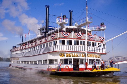
The country’s official list of buildings and places worth saving. 8 are National Historic Landmarks, the highest tier. Boundary changes and added documentation are counted with their listing.
★ Landmark
★ Landmark
★ Landmark
★ Landmark
★ Landmark
★ Landmark
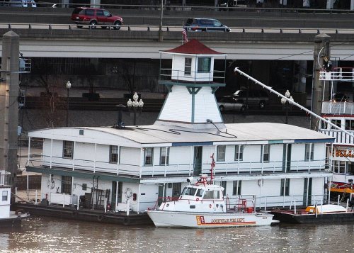
★ Landmark
★ LandmarkNational Park Service, National Register of Historic Places. Photos from Wikimedia Commons, credited on each place’s page.
Louisville’s post office has been open since 1795. 39 other post offices opened and closed inside today’s town.
Bethany Cemetery · Bethany Memorial Cemetery · Brown Cemetery · Calvary Cemetery · Cave Hill Cemetery · Cave Hill Cemetery · Cave Hill National Cemetery · Chenoweth Run Cemetery · Clark Cemetery · Cooper Cemetery · Eastern Cemetery · Evergreen Cemetery · Fairmount Cemetery · Farnsley Cemetery · Forest Home Cemetery · Greenwood Cemetery · Hikes Cemetery · Hillcrest Cemetery · Long Run Cemetery · Louisville Cemetery · Louisville Memorial Gardens and Funeral Home East · Manslick Road Cemetery · McCawley Cemetery · Middletown Historic Cemetery · Mill Creek Cemetery · Mount Holly Cemetery · Portland Cemetery · Prince Family Cemetery · Rest Haven Memorial Cemetery · Saint Andrews Cemetery · Saint John's Cemetery · Saint Louis Cemetery · Saint Michael Cemetery · Saint Stephens Cemetery · Schardein Cemetery · South Jefferson Cemetery · Terry Cemetery · Walker Cemetery · Western Cemetery · Zachary Taylor National Cemetery
US Post Offices dataset (Blevins & Helbock, CC0). Places and cemeteries from the USGS Geographic Names Information System (2021).
Wikipedia doesn’t have a history of Louisville yet. The photos, dates and memories neighbors add here are how it gets written.
Between the 2010 and 2020 censuses its population grew from 741,096 to 782,969 (+6%).
Woven from the archive, old maps, post office records, the National Register and the people born here.
BuiltZachary Taylor House is built
BuiltSouthern National Bank is built
BuiltUnited States Marine Hospital of Louisville is built
BuiltLouisville Water Company Pumping Station is built
On the mapFirst mapped by the U.S. Geological SurveyWeddings on Main Street, storms, parades, school pictures, the old store. If it’s in your family album, it belongs here.
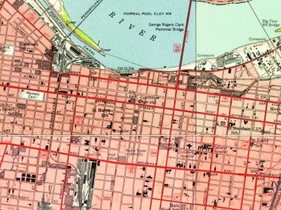
Every edition of the U.S. Geological Survey’s map of Louisville. Tap a year, or press play to watch the town change.

U.S. Geological Survey historical topographic maps (public domain), via Esri’s collection of the scans. The red ring marks the center of Louisville.
The first neighbors to add old photos shape how Louisville’s history is told.
Louisville is more historic than 87% of U.S. towns, #14 of 142 in Kentucky. The History grade combines the town’s founding era, the share of homes built before 1940 and its National Register listings. It’s a character grade, so it isn’t part of the overall grade. How it works.
513 listings, 8 of them National Historic Landmarks: 344 buildings, among them the Zachary Taylor House (a National Historic Landmark since 1961), 61 historic districts with 18,686 contributing buildings, 3 sites, 8 structures, and 3 objects. 20,895 historic buildings in all.
14% of Louisville’s homes were built before 1940 (Census estimate), against a typical 5.9% for a Kentucky town; the median home was built in 1972.
What the archives can’t tell you, neighbors can.
Founding dates: Wikidata, Wikipedia, the U.S. post office records of Blevins & Helbock (CC0) and the Census. Homes by year built: Census ACS 2020–24. National Register of Historic Places: National Park Service (list of May 22, 2026). Old photos, postcards and papers: Wikimedia Commons, the Library of Congress and other public archives, credited on each item’s page. Maps: U.S. Geological Survey historical topographic maps (via Esri) and Sanborn fire-insurance maps (Library of Congress). History text and census tables: Wikipedia (CC BY-SA 4.0). Places that used to be: USGS Geographic Names Information System (2021).
From the National Register of Historic Places (419), U.S. Geological Survey historical maps, the US Post Offices dataset (Blevins & Helbock) and the USGS Geographic Names Information System. Archive images are copied here with their credits and licenses, shown on each photo’s page. Refreshed monthly.


1950New Albany sheet · 1:24,000