Wikipedia doesn’t have a history of Knottsville yet. The photos, dates and memories neighbors add here are how it gets written.
Knottsville is a small unincorporated community and census-designated place (CDP) in eastern Daviess County, Kentucky. The population was 183 as of the 2020 census. The first house was built by Leonard Knott in the fall of 1827, for which the town was named. It was laid out in 1836 by William R. Griffith and James Millay.
Knottsville was established in 1836.
Intro from Wikipedia. Population: U.S. Census Bureau.
From the old history books
What they wrote about Knottsville in 1883
Passages that mention Knottsville, cut from the printed page as they were published.
History of Daviess County, Kentucky, together with sketches of its cities, villages, and townships, educational religious, civil military, and political history, portraits of prominent persons, biographies of representative citizens, and an outline histor1883 · page 850Read the page →
Read the text
The first settler in this precinct was Valentine Husk, who came in 1796, and after living a short time at Yellow Banks settled at the mouth of Pap Creek. In 1804 he moved to Knottsville Precinct, where he died. James Smeathers and James Adam's came very early; both subsequently settled in Knottsville, and died many years ago. Richard C. Jett, born in Virafinia, settled on Blackford Creek in 1809. Hon. Benjamin Duncan was one of the pioneers. He was from Virginia, and died in the Kentucky Senate
Text read by machine from the scan; it may contain errors.
History of Daviess County Kentucky1883 · page 850Read the page →
Read the text
The first settler in this precinct was Valentine Husk, who came in 1796, and after living a short time at Yellow Banks settled at the mouth of Pup Creek. In 1804 he moved to Knottsville Precinct, where he died. James Smeathers and James Adams came very early; both subsequently settled in Knottsville, and died many years ago. Richard C. Jett, born in Virginia, settled on Blackford Creek in 1809. Hon. Benjamin Duncan was one of the pioneers. He was from Virginia, and died in the Kentucky Senate
Text read by machine from the scan; it may contain errors.
History of Daviess County, Kentucky, together with sketches of its cities, villages, and townships, educational religious, civil military, and political history, portraits of prominent persons, biographies of representative citizens, and an outline histor1883 · page 592Read the page →
Read the text
Wilson, father of Robert T. Wilson, came to the county in 1820, from Nelson County, and settled on a farm four miles west of Knottsville. The Mays came from Nelson County about the same time, and settled on the Hardinsburir road west of Knottsville. The first school in this part of tlie county was taught by a man named Walker, who happened to be passing through the country; it was taught on Pup Creek, on land afterward owned by John Bell, and the old log cabin in which it was held went to decay more
Text read by machine from the scan; it may contain errors.
History of Daviess County Kentucky1883 · page 592Read the page →
Read the text
Wilson, father of Robert T. Wilson, came to the county in 1820, from Nelson County, and settled on a farm four miles west of Knottsville. The Mays came from Nelson County abont the same time, and settled on the Hardinsburg road west of Knottsville. The first school in this part of the county was taught by a man named Walker, who happened to be passing through the country; it was taught on Pup Creek, on land afterward owned by John Bell, and the old log cabin in which it was held went to decay more
Text read by machine from the scan; it may contain errors.
Scans and text from the Internet Archive. Books published in 1930 or earlier, which are in the public domain.
By decade
No old photos in the archives yet
Weddings on Main Street, storms, parades, school pictures, the old store. If it’s in your family album, it belongs here.
Be the first to add onePhotograph a print flat, in daylight, no flash.
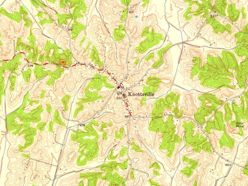
Founding dates: Wikidata, Wikipedia, the U.S. post office records of Blevins & Helbock (CC0) and the Census. Homes by year built: Census ACS 2020–24. National Register of Historic Places: National Park Service (list of May 22, 2026). Old photos, postcards and papers: Wikimedia Commons, the Library of Congress and other public archives, credited on each item’s page. Maps: U.S. Geological Survey historical topographic maps (via Esri) and Sanborn fire-insurance maps (Library of Congress). History text and census tables: Wikipedia (CC BY-SA 4.0). Places that used to be: USGS Geographic Names Information System (2021). How TownRatings grades history →
From U.S. Geological Survey historical maps, the US Post Offices dataset (Blevins & Helbock), the USGS Geographic Names Information System and old county and town histories (Internet Archive). Archive images are copied here with their credits and licenses, shown on each photo’s page. Refreshed monthly.