Hopkinsville dates to 1796, and 31 of its places are on the National Register
More historic than 73% of U.S. towns · #47 of 142 in Kentucky. What drives it
Most of Hopkinsville was built recently: 7% of its homes predate 1940 and the median home dates from 1976. 31 places in town are on the National Register, among them five historic districts with 163 buildings between them. Below: 1 old photo or paper, maps from 1886 on, and the census since 1810.
Founding year: Wikidata. First post office: 1804.The full story ↓
History grade
What drives Hopkinsville’s History grade
On its age, its old homes and the National Register, Hopkinsville is more historic than 73% of U.S. towns, #47 of 142 in Kentucky. Its National Register listings hold the grade up; its share of homes from before 1940 pulls it down.
B+
HistoryA character grade: shown, never part of Hopkinsville’s overall grade.
Kentucky towns list more on the Register than most of the country (a typical Kentucky town has 29.9 per 10,000 residents, the U.S. 2.4), so Hopkinsville’s 60.5 sits near the middle of its state (61% of Kentucky towns have fewer) while its 187 historic buildings outnumber those of 93% of U.S. towns.
How sure. Graded on any two of the three inputs instead, the letter would range from B to A−. The pre-1940 share (±1.5 points) is firm at this size. Two sources give 1796.
Founding year: Wikidata (other dates in Quick answers). Homes: Census ACS 2020–24. National Register: National Park Service, May 2026 list; each listing counted once (boundary changes and added documentation belong to their listing), and a historic district counts its contributing buildings. How TownRatings grades history →
What stands out about Hopkinsville’s past
Read from the archive, the National Register and the record. The page puts what stands out first.
The area of present-day Hopkinsville was initially claimed in 1796 by Bartholomew Wood as part of a 1,200-acre (5 km2) grant for his service in the American Revolution. He and his wife Martha Ann moved from Jonesborough, Tennessee, first to a cabin near present-day W. Seventh and Bethel streets; then to a second cabin near present-day 9th and Virginia streets; and finally to a third home near 14th and Campbell.
Passages that mention Hopkinsville, cut from the printed page as they were published.
A History of Christian County Kentucky from Oxcart to Airplane1930 · page 173Read the page →
Read the text
In 1870 the town of Hopkinsville ceased to exist and the city of Hopkinsville took its place, with a new charter. Perhaps there had been a building rented for post office purposes a good many years before 1870, but the records are so incomplete that no attempt will be made to enroll the postmasters prior to 1870.
Text read by machine from the scan; it may contain errors.
A History of Christian County Kentucky from Oxcart to Airplane1930 · page 150Read the page →
Read the text
Under General Echols the railroad was reconditioned and improved, and steps were promptly taken to extend the line to Hopkinsville. The Indiana, Alabama & Texas Railroad Company had built a line from Princeton to Gracey, and the line had been acquired by the Louisville & Nashville Railroad. In January, 1892, General Echols’ company leased this line, and during the summer of 1892 the line was extended from Gracey to Hopkinsville, thus providing the Ohio Valley Railway Company with a through line from Evansville, Ind., to Hopkinsville.
Text read by machine from the scan; it may contain errors.
Scans and text from the Internet Archive. Books published in 1930 or earlier, which are in the public domain.
Timeline
Hopkinsville, 1796 to 1952
Woven from the archive, old maps, post office records, the National Register and the people born here.
Nothing in the archives for these yearsWeddings on Main Street, storms, parades, school pictures, the old store. If it’s in your family album, it belongs here.
Every edition of the U.S. Geological Survey’s map of Hopkinsville. Tap a year, or press play to watch the town change.
1951Hopkinsville sheet · 1:24,000
U.S. Geological Survey historical topographic maps (public domain), via Esri’s collection of the scans. The red ring marks the center of Hopkinsville.
Every building
Hopkinsville, building by building, 1886–1923
Fire insurance maps drew every building, what it was made of and what it was used for, so insurers could price the risk of fire. Pick a year, then a sheet.
In 1796, according to Wikidata. Hopkinsville’s post office opened in 1804, and the census of 1810 counted 131 people here.
How does Hopkinsville rank for history?
Hopkinsville is more historic than 73% of U.S. towns, #47 of 142 in Kentucky. The History grade combines the town’s founding era, the share of homes built before 1940 and its National Register listings. It’s a character grade, so it isn’t part of the overall grade. How it works.
What is on the National Register in Hopkinsville?
31 listings: 23 buildings, among them the Hopkinsville L & N Railroad Depot (listed 1975, the first), 5 historic districts with 163 contributing buildings, 1 site, and 2 objects. 187 historic buildings in all.
How old are the homes in Hopkinsville?
7% of Hopkinsville’s homes were built before 1940 (Census estimate, ±1.5 points), against a typical 5.9% for a Kentucky town; the median home was built in 1976.
Founding dates: Wikidata, Wikipedia, the U.S. post office records of Blevins & Helbock (CC0) and the Census. Homes by year built: Census ACS 2020–24. National Register of Historic Places: National Park Service (list of May 22, 2026). Old photos, postcards and papers: Wikimedia Commons, the Library of Congress and other public archives, credited on each item’s page. Maps: U.S. Geological Survey historical topographic maps (via Esri) and Sanborn fire-insurance maps (Library of Congress). History text and census tables: Wikipedia (CC BY-SA 4.0). Places that used to be: USGS Geographic Names Information System (2021).
From Wikimedia Commons (8), Wikidata (3), the National Register of Historic Places (31), Wikipedia, Wikidata and Wikipedia for famous people, U.S. Geological Survey historical maps, U.S. Census counts (via Wikipedia), the US Post Offices dataset (Blevins & Helbock), the USGS Geographic Names Information System, Sanborn fire insurance maps (Library of Congress) and old county and town histories (Internet Archive). Archive images are copied here with their credits and licenses, shown on each photo’s page. Refreshed monthly.


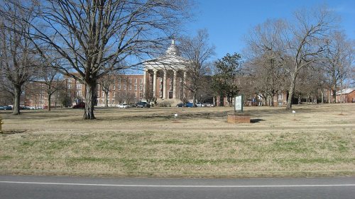


 2008
 2008
 2008
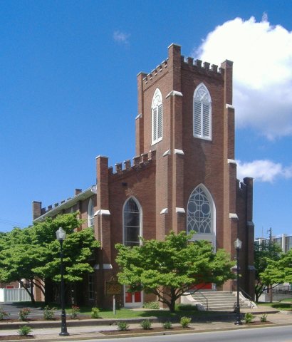 2008
 2008
 2008
 2008


