Hindman’s post office opened in 1884, and 2 of its places are on the National Register
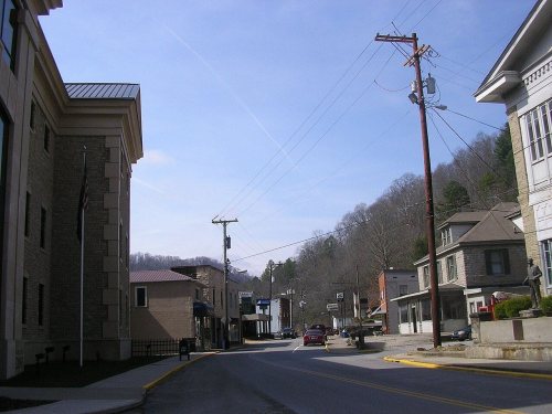
Most of Hindman was built recently: 10% of its homes predate 1940 and the median home dates from 1982. 2 places in town are on the National Register, among them a historic district with 36 buildings. Below: 2 old photos and papers from 1880 on.
The Hindman post office opened in 1884, the earliest record of the town by name. Another post office, McPherson (1874), opened inside today’s city and later closed.
2020 census: 701142 years
Founding year: the first Hindman post office (Blevins & Helbock, CC0).The full story ↓
What stands out about Hindman’s past
Read from the archive, the National Register and the record. The page puts what stands out first.
Before Hindman was established, the area was known as The Forks of Troublesome.
The land for the town was provided by local landowner and postmaster Peyton Duke, but Hindman was named in honor of James Hindman, who was the lieutenant governor when the town was founded in 1884 to serve as the seat of government for the newly formed Knott County.
Early town politics included conflicts between the early settlers of The Forks, with fights between factions led by Anderson Hays and Clabe Jones in which several people were killed, including one where Clabe and supporters were barricaded in the Hindman jail and Hays and supporters were across the street in a log house.
Nothing in the archives for these yearsWeddings on Main Street, storms, parades, school pictures, the old store. If it’s in your family album, it belongs here.
Nothing in the archives for these yearsWeddings on Main Street, storms, parades, school pictures, the old store. If it’s in your family album, it belongs here.
Founding dates: Wikidata, Wikipedia, the U.S. post office records of Blevins & Helbock (CC0) and the Census. Homes by year built: Census ACS 2020–24. National Register of Historic Places: National Park Service (list of May 22, 2026). Old photos, postcards and papers: Wikimedia Commons, the Library of Congress and other public archives, credited on each item’s page. Maps: U.S. Geological Survey historical topographic maps (via Esri) and Sanborn fire-insurance maps (Library of Congress). History text and census tables: Wikipedia (CC BY-SA 4.0). Places that used to be: USGS Geographic Names Information System (2021). How TownRatings grades history →
From Wikimedia Commons (6), the National Register of Historic Places (2), Wikipedia, Wikidata and Wikipedia for famous people, the US Post Offices dataset (Blevins & Helbock) and the USGS Geographic Names Information System. Archive images are copied here with their credits and licenses, shown on each photo’s page. Refreshed monthly.




 2014
 2008
 2008
 2004