Henderson dates to 1797, and 10% of its homes were built before 1940
More historic than 82% of U.S. towns · #29 of 142 in Kentucky. What drives it
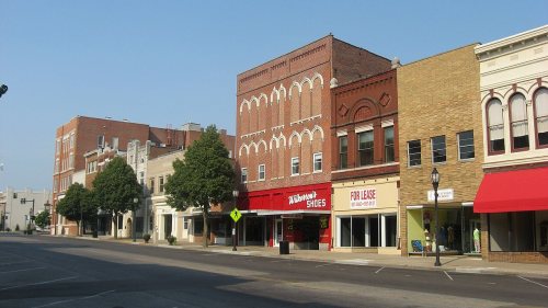
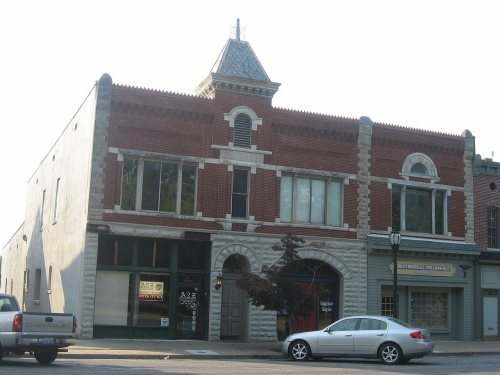
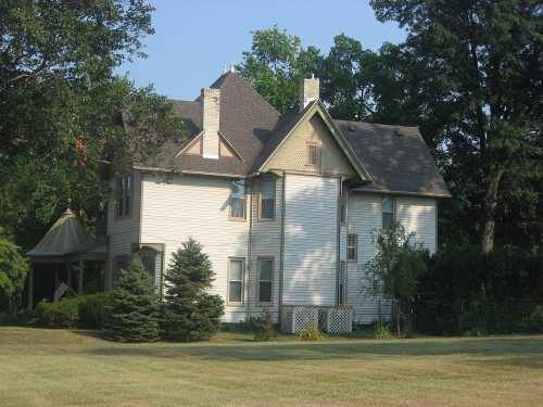
22 places in town are on the National Register, among them six historic districts with 393 buildings between them. Below: 3 old photos and papers, maps from 1885 on, and the census since 1800.
Founding year: Wikidata. First post office: 1801.The full story ↓
History grade
What drives Henderson’s History grade
On its age, its old homes and the National Register, Henderson is more historic than 82% of U.S. towns, #29 of 142 in Kentucky. Its National Register listings hold the grade up; its share of homes from before 1940 pulls it down.
A−
HistoryA character grade: shown, never part of Henderson’s overall grade.
Kentucky towns list more on the Register than most of the country (a typical Kentucky town has 29.9 per 10,000 residents, the U.S. 2.4), so Henderson’s 151 sits above most of its state (76% of Kentucky towns have fewer) while its 421 historic buildings outnumber those of 97% of U.S. towns.
How sure. Graded on any two of the three inputs instead, the letter would range from B to A. The pre-1940 share (±1.6 points) is firm at this size. Two sources give 1797.
Founding year: Wikidata (other dates in Quick answers). Homes: Census ACS 2020–24. National Register: National Park Service, May 2026 list; each listing counted once (boundary changes and added documentation belong to their listing), and a historic district counts its contributing buildings. How TownRatings grades history →
What stands out about Henderson’s past
Read from the archive, the National Register and the record. The page puts what stands out first.
Archaeological research shows that people were living in what is now Kentucky by at least 9,500 BCE, although they may have arrived much earlier.
The settlers of the area after the start of the 1st millennium CE were of the Mississippian culture, a Native American civilization that flourished throughout what is now the Midwestern, Eastern, and Southeastern United States, from approximately 800 CE to 1600 CE. The population of most settlements of this culture had dispersed or were experiencing severe social and environmental stress by 1500.
Passages that mention Henderson, cut from the printed page as they were published.
History of Henderson County, Kentucky1887 · page 56Read the page →
Read the text
mons, the land owners consented to the opening of the road, and thereupon it was — '■ Ordered that the said road from the Town of Henderson to the mouth of Clear Creek he opened, and that Edmund Hopkins he appointed surveyor from the Square in the Town of Henderson to tlie line of the Henderson & Co, Grant, and that he, witli his own male tithables Dr. Adam Rankin. Sherwood Hicks, James Worthington, Jocob Newman, Abraham Landers, John Landers. William Laurence, Rawland Hughes Josenli Worthington and their
Text read by machine from the scan; it may contain errors.
History of Henderson County, Kentucky1887 · page 377Read the page →
Read the text
The town of Cairo is located in the southwest part of Henderson County, eleven miles from the City of Henderson, and seven miles west from Robards Station on the Henderson & Nashville branch of the Louisville & Nashville Railroad. The first person known to have settled in business upon the ground where the town is located, was William H. Hancock, who established a blacksmith shop for the convenience of the surrounding country. Albert G. Walker
Text read by machine from the scan; it may contain errors.
Scans and text from the Internet Archive. Books published in 1930 or earlier, which are in the public domain.
Timeline
Henderson, 1797 to 1968
Woven from the archive, old maps, post office records, the National Register and the people born here.
Nothing in the archives for these yearsWeddings on Main Street, storms, parades, school pictures, the old store. If it’s in your family album, it belongs here.
Every edition of the U.S. Geological Survey’s map of Henderson. Tap a year, or press play to watch the town change.
1916Henderson sheet · 1:62,500
U.S. Geological Survey historical topographic maps (public domain), via Esri’s collection of the scans. The red ring marks the center of Henderson.
Every building
Henderson, building by building, 1885–1923
Fire insurance maps drew every building, what it was made of and what it was used for, so insurers could price the risk of fire. Pick a year, then a sheet.
Lost post offices, old corners and burying grounds
Henderson’s post office has been open since 1801. Another post office, Audubon, opened and closed inside today’s town.
Henderson
1801–today
Audubon
1891–1895
18001910today
Hamlets and corners on the map
Weaverton
4cemeteries and burying grounds inside Henderson
FairmontFernwoodMount ZionSaint Louis
US Post Offices dataset (Blevins & Helbock, CC0). Places and cemeteries from the USGS Geographic Names Information System (2021).
Questions about Henderson’s history
What year was Henderson founded?
In 1797, according to Wikidata. Henderson’s post office opened in 1801, and the census of 1800 counted 205 people here.
How does Henderson rank for history?
Henderson is more historic than 82% of U.S. towns, #29 of 142 in Kentucky. The History grade combines the town’s founding era, the share of homes built before 1940 and its National Register listings. It’s a character grade, so it isn’t part of the overall grade. How it works.
What is on the National Register in Henderson?
22 listings: 16 buildings, among them the Barret House (listed 1978, the first), and 6 historic districts with 393 contributing buildings. 421 historic buildings in all.
How old are the homes in Henderson?
10% of Henderson’s homes were built before 1940 (Census estimate, ±1.6 points), against a typical 5.9% for a Kentucky town; the median home was built in 1974.
Founding dates: Wikidata, Wikipedia, the U.S. post office records of Blevins & Helbock (CC0) and the Census. Homes by year built: Census ACS 2020–24. National Register of Historic Places: National Park Service (list of May 22, 2026). Old photos, postcards and papers: Wikimedia Commons, the Library of Congress and other public archives, credited on each item’s page. Maps: U.S. Geological Survey historical topographic maps (via Esri) and Sanborn fire-insurance maps (Library of Congress). History text and census tables: Wikipedia (CC BY-SA 4.0). Places that used to be: USGS Geographic Names Information System (2021).
From Wikimedia Commons (3), Wikidata (3), the National Register of Historic Places (22), Wikipedia, Wikidata and Wikipedia for famous people, U.S. Geological Survey historical maps, U.S. Census counts (via Wikipedia), the US Post Offices dataset (Blevins & Helbock), the USGS Geographic Names Information System, Sanborn fire insurance maps (Library of Congress) and old county and town histories (Internet Archive). Archive images are copied here with their credits and licenses, shown on each photo’s page. Refreshed monthly.






 1880


