Covington’s post office opened in 1815, and 44% of its homes were built before 1940
More historic than 98% of U.S. towns · #3 of 142 in Kentucky. What drives it
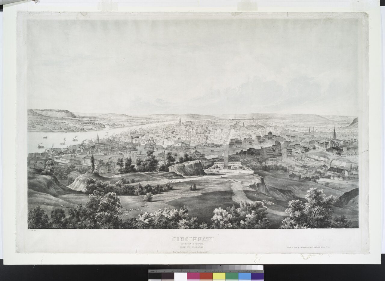
47 places in town are on the National Register, among them 2 National Historic Landmarks and ten historic districts with 5,391 buildings between them. Below: 14 old photos and papers, maps from 1886 on, and the census since 1830.
The Covington post office opened in 1815, the earliest record of the town by name. Seven smaller post offices, Weavers Mill (1850), Latonia Springs (1858) and South Covington (1872), opened inside today’s city and later closed.
First census: 743 in 18302020 census: 40,961211 years
How did Covington get its name?
Covington was named in honor of Gen. Leonard Covington, who was killed at the Battle of Crysler's Farm during the War of 1812.
How historic is Covington?
A+
More historic than 98% of U.S. towns, on its age, its old homes and the National Register.
On its age, its old homes and the National Register, Covington is more historic than 98% of U.S. towns, #3 of 142 in Kentucky. All 3 inputs are above most U.S. towns; its National Register listings ranks highest and its age lowest.
A+
HistoryA character grade: shown, never part of Covington’s overall grade.
Kentucky towns list more on the Register than most of the country (a typical Kentucky town has 29.9 per 10,000 residents, the U.S. 2.4), so Covington’s 1,318 sits above most of its state (97% of Kentucky towns have fewer) while its 5,418 historic buildings outnumber those of 100% of U.S. towns.
How sure. Graded on any two of the three inputs instead, the letter would range from A to A+. The pre-1940 share (±2.7 points) is firm at this size. The founding year is the first post office, not a stated founding date.
Founding year: the first post office (other dates in Quick answers). Homes: Census ACS 2020–24. National Register: National Park Service, May 2026 list; each listing counted once (boundary changes and added documentation belong to their listing), and a historic district counts its contributing buildings. How TownRatings grades history →
What stands out about Covington’s past
Read from the archive, the National Register and the record. The page puts what stands out first.
The country’s official list of buildings and places worth saving. 2 are National Historic Landmarks, the highest tier. Boundary changes and added documentation are counted with their listing.
National Park Service, National Register of Historic Places. Photos from Wikimedia Commons, credited on each place’s page.
Places that used to be
Lost post offices, old corners, places now gone and burying grounds
Covington’s post office has been open since 1815. Seven other post offices opened and closed inside today’s town.
Covington
1815–today
Weavers Mill
1850–1851
Latonia Springs
1858–1874
South Covington
1872–1880
White House
1876–1879
Latonia
1878–1880
Milldale
1880–1900
Latonia
1900–1909
18101920today
Hamlets and corners on the map
Jacob Price HomesKenton HillsLatoniaLatonia TerraceWest CovingtonWinston Park
Gone or out of use
Bethany Evangelical Lutheran ChurchchurchCalvary Christian ChurchchurchEngine Company Number 2buildingFifth District SchoolschoolGrace Evangelical And Reformed ChurchchurchKennedys FerrycrossingLincoln-Grant SchoolschoolMain Street Methodist Episcopal ChurchchurchMaurice Railroad StationlocaleMilldale Post Officepost officeNorthern Kentucky Community CenterbuildingRiverbreeze BallparkparkRoadside ChapelchurchSaint Paul's Evangelical And Reformed ChurchchurchShinkle Methodist ChurchchurchShortway BridgebridgeW M Booth Memorial HospitalhospitalWeavers Mill Post Officepost office
2cemeteries and burying grounds inside Covington
Linden GroveWayman
US Post Offices dataset (Blevins & Helbock, CC0). Places and cemeteries from the USGS Geographic Names Information System (2021).
In 1814, John Gano, Richard Gano, and Thomas Carneal purchased The Point, 150 acres (0.6 km2) of land on the west side of the Licking River at its confluence with the Ohio, from Thomas Kennedy for $50,000, and laid out the settlement of Covington the next year. It was named in honor of Gen. Leonard Covington, who was killed at the Battle of Crysler's Farm during the War of 1812. The town was formally incorporated by the Kentucky General Assembly a year later and raised to city status in 1834.
Passages that mention Covington, cut from the printed page as they were published.
History of the diocese of Covington Kentucky1853 · page 95Read the page →
Read the text
was erected in the town of Covington in 1834. St. Mary Mission in Covington became a parish in 1837, and in 1842, Covington received its second parish, Mother of God. In the adjoining town of Newport, the first parish was established in 1845. In 1847 the mission at Maysville was established into a parish. And in 1851, the eighth parish to be established was in rural Campbell County at Four Mile Creek.
Text read by machine from the scan; it may contain errors.
History of the diocese of Covington Kentucky1853 · page 110Read the page →
Read the text
St. Mary Parish, Covington The first parish established in the city of Covington in 1837 was St. Mary Parish. It was owing to the proximity of Covington to Cincinnati, that the Catholics of Covington, Newport, and the surrounding territory of Campbell County, in the 1820’s did not suffer absolute privation of the consolation of religion which had to be endured by Catholics far removed from any
Text read by machine from the scan; it may contain errors.
Scans and text from the Internet Archive. Books published in 1930 or earlier, which are in the public domain.
Timeline
Covington, 1815 to 1914
Woven from the archive, old maps, post office records, the National Register and the people born here.
Nothing in the archives for these yearsWeddings on Main Street, storms, parades, school pictures, the old store. If it’s in your family album, it belongs here.
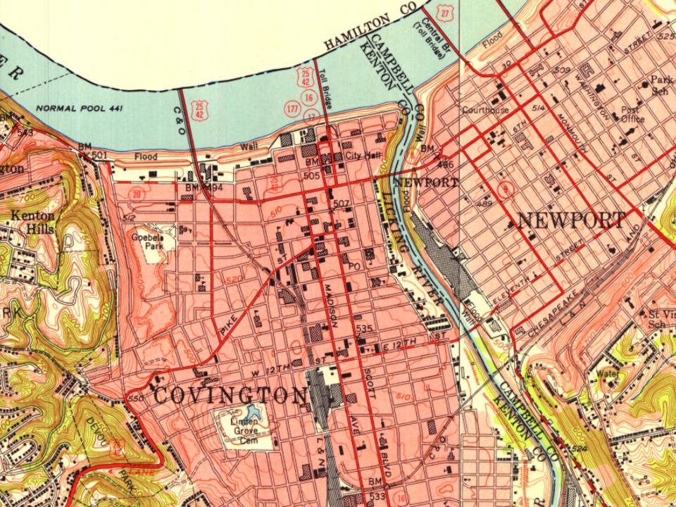
Every edition of the U.S. Geological Survey’s map of Covington. Tap a year, or press play to watch the town change.
1914West Cincinnati sheet · 1:62,500
U.S. Geological Survey historical topographic maps (public domain), via Esri’s collection of the scans. The red ring marks the center of Covington.
Every building
Covington, building by building, 1886–1909
Fire insurance maps drew every building, what it was made of and what it was used for, so insurers could price the risk of fire. Pick a year, then a sheet.
The Covington post office opened in 1815, the earliest record of the town by name (U.S. post office records).
How does Covington rank for history?
Covington is more historic than 98% of U.S. towns, #3 of 142 in Kentucky. The History grade combines the town’s founding era, the share of homes built before 1940 and its National Register listings. It’s a character grade, so it isn’t part of the overall grade. How it works.
What is on the National Register in Covington?
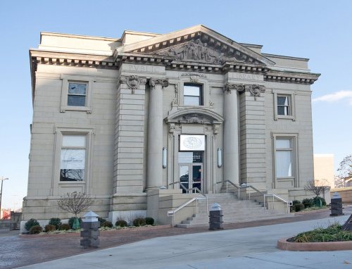
47 listings, 2 of them National Historic Landmarks: 23 buildings, among them the Daniel Carter Beard Boyhood Home (listed 1966, the first), 19 historic districts with 5,391 contributing buildings, 1 site, 2 structures, and 2 objects. 5,418 historic buildings in all.
How old are the homes in Covington?
44% of Covington’s homes were built before 1940 (Census estimate, ±2.7 points), against a typical 5.9% for a Kentucky town; the median home was built in 1947.
Founding dates: Wikidata, Wikipedia, the U.S. post office records of Blevins & Helbock (CC0) and the Census. Homes by year built: Census ACS 2020–24. National Register of Historic Places: National Park Service (list of May 22, 2026). Old photos, postcards and papers: Wikimedia Commons, the Library of Congress and other public archives, credited on each item’s page. Maps: U.S. Geological Survey historical topographic maps (via Esri) and Sanborn fire-insurance maps (Library of Congress). History text and census tables: Wikipedia (CC BY-SA 4.0). Places that used to be: USGS Geographic Names Information System (2021).
From Wikimedia Commons (11), the Library of Congress (3), Wikidata (4), the National Register of Historic Places (47), Wikipedia, Wikidata and Wikipedia for famous people, U.S. Geological Survey historical maps, U.S. Census counts (via Wikipedia), the US Post Offices dataset (Blevins & Helbock), the USGS Geographic Names Information System, Sanborn fire insurance maps (Library of Congress) and old county and town histories (Internet Archive). Archive images are copied here with their credits and licenses, shown on each photo’s page. Refreshed monthly.



 ★ Landmark



 1848
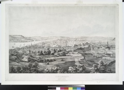 1852
 1855
 1855
 1867
 1868
 1917
 1917
 1917