
The story
Read it all →How Republic came to be
From Wikipedia’s history of Republic.
Republic was founded in 1871. It was named from Republic County.
Text from Wikipedia, licensed CC BY-SA 4.0.
Each edition grades its towns against each other only.
Below: maps from 1892 on and the census since 1880.
Republic dates its founding to 1871 (Wikipedia’s history). The census first counted it in 1880.
Republic was named from Republic County.
Read from the archive, the National Register and the record. The page puts what stands out first.
The first neighbors to add old photos shape how Republic’s history is told.
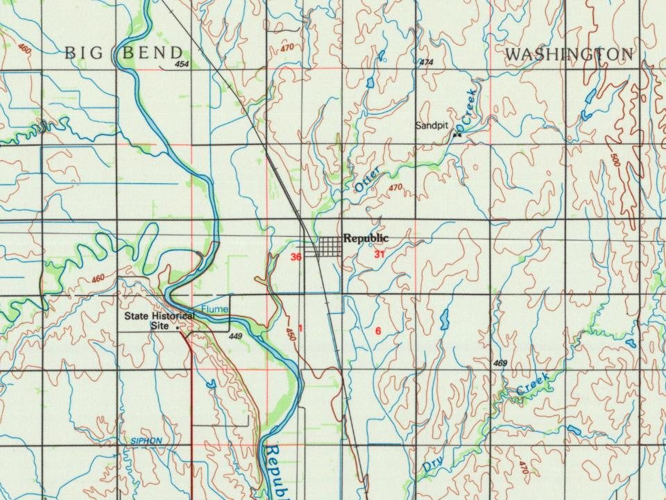
Every edition of the U.S. Geological Survey’s map of Republic. Tap a year, or press play to watch the town change.
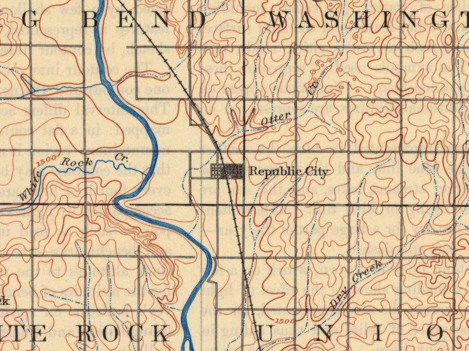
U.S. Geological Survey historical topographic maps (public domain), via Esri’s collection of the scans. The red ring marks the center of Republic.
From Wikipedia’s history of Republic.
Republic was founded in 1871. It was named from Republic County.
Text from Wikipedia, licensed CC BY-SA 4.0.
Passages that mention Republic, cut from the printed page as they were published.

We are indebted to A. B. Whiting, formerly of Clay county, but now living in Topeka, for the following account of an Indian massacre committed in Republic county, near the present town site of Republic City, in the year 1857, nearly four years prior to the first settlement of the county.
Text read by machine from the scan; it may contain errors.
We are indebted to A. B. Whiting, formerly of Clay county, but now living in Topeka, for the following account of an Indian massacre committed in Republic county, near the present town site of Republic City, in the year 1857, nearly four years prior to the first settlement of the county.
Text read by machine from the scan; it may contain errors.
At a called meeting of the citizens of Republic county held at Belleville, April 26th, 1878, for the purpose of taking into consideration the proper steps to be taken to secure a railroad, the following named persons were chosen as a committee to visit Kansas City to confer with the officers of the Kansas Pacific railroad and the Kansas City Board of Trade in relation to railroad matters: namely, Hon. W. H. Pilkenton, I. O. Savage, Ed. E. Chapman, Dr.
Text read by machine from the scan; it may contain errors.
Republic county is located in what was known, from 1872 to 1878, as the spring wheat belt of Kansas, composed of seven counties lying in a compact body in the northwest, five of Avhich, Marshall, Washington, Republic, Jewell and Smith, being in the northern tier, and the other two, Cloud and Mitchell, adjoining. In 1878, these seven counties produced 3,345,340 bushels, or nearly three-fifths the entire spring wheat product of the State. In the number of bushels raised, Republic county ranked in the State as follows :
Text read by machine from the scan; it may contain errors.Scans and text from the Internet Archive. Books published in 1930 or earlier, which are in the public domain.
Woven from the archive, old maps, post office records, the National Register and the people born here.
 Born hereJesse Ray Ward is born here
 On the mapFirst mapped by the U.S. Geological Survey
Weddings on Main Street, storms, parades, school pictures, the old store. If it’s in your family album, it belongs here.
Fire insurance maps drew every building, what it was made of and what it was used for, so insurers could price the risk of fire. Pick a year, then a sheet.
 1905Sheet 1 of 1
Sanborn Map Company, via the Library of Congress. Editions published in 1930 or earlier, which are in the public domain.
Peaked at 450 in 1910; 82 people lived here in 2020.
15 censuses, 1880–2020.
U.S. Census Bureau decennial counts, from the census table on Republic’s Wikipedia page.
Writers, athletes, leaders and more, ranked by how widely they’re known.
Republic’s post office has been open since 1880. Another post office, Gomeria, opened and closed inside today’s town.
US Post Offices dataset (Blevins & Helbock, CC0). Places and cemeteries from the USGS Geographic Names Information System (2021).
In 1871, according to Wikipedia’s history of the town. Republic’s post office opened in 1870, and the census of 1880 counted 50 people here.
What the archives can’t tell you, neighbors can.
Founding dates: Wikidata, Wikipedia, the U.S. post office records of Blevins & Helbock (CC0) and the Census. Homes by year built: Census ACS 2020–24. National Register of Historic Places: National Park Service (list of May 22, 2026). Old photos, postcards and papers: Wikimedia Commons, the Library of Congress and other public archives, credited on each item’s page. Maps: U.S. Geological Survey historical topographic maps (via Esri) and Sanborn fire-insurance maps (Library of Congress). History text and census tables: Wikipedia (CC BY-SA 4.0). Places that used to be: USGS Geographic Names Information System (2021). How TownRatings grades history →
From Wikipedia, Wikidata and Wikipedia for famous people, U.S. Geological Survey historical maps, U.S. Census counts (via Wikipedia), the US Post Offices dataset (Blevins & Helbock), the USGS Geographic Names Information System, Sanborn fire insurance maps (Library of Congress) and old county and town histories (Internet Archive). Archive images are copied here with their credits and licenses, shown on each photo’s page. Refreshed monthly.