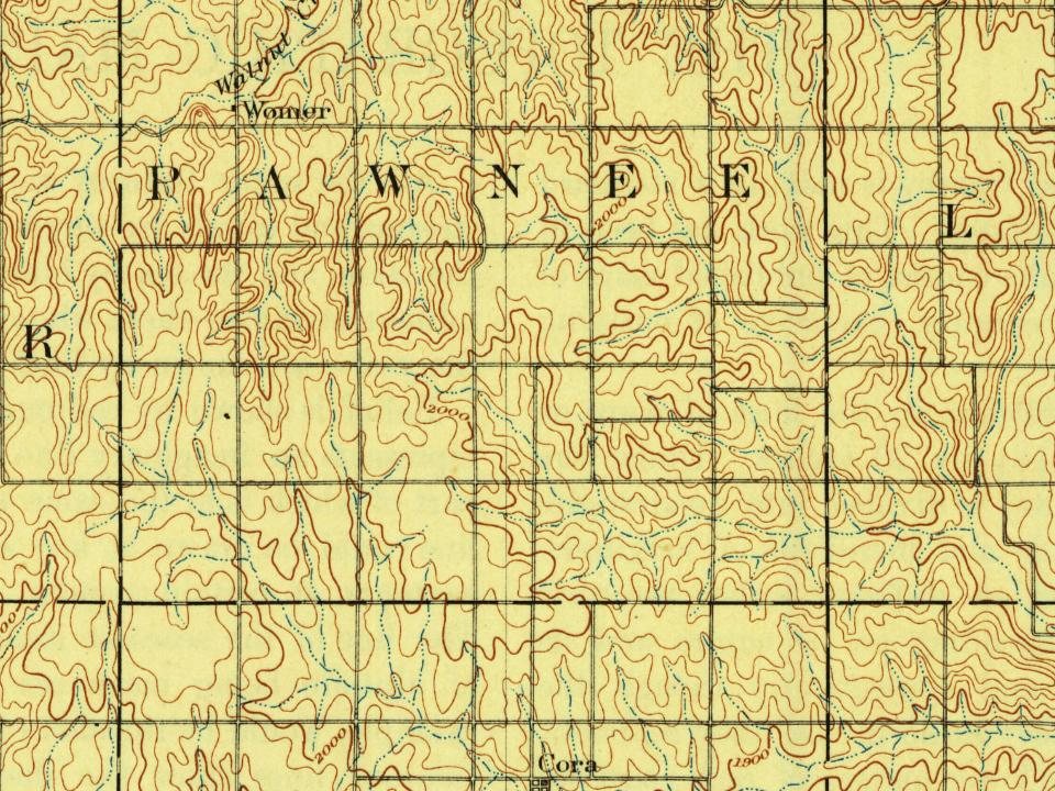
Every edition of the U.S. Geological Survey’s map of Pawnee Township. Tap a year, or press play to watch the town change.
1893Smith Center sheet · 1:125,000
U.S. Geological Survey historical topographic maps (public domain), via Esri’s collection of the scans. The red ring marks the center of Pawnee Township.
Places that used to be
Lost post offices, old corners and places now gone
Two other post offices opened and closed inside today’s town.
Judson
1874–1901
Womer
1883–1905
18701950today
Hamlets and corners on the map
Womer
Gone or out of use
Judsonlocale
US Post Offices dataset (Blevins & Helbock, CC0). Places and cemeteries from the USGS Geographic Names Information System (2021).
Pawnee, named after a native tribe that had inhabited its land, was located on the far western frontier of Kansas Territory, between the new settlement of Manhattan and the U.S. Army post at Fort Riley. Pawnee was first laid out in 1854. Fort Riley's commander, Colonel William R. Montgomery, authorized the acquisition by the Pawnee Town Association investors of 400 acres believed to be part of the military reservation. In December 1854 or January 1855, the site was selected as capital by recently-commissioned first Territorial Governor Andrew Reeder, after his delayed arrival from Pennsylvania. Governor Reeder had an economic stake in the site, since he was one of the investors and a new landowner in the settlement, and he was not disappointed: Within six weeks of his announcement, hundreds of people arrived in the town. It quickly sprouted new homes, stores, and hotels, and he soon b…
Nothing in the archives for these yearsWeddings on Main Street, storms, parades, school pictures, the old store. If it’s in your family album, it belongs here.
Founding dates: Wikidata, Wikipedia, the U.S. post office records of Blevins & Helbock (CC0) and the Census. Homes by year built: Census ACS 2020–24. National Register of Historic Places: National Park Service (list of May 22, 2026). Old photos, postcards and papers: Wikimedia Commons, the Library of Congress and other public archives, credited on each item’s page. Maps: U.S. Geological Survey historical topographic maps (via Esri) and Sanborn fire-insurance maps (Library of Congress). History text and census tables: Wikipedia (CC BY-SA 4.0). Places that used to be: USGS Geographic Names Information System (2021). How TownRatings grades history →
From Wikimedia Commons (3), the Library of Congress (1), Wikipedia, U.S. Geological Survey historical maps, the US Post Offices dataset (Blevins & Helbock) and the USGS Geographic Names Information System. Archive images are copied here with their credits and licenses, shown on each photo’s page. Refreshed monthly.






 1909
