Lebanon was founded in 1876 at a site about 4 miles (6.4 km) distant from its present site. It was moved to the new site in about 1887–1888. Lebanon is named after Lebanon, Kentucky.
In 1918, a scientific survey established the geographic center of the 48 contiguous US states about 2.6 miles (4.2 km) northwest of Lebanon, and a monument was subsequently erected at the site. The geographic center of all 50 of the US states is located near Belle Fourche, South Dakota.
Nothing in the archives for these yearsWeddings on Main Street, storms, parades, school pictures, the old store. If it’s in your family album, it belongs here.
Founding dates: Wikidata, Wikipedia, the U.S. post office records of Blevins & Helbock (CC0) and the Census. Homes by year built: Census ACS 2020–24. National Register of Historic Places: National Park Service (list of May 22, 2026). Old photos, postcards and papers: Wikimedia Commons, the Library of Congress and other public archives, credited on each item’s page. Maps: U.S. Geological Survey historical topographic maps (via Esri) and Sanborn fire-insurance maps (Library of Congress). History text and census tables: Wikipedia (CC BY-SA 4.0). Places that used to be: USGS Geographic Names Information System (2021). How TownRatings grades history →
From Wikimedia Commons (9), the Library of Congress (1), Wikipedia, Wikidata and Wikipedia for famous people, U.S. Geological Survey historical maps, U.S. Census counts (via Wikipedia), the US Post Offices dataset (Blevins & Helbock), the USGS Geographic Names Information System and Sanborn fire insurance maps (Library of Congress). Archive images are copied here with their credits and licenses, shown on each photo’s page. Refreshed monthly.


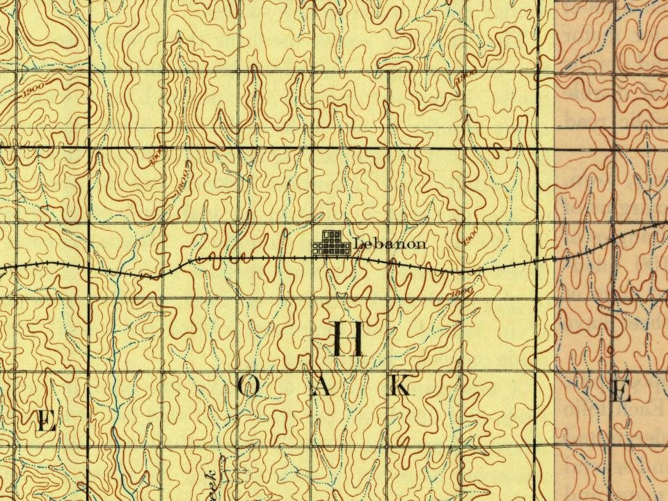




 1902
 2024
 2019
 2017
 2013
 2013
 2006
 2005
