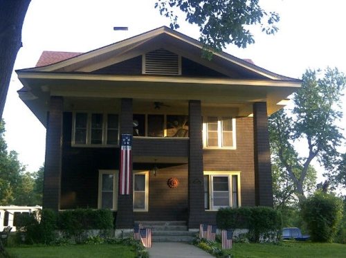
The Highland post office opened in 1855, the earliest record of the town by name. Another post office, Highland Station (1871), opened inside today’s city and later closed.
First census: 120 in 18602020 census: 903171 years
Founding year: the first Highland post office (Blevins & Helbock, CC0).The full story ↓
What stands out about Highland’s past
Read from the archive, the National Register and the record. The page puts what stands out first.
Every edition of the U.S. Geological Survey’s map of Highland. Tap a year, or press play to watch the town change.
1885Atchison sheet · 1:125,000
U.S. Geological Survey historical topographic maps (public domain), via Esri’s collection of the scans. The red ring marks the center of Highland.
Every building
Highland, building by building, 1901–1915
Fire insurance maps drew every building, what it was made of and what it was used for, so insurers could price the risk of fire. Pick a year, then a sheet.
1901Sheet 1 of 1
Edition
Sheets
BrickWoodStone
Sanborn Map Company, via the Library of Congress. Editions published in 1930 or earlier, which are in the public domain.
The Highland Township was started with the founding of the Iowa and Sac & Fox Mission State Historic Site by Reverend Samuel Irvin and Reverend William Hamilton in 1837. The mission was sponsored and funded by the Presbyterians. The Founders plan behind the town was to make it an educational town and in 1857 when the town was laid out a spot was chosen for the future university. Samuel Irvin established the first Highland Community College Building Irvin Hall with the building being built in 1858. The college was chartered and founded in 1858 and has gone through eight name changes over the course of its history.
In 2011 Highland became the self proclaimed Snowflake City of Kansas
Passages that mention Highland, cut from the printed page as they were published.
Doniphan County, Kansas, history and directory for 1868-91868 · page 293Read the page →
Read the text
Soon after the enterprising whites took possession of the country (in 1855), the village of Highland was laid out. This village is two miles west from where the old mission stands. This was thought to be a suitable place for the contemplated high school, and on the first lithographed chart of the town it is stated to he "Intended as a seat of Learning."
Text read by machine from the scan; it may contain errors.
Gray's Doniphan County history. A record of the happenings of half a hundred years1905 · page 32Read the page →
Read the text
Sacs and F'oxes as missionaries, and founded the ohl Presbyterian Mission about 1843, east of where the town of Highland now is, spent all the best years of their lives among the Indians in a noble but futile effort to plant theseeds of Christian civilization in a soil not adapted to its successful propagation.
Text read by machine from the scan; it may contain errors.
Doniphan County, Kansas, history and directory for 1868-91868 · page 276Read the page →
Read the text
The first settlement in Doniphan County was made at what is known as the Missouri Faem, being then the Iowa and Sac Mission, situate about three-fourths of a mile east of the present village of Highland, on one of the branches of Wolf River. This mission was first established by missionaries who were sent 4from the east to establish institutions of civilization among the tribes of Indians who then occupied this portioii of the territory.
Text read by machine from the scan; it may contain errors.
Gray's Doniphan County history. A record of the happenings of half a hundred years1905 · page 144Read the page →
Read the text
country, extending south from the mouthof Wolf river to Eagle Springs and westward along the Wolf river valley north of Highland Station on the Burlington and Missouri River railroad and southeast to the old town site of Lafayette on the Missouri river, now occupied as a fruit farm by Levi Kunkle. At Eagle
Text read by machine from the scan; it may contain errors.
Scans and text from the Internet Archive. Books published in 1930 or earlier, which are in the public domain.
Timeline
Highland, 1855 to 1988
Woven from the archive, old maps, post office records, the National Register and the people born here.
Nothing in the archives for these yearsWeddings on Main Street, storms, parades, school pictures, the old store. If it’s in your family album, it belongs here.
Founding dates: Wikidata, Wikipedia, the U.S. post office records of Blevins & Helbock (CC0) and the Census. Homes by year built: Census ACS 2020–24. National Register of Historic Places: National Park Service (list of May 22, 2026). Old photos, postcards and papers: Wikimedia Commons, the Library of Congress and other public archives, credited on each item’s page. Maps: U.S. Geological Survey historical topographic maps (via Esri) and Sanborn fire-insurance maps (Library of Congress). History text and census tables: Wikipedia (CC BY-SA 4.0). Places that used to be: USGS Geographic Names Information System (2021). How TownRatings grades history →
From Wikimedia Commons (4), the Library of Congress (1), Wikidata (5), the National Register of Historic Places (6), Wikipedia, Wikidata and Wikipedia for famous people, U.S. Geological Survey historical maps, U.S. Census counts (via Wikipedia), the US Post Offices dataset (Blevins & Helbock), the USGS Geographic Names Information System, Sanborn fire insurance maps (Library of Congress) and old county and town histories (Internet Archive). Archive images are copied here with their credits and licenses, shown on each photo’s page. Refreshed monthly.


 Date?
 2008
 2004