The Geuda Springs post office opened in 1884, the earliest record of the town by name. Two smaller post offices, Remanto (1872) and Geuda (1882), opened inside today’s city and later closed.
First census: 355 in 18902020 census: 158142 years
Founding year: the first Geuda Springs post office (Blevins & Helbock, CC0).The full story ↓
What stands out about Geuda Springs’ past
Read from the archive, the National Register and the record. The page puts what stands out first.
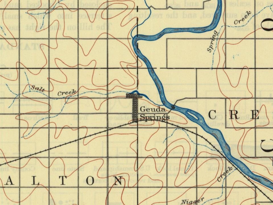
Every edition of the U.S. Geological Survey’s map of Geuda Springs. Tap a year, or press play to watch the town change.
1890Wellington sheet · 1:125,000
U.S. Geological Survey historical topographic maps (public domain), via Esri’s collection of the scans. The red ring marks the center of Geuda Springs.
Places that used to be
Lost post offices
Geuda Springs’s post office has been open since 1884. Two other post offices opened and closed inside today’s town.
Remanto
1872–1874
Geuda
1882–1900
Geuda Springs
1884–today
18701950today
US Post Offices dataset (Blevins & Helbock, CC0). Places and cemeteries from the USGS Geographic Names Information System (2021).
On the line between Cowley and Sumner counties is a remarkable group of salt springs that each put out 100 to 450 gallons per hour and have been known since the earliest settlement of that region. These springs are on a branch of the St. Louis & San Francisco railroad, a little to the north of the town of Geuda Springs and about 7 miles (11 km) from Arkansas City. The waters from these springs infiltrate the waters of the nearby creeks. A lake formed by the creek near these springs has been greatly enlarged by damming the creek and now covers about 50 acres (200,000 m2), making it the largest body of salt water in the state. Geuda is said to be an Indian word, Ge-u-da, meaning healing springs, and the place must have been a well known stopping place with the Indians. Many improvements were made at the springs during the late 1880s, including a bath-house and hotel, lake improvements, an…
Founding dates: Wikidata, Wikipedia, the U.S. post office records of Blevins & Helbock (CC0) and the Census. Homes by year built: Census ACS 2020–24. National Register of Historic Places: National Park Service (list of May 22, 2026). Old photos, postcards and papers: Wikimedia Commons, the Library of Congress and other public archives, credited on each item’s page. Maps: U.S. Geological Survey historical topographic maps (via Esri) and Sanborn fire-insurance maps (Library of Congress). History text and census tables: Wikipedia (CC BY-SA 4.0). Places that used to be: USGS Geographic Names Information System (2021). How TownRatings grades history →
From Wikimedia Commons (1), Wikipedia, U.S. Geological Survey historical maps, U.S. Census counts (via Wikipedia), the US Post Offices dataset (Blevins & Helbock) and the USGS Geographic Names Information System. Archive images are copied here with their credits and licenses, shown on each photo’s page. Refreshed monthly.


 2005