The Fontana post office opened in 1873, the earliest record of the town by name. Wikidata gives 1889. Two smaller post offices, Osage (1864) and Fontania (1869), opened inside today’s city and later closed.
First census: 174 in 18802020 census: 210153 years
Founding year: the first Fontana post office (Blevins & Helbock, CC0). Wikidata: 1889.The full story ↓
What stands out about Fontana’s past
Read from the archive, the National Register and the record. The page puts what stands out first.
Captain David Martin, a veteran of the War of 1812, received a land grant for 160 acres (0.65 km2) in Lykins County, Kansas (Miami County, Kansas) due to an 1855 congressional act. Part of this property would eventually become the townsite and rural community of Fontana. J.B. Grinnell purchased 120 acres (0.49 km2) of the property in 1869, and put Fontana in the center near a railroad right of way. The city was incorporated in 1889.
Passages that mention Fontana, cut from the printed page as they were published.
A centenary of Catholicity in Kansas, 1822-19221921 · page 82Read the page →
Read the text
Dalton, four years later. Shortly afterward the young couple went to Canada, where Mr. Dalton followed contract mining about fifteen years. Then they moved to Michigan, coming to Kansas almost fifty years ago. They located on the homestead in the Irish settlement near Fontana, which has been the family home ever since. It was the center of hospitality in the neighborhood, and it was the warm Irish heart and cheerfulness of Mrs. Dalton that made it such a popular spot.
Text read by machine from the scan; it may contain errors.
Scans and text from the Internet Archive. Books published in 1930 or earlier, which are in the public domain.
Timeline
Fontana, 1864 to 1958
Woven from the archive, old maps, post office records, the National Register and the people born here.
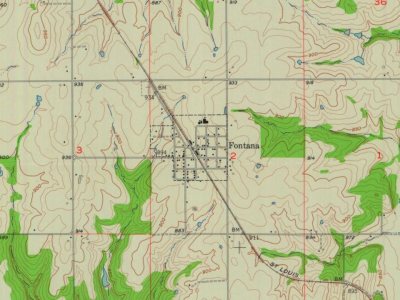
Founding dates: Wikidata, Wikipedia, the U.S. post office records of Blevins & Helbock (CC0) and the Census. Homes by year built: Census ACS 2020–24. National Register of Historic Places: National Park Service (list of May 22, 2026). Old photos, postcards and papers: Wikimedia Commons, the Library of Congress and other public archives, credited on each item’s page. Maps: U.S. Geological Survey historical topographic maps (via Esri) and Sanborn fire-insurance maps (Library of Congress). History text and census tables: Wikipedia (CC BY-SA 4.0). Places that used to be: USGS Geographic Names Information System (2021). How TownRatings grades history →
From Wikimedia Commons (4), Wikipedia, U.S. Geological Survey historical maps, U.S. Census counts (via Wikipedia), the US Post Offices dataset (Blevins & Helbock), the USGS Geographic Names Information System and old county and town histories (Internet Archive). Archive images are copied here with their credits and licenses, shown on each photo’s page. Refreshed monthly.

 2011
 2008
 2008
 2004


