Eskridge dates to 1868, and 47% of its homes were built before 1940
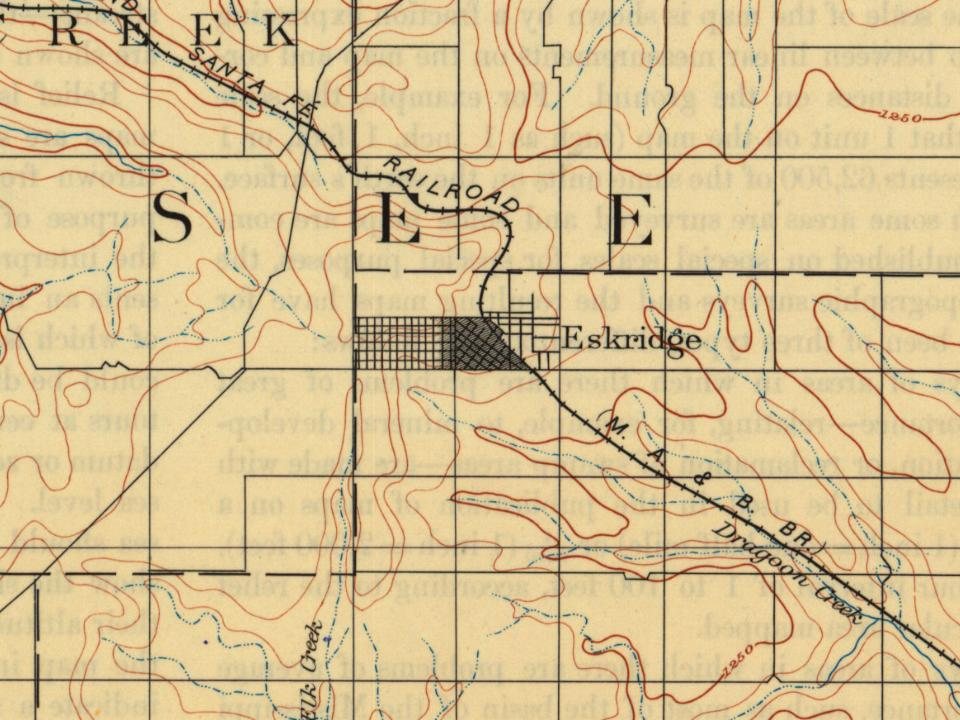
Its Register listings are the Security State Bank and the Eskridge Bandstand. Below: 2 old photos and papers, maps from 1885 on, and the census since 1890.
Eskridge was laid out in 1868. The town experienced growth in 1880 when the railroad was built through it.
Eskridge is named for Charles V. Eskridge, an Emporia journalist and politician. Colonel Ephraim Sanford, the founder of the town company allowed Eskridge to buy the first lot and have the town named after him. Eskridge served in both houses of the legislature and was elected as lieutenant governor under Governor James M. Harvey in 1869.
Passages that mention Eskridge, cut from the printed page as they were published.
Early history of Wabaunsee County, Kansas, with stories of pioneer days and glimpses of our western border..1901 · page 334Read the page →
Read the text
Eskridge (the new town) platted in April and first house hauled on the town site by Dr. Trivett and placed on corner where bank now located. First residence built by Dr. Trivett, for O. T. Lamb.
Text read by machine from the scan; it may contain errors.
Early history of Wabaunsee County, Kansas, with stories of pioneer days and glimpses of our western border..1901 · page 352Read the page →
Read the text
The Land Mark, E. H. Sanford, editor. First published at Eskridge, in 1871. It was published at intervals— first at Eskridge, then at Alma, and again at Eskridge until the publication was discontinued. The Eskridge Star, Vol. ], No. 1, J. J. Mitchell, editor, October 19, 1883; Mitchell & Dowd, January 31, 1884: Rickel & Dowd, March 27, 1884; D. V. Dowd, June 21, 1884; Dowd & Shelton, August, 1885; E. L. Shelton, October 22, 1885: Perry & Gardiner, July 1, 1886; E. n.
Text read by machine from the scan; it may contain errors.
Scans and text from the Internet Archive. Books published in 1930 or earlier, which are in the public domain.
Timeline
Eskridge, 1868 to 1910
Woven from the archive, old maps, post office records, the National Register and the people born here.
Nothing in the archives for these yearsWeddings on Main Street, storms, parades, school pictures, the old store. If it’s in your family album, it belongs here.
Founding dates: Wikidata, Wikipedia, the U.S. post office records of Blevins & Helbock (CC0) and the Census. Homes by year built: Census ACS 2020–24. National Register of Historic Places: National Park Service (list of May 22, 2026). Old photos, postcards and papers: Wikimedia Commons, the Library of Congress and other public archives, credited on each item’s page. Maps: U.S. Geological Survey historical topographic maps (via Esri) and Sanborn fire-insurance maps (Library of Congress). History text and census tables: Wikipedia (CC BY-SA 4.0). Places that used to be: USGS Geographic Names Information System (2021). How TownRatings grades history →
From Wikimedia Commons (5), Wikidata (1), the National Register of Historic Places (2), Wikipedia, U.S. Geological Survey historical maps, U.S. Census counts (via Wikipedia), the US Post Offices dataset (Blevins & Helbock), the USGS Geographic Names Information System and old county and town histories (Internet Archive). Archive images are copied here with their credits and licenses, shown on each photo’s page. Refreshed monthly.




![The Land Mark, E. H. Sanford, editor. First published at Eskridge, in 1871. It was published at intervals— first at Eskridge, then at Alma, and again at Eskridge until the publication was discontinued. The Eskridge Star, Vol. ], No. 1, J. J. Mitchell, editor, October 19, 1883; Mitchell & Dowd, Janu…](https://images.townratings.com/story/6318/bk-e5e4cadf51b50a7d-l.jpg)


 2021
 2021
 2005