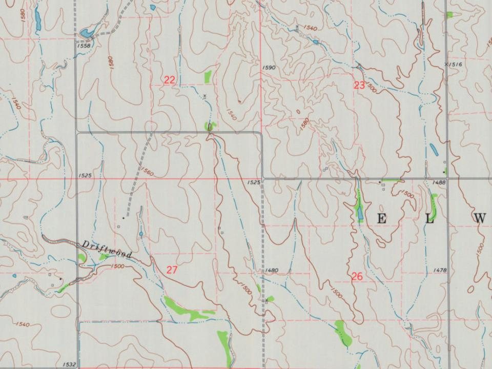
Every edition of the U.S. Geological Survey’s map of Elwood Township. Tap a year, or press play to watch the town change.
1891Medicine Lodge sheet · 1:125,000
U.S. Geological Survey historical topographic maps (public domain), via Esri’s collection of the scans. The red ring marks the center of Elwood Township.
Places that used to be
Lost post offices, old corners, places now gone and burying grounds
Three other post offices opened and closed inside today’s town.
Canema
1882–1894
Eldred
1886–1908
Melior
1886–1891
18801950today
Hamlets and corners on the map
Eldred
Gone or out of use
CanemalocaleMeliorlocale
1cemetery inside Elwood Township
Hardtner
US Post Offices dataset (Blevins & Helbock, CC0). Places and cemeteries from the USGS Geographic Names Information System (2021).
The story so far
Elwood Township, in brief
Wikipedia doesn’t have a history of Elwood Township yet. The photos, dates and memories neighbors add here are how it gets written.
Elwood Township is a township in Barber County, Kansas, United States. As of the 2000 census, its population was 275.
Between the 2010 and 2020 censuses its population fell from 241 to 219 (-9%).
Intro from Wikipedia. Population: U.S. Census Bureau.
Timeline
Elwood Township, 1882 to 1908
Woven from the archive, old maps, post office records, the National Register and the people born here.
Founding dates: Wikidata, Wikipedia, the U.S. post office records of Blevins & Helbock (CC0) and the Census. Homes by year built: Census ACS 2020–24. National Register of Historic Places: National Park Service (list of May 22, 2026). Old photos, postcards and papers: Wikimedia Commons, the Library of Congress and other public archives, credited on each item’s page. Maps: U.S. Geological Survey historical topographic maps (via Esri) and Sanborn fire-insurance maps (Library of Congress). History text and census tables: Wikipedia (CC BY-SA 4.0). Places that used to be: USGS Geographic Names Information System (2021). How TownRatings grades history →
From U.S. Geological Survey historical maps, the US Post Offices dataset (Blevins & Helbock) and the USGS Geographic Names Information System. Archive images are copied here with their credits and licenses, shown on each photo’s page. Refreshed monthly.