The Elmdale post office opened in 1873, the earliest record of the town by name. Another post office, Middle Creek (1862), opened inside today’s city and later closed.
First census: 95 in 18802020 census: 40153 years
Founding year: the first Elmdale post office (Blevins & Helbock, CC0).The full story ↓
What stands out about Elmdale’s past
Read from the archive, the National Register and the record. The page puts what stands out first.
In 1806, Zebulon Pike led the Pike Expedition westward from St Louis, Missouri, of which part of their journey followed the Cottonwood River through Chase County near the current city of Elmdale.
In 1854, the Kansas Territory was organized, then in 1861 Kansas became the 34th U.S. state. In 1859, Chase County was established within the Kansas Territory, which included the land for modern day Elmdale.
In 1871, the Atchison, Topeka and Santa Fe Railway built a main line east–west through Elmdale. In 1873, a post office was relocated from Middle Creek (an extinct town), to the rail community of Elmdale. Elmdale was incorporated in 1904.
In 1916, Camp Wood YMCA was built about 1.5 miles south of Elmdale.
Nothing in the archives for these yearsWeddings on Main Street, storms, parades, school pictures, the old store. If it’s in your family album, it belongs here.
Nothing in the archives for these yearsWeddings on Main Street, storms, parades, school pictures, the old store. If it’s in your family album, it belongs here.
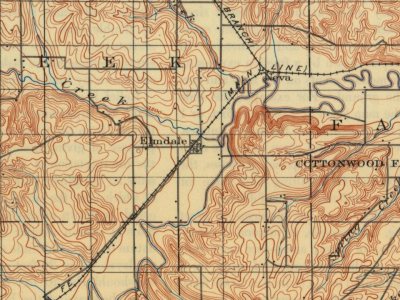
Founding dates: Wikidata, Wikipedia, the U.S. post office records of Blevins & Helbock (CC0) and the Census. Homes by year built: Census ACS 2020–24. National Register of Historic Places: National Park Service (list of May 22, 2026). Old photos, postcards and papers: Wikimedia Commons, the Library of Congress and other public archives, credited on each item’s page. Maps: U.S. Geological Survey historical topographic maps (via Esri) and Sanborn fire-insurance maps (Library of Congress). History text and census tables: Wikipedia (CC BY-SA 4.0). Places that used to be: USGS Geographic Names Information System (2021). How TownRatings grades history →
From Wikimedia Commons (11), Wikipedia, Wikidata and Wikipedia for famous people, U.S. Geological Survey historical maps, U.S. Census counts (via Wikipedia), the US Post Offices dataset (Blevins & Helbock) and the USGS Geographic Names Information System. Archive images are copied here with their credits and licenses, shown on each photo’s page. Refreshed monthly.




 1974
 1974
 1974
 2017
 2017
 2011
 2010
 2004

