Coldwater’s post office opened in 1884, and 46% of its homes were built before 1940
Its Register listings are the Comache County Courthouse and the Chief Theater. Below: 2 old photos and papers, maps from 1886 on, and the census since 1890.
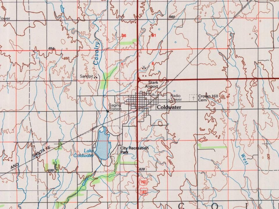
Every edition of the U.S. Geological Survey’s map of Coldwater. Tap a year, or press play to watch the town change.
1892Coldwater sheet · 1:125,000
U.S. Geological Survey historical topographic maps (public domain), via Esri’s collection of the scans. The red ring marks the center of Coldwater.
Every building
Coldwater, building by building, 1886–1923
Fire insurance maps drew every building, what it was made of and what it was used for, so insurers could price the risk of fire. Pick a year, then a sheet.
1886Sheet 1 of 1
Edition
Sheets
BrickWoodStone
Sanborn Map Company, via the Library of Congress. Editions published in 1930 or earlier, which are in the public domain.
In 1884 G.W. Vickers conceived the idea of laying out a town in the northern part of Comanche County, in company with Timothy Shields, J. P. Grove, Samuel Sisson, C. M. Cade and C. D. Bickford, all from Harper County. They preempted a section of land, had it platted off as a town site and named it after the city of Coldwater, Michigan. Early the following year the county had the required number of inhabitants, who petitioned the governor for its organization, and on February 27, 1885, it was organized with Owen Connaughton, George M. Morris and David T. Mclntire, commissioners and R. A. Grossman, clerk. Coldwater was designated as the county seat.
The first post office in Coldwater was established on October 17, 1884.
Nothing in the archives for these yearsWeddings on Main Street, storms, parades, school pictures, the old store. If it’s in your family album, it belongs here.
Founding dates: Wikidata, Wikipedia, the U.S. post office records of Blevins & Helbock (CC0) and the Census. Homes by year built: Census ACS 2020–24. National Register of Historic Places: National Park Service (list of May 22, 2026). Old photos, postcards and papers: Wikimedia Commons, the Library of Congress and other public archives, credited on each item’s page. Maps: U.S. Geological Survey historical topographic maps (via Esri) and Sanborn fire-insurance maps (Library of Congress). History text and census tables: Wikipedia (CC BY-SA 4.0). Places that used to be: USGS Geographic Names Information System (2021). How TownRatings grades history →
From Wikimedia Commons (2), the Library of Congress (2), Wikidata (2), the National Register of Historic Places (2), Wikipedia, Wikidata and Wikipedia for famous people, U.S. Geological Survey historical maps, U.S. Census counts (via Wikipedia), the US Post Offices dataset (Blevins & Helbock), the USGS Geographic Names Information System and Sanborn fire insurance maps (Library of Congress). Archive images are copied here with their credits and licenses, shown on each photo’s page. Refreshed monthly.




 1926
 2010
 2004
