Guest, Sign inJoin

Post to Barnard

We’ll email a one-tap link to publish your post. No password, and nothing is public until you click it.
Already a member? Sign in
–Not graded
History · Barnard

Barnard’s post office opened in 1888, and 84% of its homes were built before 1940

Below: maps from 1894 on and the census since 1910.

1888first post office
0on the National Register
84%homes built before 1940
Quick answers

How Barnard began

When was Barnard founded?

1888

The Barnard post office opened in 1888, the earliest record of the town by name. Another post office, Nimrod (1882), opened inside today’s city and later closed.

First census: 425 in 19102020 census: 64138 years
Founding year: the first Barnard post office (Blevins & Helbock, CC0).The full story ↓

What stands out about Barnard’s past

Read from the archive, the National Register and the record. The page puts what stands out first.

★ What stands out · Help out

Start Barnard’s collection

The first neighbors to add old photos shape how Barnard’s history is told.

Decades since 1900 with photos
00s10s20s30s40s50s60s70s80s90s
0 of 10 decades. The empty ones are waiting for someone’s album.
On the map

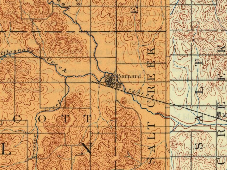
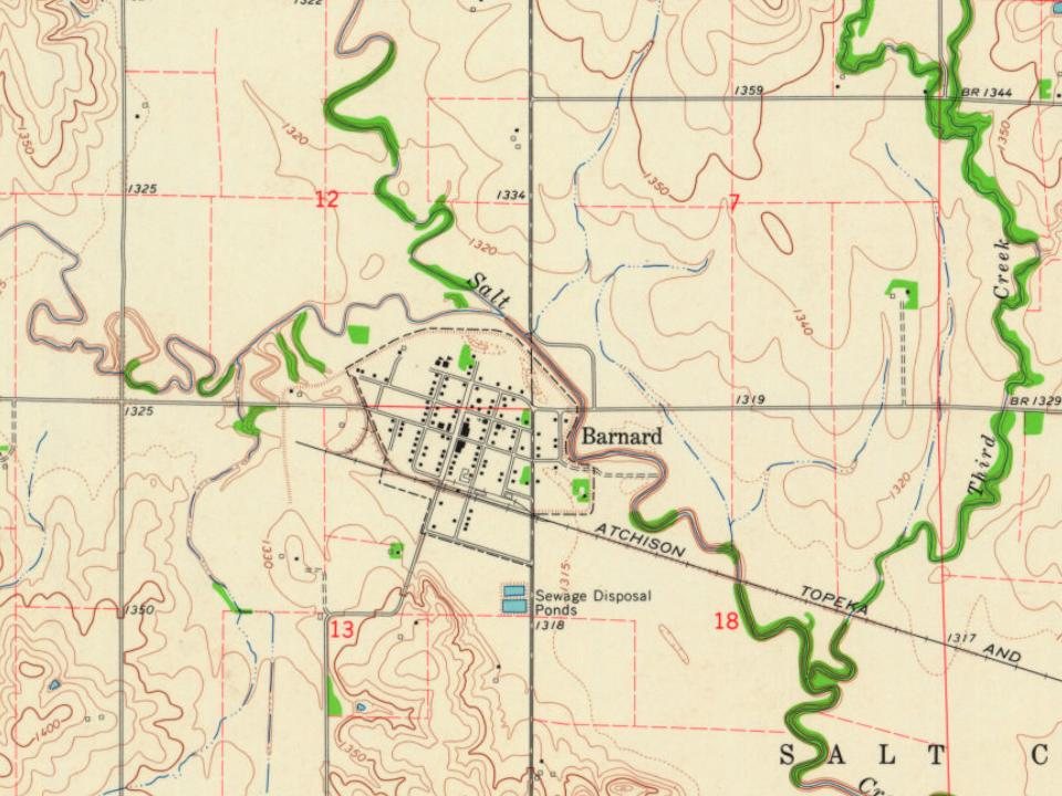
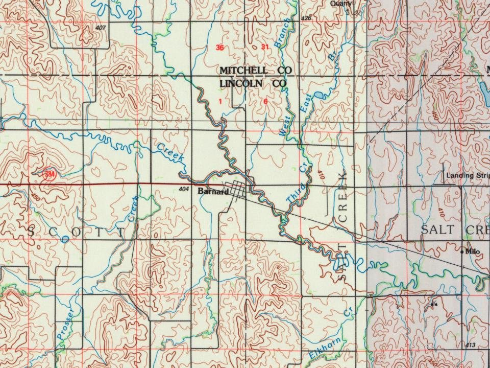
Barnard on the map, 1894 to 1985

Every edition of the U.S. Geological Survey’s map of Barnard. Tap a year, or press play to watch the town change.

Barnard on the 1894 USGS mapBarnard on the 1964 USGS mapBarnard on the 1985 USGS map1894Beloit sheet · 1:125,000

U.S. Geological Survey historical topographic maps (public domain), via Esri’s collection of the scans. The red ring marks the center of Barnard.

The story

How Barnard came to be

From Wikipedia’s history of Barnard.

Read it all →

Barnard was first settled in 1888 when a rail line of the Chicago, Kansas & Western Railroad Company reached the town, and it was incorporated as a city in 1904. Barnard was named for J.F. Barnard, a railroad employee.

The Atchison, Topeka and Santa Fe Railway acquired the C,K & W.R. in 1901. The railroad applied to abandon the 43.38 mile "Minneapolis District" line from Manchester to Barnard in 1983.

Text from Wikipedia, licensed CC BY-SA 4.0.

From the old history books

What they wrote about Barnard in 1908

Passages that mention Barnard, cut from the printed page as they were published.

Plymat owns about a section of land three miles north of Barnard and sells all his stock from this farm. He makes no special sales, but farmers and others wishing good, useful animals, will find them always in salable condition at the right prices at the Plymat Farm, three miles north of Barnard.
A souvenir history of Lincoln County, Kansas1908 · page 119Read the page →
Read the text

Plymat owns about a section of land three miles north of Barnard and sells all his stock from this farm. He makes no special sales, but farmers and others wishing good, useful animals, will find them always in salable condition at the right prices at the Plymat Farm, three miles north of Barnard.

Text read by machine from the scan; it may contain errors.
history of Lincoln Coutdy investnaent company, a dii-ector of the Bank of Barnard, ami president of the Barnard Telephone Company. Mr. McCurry tells us that tlie chief industry in Kansas m the early days was cattle raising, which greatly held back the farming industry. But the herd law of 1874 came…
A souvenir history of Lincoln County, Kansas1908 · page 65Read the page →
Read the text

history of Lincoln Coutdy investnaent company, a dii-ector of the Bank of Barnard, ami president of the Barnard Telephone Company. Mr. McCurry tells us that tlie chief industry in Kansas m the early days was cattle raising, which greatly held back the farming industry. But the herd law of 1874 came to the relief of the farmers, although it was at ttrst feared that it would be a detriment to them on account of having a tendency

Text read by machine from the scan; it may contain errors.

Scans and text from the Internet Archive. Books published in 1930 or earlier, which are in the public domain.

Timeline

Barnard, 1882 to 1894

Woven from the archive, old maps, post office records, the National Register and the people born here.

  1. 19th century
  2. 1882Post officeThe Nimrod post office opens
  3. 1888Post officeThe Nimrod post office closes
  4. 1888Post officeThe Barnard post office opens
  5. 1894On the mapFirst mapped by the U.S. Geological Survey
By decade

No old photos in the archives yet

Weddings on Main Street, storms, parades, school pictures, the old store. If it’s in your family album, it belongs here.

Be the first to add onePhotograph a print flat, in daylight, no flash.
Add from your album
People over time

Barnard, census by census

0100200300400192019401960198020002020Peak: 425

Between 64 and 425 people in every census since 1910.

12 censuses, 1910–2020.

U.S. Census Bureau decennial counts, from the census table on Barnard’s Wikipedia page.

Famous people

Famous people close to Barnard

Nobody well known was born in Barnard itself, so here are the best known from just nearby.

See all →
Places that used to be

Lost post offices

Barnard’s post office has been open since 1888. Another post office, Nimrod, opened and closed inside today’s town.

Nimrod
1882–1888
Barnard
1888–today
18801950today

US Post Offices dataset (Blevins & Helbock, CC0). Places and cemeteries from the USGS Geographic Names Information System (2021).

Questions about Barnard’s history

What year was Barnard founded?

The Barnard post office opened in 1888, the earliest record of the town by name (U.S. post office records).

Memory lane

What the archives can’t tell you, neighbors can.

Town Square →
Start a conversation
Sources

Where this page comes from

Founding dates: Wikidata, Wikipedia, the U.S. post office records of Blevins & Helbock (CC0) and the Census. Homes by year built: Census ACS 2020–24. National Register of Historic Places: National Park Service (list of May 22, 2026). Old photos, postcards and papers: Wikimedia Commons, the Library of Congress and other public archives, credited on each item’s page. Maps: U.S. Geological Survey historical topographic maps (via Esri) and Sanborn fire-insurance maps (Library of Congress). History text and census tables: Wikipedia (CC BY-SA 4.0). Places that used to be: USGS Geographic Names Information System (2021). How TownRatings grades history →

From Wikipedia, U.S. Geological Survey historical maps, U.S. Census counts (via Wikipedia), the US Post Offices dataset (Blevins & Helbock), the USGS Geographic Names Information System and old county and town histories (Internet Archive). Archive images are copied here with their credits and licenses, shown on each photo’s page. Refreshed monthly.