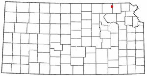
The first settlements were made at Axtell in the 1860s. The first post office in Axtell was established in December 1871. Axtell was laid out in 1872 when the railroad was extended to that point, and a railroad depot was built that year. It was named for Jesse Axtell, a railroad official.
Passages that mention Axtell, cut from the printed page as they were published.
History of Marshall County, Kansas1917 · page 745Read the page →
Read the text
Byron C. Graham received his education in the local schools of Medina county, and grew to manhood in the city of Spencer, Ohio, and where he remained until he was twenty-one years of age. He came to Kansas in 1880 and was employed on the railroad section for three years, at Axtell. He then purchased a farm of forty acres south of Axtell, where he engaged in farming for three years. He later sold the place and in 1895 bought a farm east of Mina, where he remained until 1903, when he purchased his present farm in St. Bridget township, where he is now the owner of three hundred
Text read by machine from the scan; it may contain errors.
The townsite of Axtell was surveyed in January, 1872, by the St. Joseph Town Company. The first building was erected by "Shoe-string" W. H. Dickinson, early in 1872, and used by him as a store for one year, when he was succeeded by R. F. White.
Text read by machine from the scan; it may contain errors.
Scans and text from the Internet Archive. Books published in 1930 or earlier, which are in the public domain.
Founding dates: Wikidata, Wikipedia, the U.S. post office records of Blevins & Helbock (CC0) and the Census. Homes by year built: Census ACS 2020–24. National Register of Historic Places: National Park Service (list of May 22, 2026). Old photos, postcards and papers: Wikimedia Commons, the Library of Congress and other public archives, credited on each item’s page. Maps: U.S. Geological Survey historical topographic maps (via Esri) and Sanborn fire-insurance maps (Library of Congress). History text and census tables: Wikipedia (CC BY-SA 4.0). Places that used to be: USGS Geographic Names Information System (2021). How TownRatings grades history →
From Wikimedia Commons (1), Wikipedia, Wikidata and Wikipedia for famous people, the US Post Offices dataset (Blevins & Helbock), the USGS Geographic Names Information System and old county and town histories (Internet Archive). Archive images are copied here with their credits and licenses, shown on each photo’s page. Refreshed monthly.


 2004