Alma’s post office opened in 1863, and 45% of its homes were built before 1940
4 places in town are on the National Register, among them a historic district with 21 buildings. Below: 7 old photos and papers, maps from 1885 on, and the census since 1880.
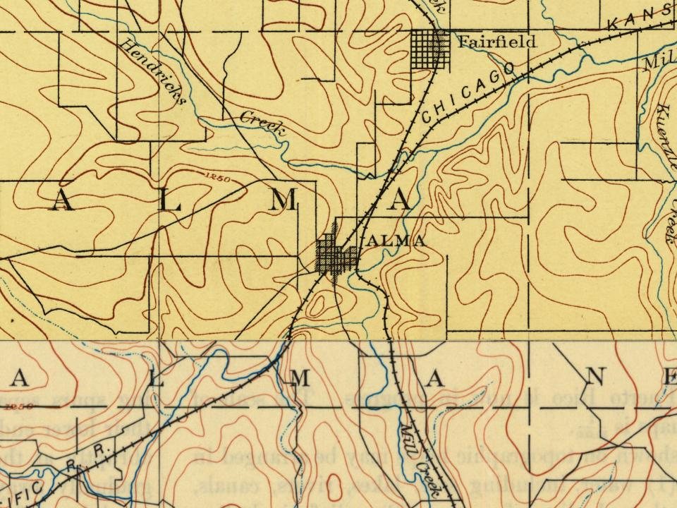
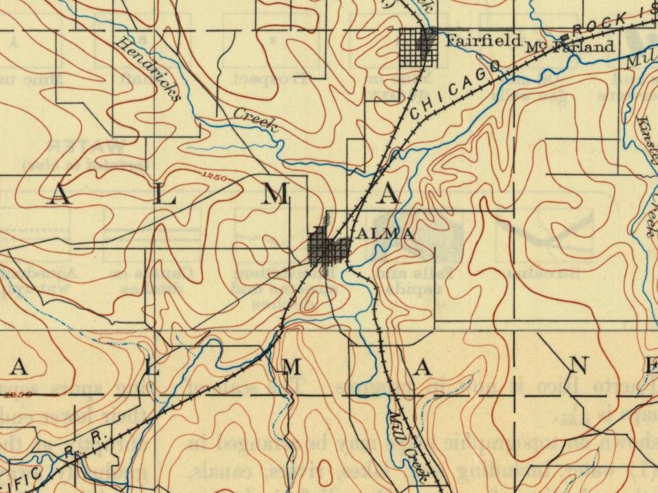
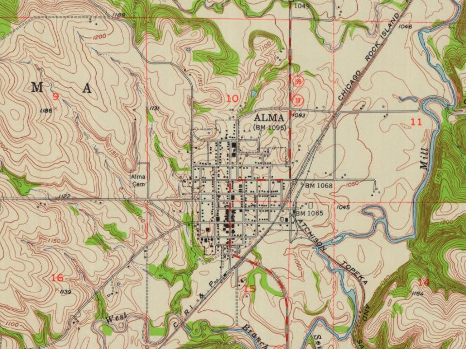
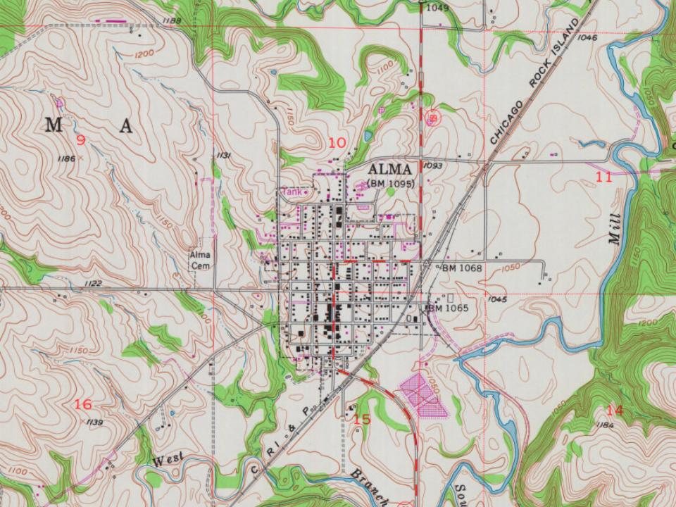
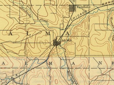
Every edition of the U.S. Geological Survey’s map of Alma. Tap a year, or press play to watch the town change.
1889Wamego sheet · 1:125,000
U.S. Geological Survey historical topographic maps (public domain), via Esri’s collection of the scans. The red ring marks the center of Alma.
People over time
Alma, census by census
Peaked at 1,125 in 1890; 802 people lived here in 2020.
15 censuses, 1880–2020.
U.S. Census Bureau decennial counts, from the census table on Alma’s Wikipedia page.
Every building
Alma, building by building, 1885–1922
Fire insurance maps drew every building, what it was made of and what it was used for, so insurers could price the risk of fire. Pick a year, then a sheet.
1885Sheet 1 of 1
Edition
Sheets
BrickWoodStone
Sanborn Map Company, via the Library of Congress. Editions published in 1930 or earlier, which are in the public domain.
In 1887, the Chicago, Kansas and Nebraska Railway built a main line from Topeka through Alma to Herington. The Chicago, Kansas and Nebraska Railway was foreclosed in 1891 and taken over by Chicago, Rock Island and Pacific Railway, which shut down in 1980. This line of the former Rock Island Railroad was sold to the Southern Pacific Railroad and later merged into the Union Pacific that operates and owns the line today. Most locals still refer to this railroad as the "Rock Island".
The city was named after either the city of Alma, Germany, or for a stream in Ukraine.
Passages that mention Alma, cut from the printed page as they were published.
Business directory and history of Wabaunsee County1907 · page 27Read the page →
Read the text
Alma, the "Shire Town," and most important point in Wabaunsee County, is located on Mill Creek. Most writers would say located at the junctions of the Rock Island and Santa Fe, but as Alma was here before the railroads, we claims that she is located on Mill Creek. With Hendricks branching from Mill Creek on the north and the Illinois on the south, the country
Text read by machine from the scan; it may contain errors.
Business directory and history of Wabaunsee County1907 · page 41Read the page →
Read the text
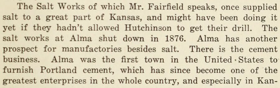
The Salt Works of which Mr. Fairfield speaks, once supplied salt to a great part of Kansas, and might have been doing it yet if they hadn't allowed Hutchinson to get their drill. The salt works at Alma shut down in 1876. Alma has another prospect for manufactories besides salt. There is the cement business. Alma was the first town in the United • States to furnish Portland cement, which has since become one of the greatest enterprises in the whole country, and especially in Kan-
Text read by machine from the scan; it may contain errors.
Scans and text from the Internet Archive. Books published in 1930 or earlier, which are in the public domain.
Timeline
Alma, 1863 to 1907
Woven from the archive, old maps, post office records, the National Register and the people born here.
Nothing in the archives for these yearsWeddings on Main Street, storms, parades, school pictures, the old store. If it’s in your family album, it belongs here.
The Alma post office opened in 1863, the earliest record of the town by name (U.S. post office records).
What is on the National Register in Alma?
4 listings: 3 buildings, among them the Wabaunsee County Courthouse (listed 2002, the first), and 1 historic district, the Alma Downtown Historic District, with 21 contributing buildings. 24 historic buildings in all.
Founding dates: Wikidata, Wikipedia, the U.S. post office records of Blevins & Helbock (CC0) and the Census. Homes by year built: Census ACS 2020–24. National Register of Historic Places: National Park Service (list of May 22, 2026). Old photos, postcards and papers: Wikimedia Commons, the Library of Congress and other public archives, credited on each item’s page. Maps: U.S. Geological Survey historical topographic maps (via Esri) and Sanborn fire-insurance maps (Library of Congress). History text and census tables: Wikipedia (CC BY-SA 4.0). Places that used to be: USGS Geographic Names Information System (2021). How TownRatings grades history →
From Wikimedia Commons (10), Wikidata (4), the National Register of Historic Places (4), Wikipedia, U.S. Geological Survey historical maps, U.S. Census counts (via Wikipedia), the US Post Offices dataset (Blevins & Helbock), the USGS Geographic Names Information System, Sanborn fire insurance maps (Library of Congress) and old county and town histories (Internet Archive). Archive images are copied here with their credits and licenses, shown on each photo’s page. Refreshed monthly.






 1907
 1907
 1907
 1907
 1907
 Date?
 2025
 2017
 2010


