


The story
Read it all →How Allen came to be
From Wikipedia’s history of Allen.
Allen was founded in 1854. It was incorporated as a city in 1909.
Text from Wikipedia, licensed CC BY-SA 4.0.
Each edition grades its towns against each other only.
Below: maps from 1885 on and the census since 1910.
Allen dates its founding to 1854 (Wikipedia’s history). The census first counted it in 1910.
Read from the archive, the National Register and the record. The page puts what stands out first.
The first neighbors to add old photos shape how Allen’s history is told.
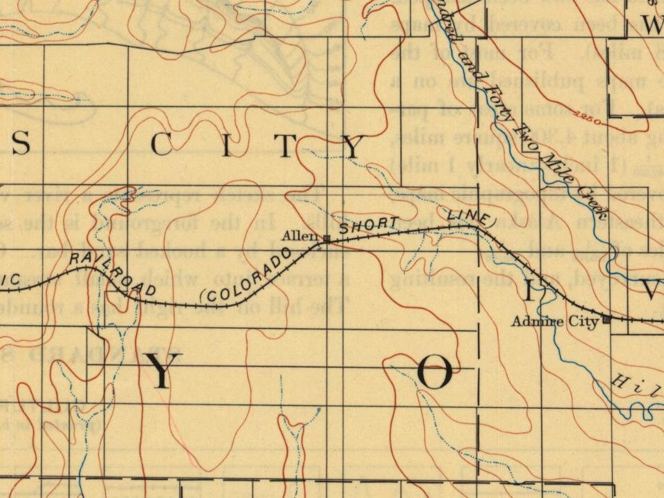
Every edition of the U.S. Geological Survey’s map of Allen. Tap a year, or press play to watch the town change.

U.S. Geological Survey historical topographic maps (public domain), via Esri’s collection of the scans. The red ring marks the center of Allen.
Peaked at 343 in 1930; 160 people lived here in 2020.
12 censuses, 1910–2020.
U.S. Census Bureau decennial counts, from the census table on Allen’s Wikipedia page.
From Wikipedia’s history of Allen.
Allen was founded in 1854. It was incorporated as a city in 1909.
Text from Wikipedia, licensed CC BY-SA 4.0.
Passages that mention Allen, cut from the printed page as they were published.

In all that engaged public interest, or went to make up her early history, whether it were an incipent county seat contest, an election to vote bonds to aid railroads or build machine shops, or a scheme to evade such bonds already voted, the lawyers of Allen County were conspicuously at the front. To preserve their names in history, and more especially to transmit to future generations of Allen County lawyers the memory of their predecessors who, during and prior to the seventies, drove angling across the unfenced quarter sections, of which it was composed, to talk politics in
Text read by machine from the scan; it may contain errors.
In 1858, at the earnest solicitation of the Union Settlement Company, which had bought a large body of land in Allen county, Kansas, and had laid out the town of Geneva, he disposed of his interest in the
Text read by machine from the scan; it may contain errors.Scans and text from the Internet Archive. Books published in 1930 or earlier, which are in the public domain.
Woven from the archive, old maps, post office records, the National Register and the people born here.
 On the mapFirst mapped by the U.S. Geological Survey
In 1854, according to Wikipedia’s history of the town. Allen’s post office opened in 1855, and the census of 1910 counted 286 people here.
What the archives can’t tell you, neighbors can.
Founding dates: Wikidata, Wikipedia, the U.S. post office records of Blevins & Helbock (CC0) and the Census. Homes by year built: Census ACS 2020–24. National Register of Historic Places: National Park Service (list of May 22, 2026). Old photos, postcards and papers: Wikimedia Commons, the Library of Congress and other public archives, credited on each item’s page. Maps: U.S. Geological Survey historical topographic maps (via Esri) and Sanborn fire-insurance maps (Library of Congress). History text and census tables: Wikipedia (CC BY-SA 4.0). Places that used to be: USGS Geographic Names Information System (2021). How TownRatings grades history →
From Wikimedia Commons (2), Wikipedia, U.S. Geological Survey historical maps, U.S. Census counts (via Wikipedia), the US Post Offices dataset (Blevins & Helbock), the USGS Geographic Names Information System and old county and town histories (Internet Archive). Archive images are copied here with their credits and licenses, shown on each photo’s page. Refreshed monthly.
 2013
 2004