Whitewater was originally called Hillsborough, and under the latter name was laid out and platted in 1828. The community was named after the nearby Whitewater River.
Passages that mention Whitewater, cut from the printed page as they were published.
History of Wayne County, Indiana1884 · page 399Read the page →
Read the text
Whitewater, an incorporated town of about 200 inhabitants, is situated near the Middle Fork of the Whitewater, on the Richmond and Whitewater turnpike. Tlie town was laid out by Stephen Elliott and John White, and plat recorded Nov. 12, 1828. An addition was made by Stephen Elliott in 1832. The town was first called Hillsboro, and it was known by that name until recently, when the name was changed to Whitewater.
Text read by machine from the scan; it may contain errors.
History of Wayne County, Indiana1884 · page 527Read the page →
Read the text
changed to Cambridge, where, for many years, only occasional preaching was had, and meetings were held in the churches of other societies and in school-houses. In 1853 the name of the Presbytery was changed to Whitewater; and the same year the name of the church was changed to Presbyterian church of Cambridge City. The present house of worship was built in 1858, on the corner of Railroad and Green streets, on a lot given to the society by Charles H. and Nathan
Text read by machine from the scan; it may contain errors.
History of Wayne county, Indiana, from its first settlement to the present time1872 · page 212Read the page →
Read the text
The progress of settlement northward was materially retarded by apprehensions of danger from the Indians, until after the close of the war of 1812^ Job Elliott, K C, in 1815 settled half a mile south of the present town of Whitewater, where F. Fonts lately lived, now Josiah White. Stephen Elliott on quarter adjoining town. Wm. Hunt, N. C, on the east side of
Text read by machine from the scan; it may contain errors.
History of Wayne county, Indiana, from its first settlement to the present time1872 · page 28Read the page →
Read the text
The next year after Holman and others settled as above stated, lands were taken up where liichmond now stands, and on the west side of Whitewater. About the first of March, 1806, David Hoover, then a young man, residing with his father in the Miami country in Ohio, with four others, in search of a place for making a settlement, took a section line some eight or ten miles north of Dayton, and traced it a distance of more than thirty miles, through an unbroken forest,
Text read by machine from the scan; it may contain errors.
Scans and text from the Internet Archive. Books published in 1930 or earlier, which are in the public domain.
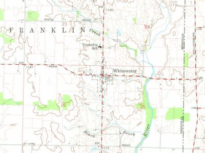
Founding dates: Wikidata, Wikipedia, the U.S. post office records of Blevins & Helbock (CC0) and the Census. Homes by year built: Census ACS 2020–24. National Register of Historic Places: National Park Service (list of May 22, 2026). Old photos, postcards and papers: Wikimedia Commons, the Library of Congress and other public archives, credited on each item’s page. Maps: U.S. Geological Survey historical topographic maps (via Esri) and Sanborn fire-insurance maps (Library of Congress). History text and census tables: Wikipedia (CC BY-SA 4.0). Places that used to be: USGS Geographic Names Information System (2021). How TownRatings grades history →
From Wikimedia Commons (1), Wikipedia, U.S. Geological Survey historical maps, U.S. Census counts (via Wikipedia), the US Post Offices dataset (Blevins & Helbock), the USGS Geographic Names Information System and old county and town histories (Internet Archive). Archive images are copied here with their credits and licenses, shown on each photo’s page. Refreshed monthly.



 2016
