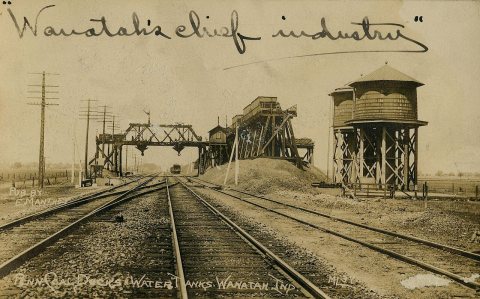
The first settlements were made at Wanatah in the 1850s when the railroad was extended to that point. Wanatah was platted in 1865. It was named for Wanata, a Native American leader.
Passages that mention Wanatah, cut from the printed page as they were published.
A Twentieth Century History and Biographical Record of Laporte County Indiana1904 · page 196Read the page →
Read the text
Wanatah, in Cass township, has had a mill where the Pittsburg, Fort Wayne & Chicago rail¬ road crosses Hog creek (erroneously named Hawk creek on the county map of 1892) since Joseph L Unruh (wrongly called Nurwgh in Chapman’s History) established one there in 1867. He had very hopefully founded the vil¬ lage of Rozelle, but the completion of the railroad
Text read by machine from the scan; it may contain errors.
A Twentieth Century History and Biographical Record of Laporte County Indiana1904 · page 621Read the page →
Read the text
Groth store in Wanatah, and is proving a worthy successor of his honored father in the conduct of the business. Lulu Bell assists in the store, and the youngest child, Loman Monroe, is still at¬ tending school in Wanatah, in the eighth grade.
Text read by machine from the scan; it may contain errors.
Scans and text from the Internet Archive. Books published in 1930 or earlier, which are in the public domain.
Founding dates: Wikidata, Wikipedia, the U.S. post office records of Blevins & Helbock (CC0) and the Census. Homes by year built: Census ACS 2020–24. National Register of Historic Places: National Park Service (list of May 22, 2026). Old photos, postcards and papers: Wikimedia Commons, the Library of Congress and other public archives, credited on each item’s page. Maps: U.S. Geological Survey historical topographic maps (via Esri) and Sanborn fire-insurance maps (Library of Congress). History text and census tables: Wikipedia (CC BY-SA 4.0). Places that used to be: USGS Geographic Names Information System (2021). How TownRatings grades history →
From Wikimedia Commons (12), Wikipedia, U.S. Geological Survey historical maps, U.S. Census counts (via Wikipedia), the US Post Offices dataset (Blevins & Helbock), the USGS Geographic Names Information System and old county and town histories (Internet Archive). Archive images are copied here with their credits and licenses, shown on each photo’s page. Refreshed monthly.


 2017
 2017
 2017
 2017
 2013
 2010
 2010
 2010
 2010
 2009
 2007
 2007


