Vincennes dates to 1732, and 31% of its homes were built before 1940
Among the most historic 1% of U.S. towns · #8 of 593 in Indiana. What drives it
10 places in town are on the National Register, among them the William Henry Harrison Home (Grouseland), a National Historic Landmark, and four historic districts with 1,098 buildings between them. Below: 9 old photos and papers, maps from 1887 on, and the census since 1850.
Founding year: Wikidata; Wikipedia’s history section gives the same year. First post office: 1799.The full story ↓
History grade
What drives Vincennes’ History grade
On its age, its old homes and the National Register, Vincennes is among the most historic 1% of U.S. towns, #8 of 593 in Indiana. All 3 inputs put Vincennes near the top nationally; its National Register listings ranks highest.
A+
HistoryA character grade: shown, never part of Vincennes’ overall grade.
Indiana towns list more on the Register than most of the country (a typical Indiana town has 7.9 per 10,000 residents, the U.S. 2.4), so Vincennes’ 693 sits above most of its state (97% of Indiana towns have fewer) while its 1,150 historic buildings outnumber those of 99% of U.S. towns.
How sure. Graded on any two of the three inputs instead, the letter would still be A+. The pre-1940 share is a Census survey estimate (±3.8 points). Two sources give 1732.
Founding year: Wikidata (other dates in Quick answers). Homes: Census ACS 2020–24. National Register: National Park Service, May 2026 list; each listing counted once (boundary changes and added documentation belong to their listing), and a historic district counts its contributing buildings. How TownRatings grades history →
What stands out about Vincennes’ past
Read from the archive, the National Register and the record. The page puts what stands out first.
National Park Service, National Register of Historic Places. Photos from Wikimedia Commons, credited on each place’s page.
Every building
Vincennes, building by building, 1887–1916
Fire insurance maps drew every building, what it was made of and what it was used for, so insurers could price the risk of fire. Pick a year, then a sheet.
The vicinity of Vincennes was inhabited for thousands of years by different cultures of indigenous peoples. During the Late Woodland period, some of these peoples used local loess hills as burial sites; some of the more prominent examples are the Sugar Loaf Mound and the Pyramid Mound. In historic times, prominent local Indian groups who drove these people out were the Shawnee, Wabash, and the Miami tribe.
Passages that mention Vincennes, cut from the printed page as they were published.
History of Knox and Daviess County, Indiana1886 · page 97Read the page →
Read the text
By this act it was provided, first, that 400 acres of land should be given to the head of each family residing at Vincennes or in the Illinois country in the year 1783; second, that a tract of land containing 5,400 acres near Vincennes, which had been under fence and used as a pasture for thirty years, should be given to the inhabitants of Vincennes to be used by them as a common until otherwise disposed of by laws ; third, that the governor of the Territory be authorized to donate a tract of land of
Text read by machine from the scan; it may contain errors.
History of Knox and Daviess County, Indiana1886 · page 269Read the page →
Read the text
This town is located on the southeast quarter of southeast quarter of Section 4, Town 5 north, Range 7 west. ' The town is on the Indianapolis & Vincennes Railroad in the Northern part of Vigo Township, and was laid out by George Halstead, October 7, 1868. The place was named in honor of a civil engineer on the Indianapolis & Vincennes Railroad. It is in a good farming community, and large quantities of grain and stock are shipped from this point. An extensive business was done in the place, between 1865 and 1870,
Text read by machine from the scan; it may contain errors.
Scans and text from the Internet Archive. Books published in 1930 or earlier, which are in the public domain.
Timeline
Vincennes, 1732 to 1966
Woven from the archive, old maps, post office records, the National Register and the people born here.
Nothing in the archives for these yearsWeddings on Main Street, storms, parades, school pictures, the old store. If it’s in your family album, it belongs here.
In 1732, according to Wikidata and Wikipedia’s history of the town. Vincennes’ post office opened in 1799, and the census of 1850 counted 2,070 people here.
How does Vincennes rank for history?
Vincennes is among the most historic 1% of U.S. towns, #8 of 593 in Indiana. The History grade combines the town’s founding era, the share of homes built before 1940 and its National Register listings. It’s a character grade, so it isn’t part of the overall grade. How it works.
What is on the National Register in Vincennes?
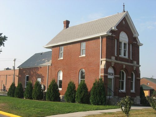
10 listings: 6 buildings, among them the William Henry Harrison Home (Grouseland) (a National Historic Landmark since 1960), and 4 historic districts with 1,098 contributing buildings. 1,150 historic buildings in all.
How old are the homes in Vincennes?
31% of Vincennes’ homes were built before 1940 (Census estimate, ±3.8 points), against a typical 14% for an Indiana town; the median home was built in 1959.
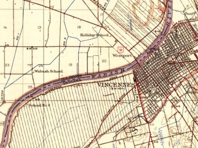
Founding dates: Wikidata, Wikipedia, the U.S. post office records of Blevins & Helbock (CC0) and the Census. Homes by year built: Census ACS 2020–24. National Register of Historic Places: National Park Service (list of May 22, 2026). Old photos, postcards and papers: Wikimedia Commons, the Library of Congress and other public archives, credited on each item’s page. Maps: U.S. Geological Survey historical topographic maps (via Esri) and Sanborn fire-insurance maps (Library of Congress). History text and census tables: Wikipedia (CC BY-SA 4.0). Places that used to be: USGS Geographic Names Information System (2021).
From Wikimedia Commons (9), Wikidata (3), the National Register of Historic Places (10), Wikipedia, Wikidata and Wikipedia for famous people, U.S. Geological Survey historical maps, U.S. Census counts (via Wikipedia), the US Post Offices dataset (Blevins & Helbock), the USGS Geographic Names Information System, Sanborn fire insurance maps (Library of Congress) and old county and town histories (Internet Archive). Archive images are copied here with their credits and licenses, shown on each photo’s page. Refreshed monthly.


 ★ Landmark




 1821
 1821
 1917
 1917
 1917
 1917


