Joseph Boxell platted Van Buren Township in 1837. Martin Van Buren was the United States president at the time. In 1843 George H. D. Rood settled here and the creek that runs through the town was called Roods Run. As the area grew and developed it was called many names including Roods Corner, Roods Town, Roods Crossroads and Stringtown. In 1888 C.W. platted the area and it was known as Van Buren. In June 1892 the town became incorporated by the state of Indiana.
Peaked at 1,189 in 1910; 790 people lived here in 2020.
14 censuses, 1880–2020.
U.S. Census Bureau decennial counts, from the census table on Van Buren’s Wikipedia page.
From the old history books
What they wrote about Van Buren in 1914
Passages that mention Van Buren, cut from the printed page as they were published.
Centennial History of Grant County Indiana1914 · page 1354Read the page →
Read the text
their grandmother's death they purchased what was known as the Plummer farm, and here they worked together until 1899, when Robert W. Bradford bought what is now the Losure farm, but soon sold this property in order to go into business in Van Buren. In 1905 he bought his present property of eighty acres, located in section 10, Van Buren township, and this he now has in a high state of cultivation, having been improved by the most approved modern methods. Mr. Bradford manures heavily, restores soil with clover and alternates his crops,
Text read by machine from the scan; it may contain errors.
Centennial History of Grant County Indiana1914 · page 1181Read the page →
Read the text
acre tract. He next divided an eighty between his son Samuel T. and a daughter, and he gave to John A. an eighty as well, while his daugh ter Rose was the recipient of a forty acre plot. In 1890 Mr. Doyle came to Van Buren and bought sixty -six acres, since that time making his home here. A part of the piece has been platted for town lots, but there yet remains forty-four and a half acres, upon which he makes his home.
Text read by machine from the scan; it may contain errors.
Scans and text from the Internet Archive. Books published in 1930 or earlier, which are in the public domain.
Timeline
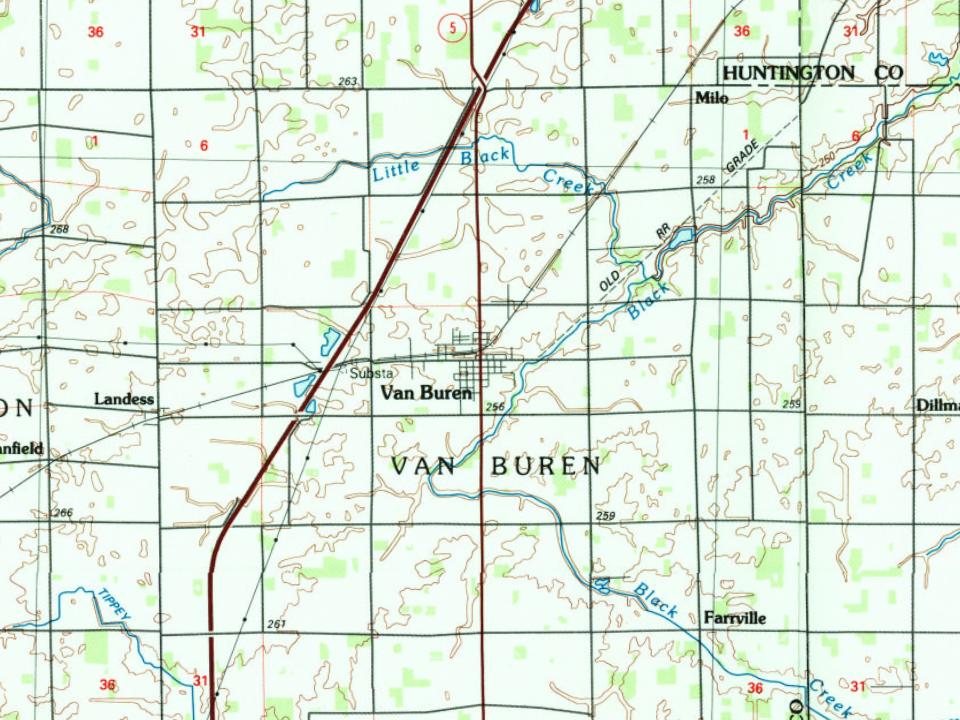
Van Buren, 1872 to 1986
Woven from the archive, old maps, post office records, the National Register and the people born here.
U.S. Geological Survey historical topographic maps (public domain), via Esri’s collection of the scans. The red ring marks the center of Van Buren.
Every building
Van Buren, building by building, 1898–1911
Fire insurance maps drew every building, what it was made of and what it was used for, so insurers could price the risk of fire. Pick a year, then a sheet.
Founding dates: Wikidata, Wikipedia, the U.S. post office records of Blevins & Helbock (CC0) and the Census. Homes by year built: Census ACS 2020–24. National Register of Historic Places: National Park Service (list of May 22, 2026). Old photos, postcards and papers: Wikimedia Commons, the Library of Congress and other public archives, credited on each item’s page. Maps: U.S. Geological Survey historical topographic maps (via Esri) and Sanborn fire-insurance maps (Library of Congress). History text and census tables: Wikipedia (CC BY-SA 4.0). Places that used to be: USGS Geographic Names Information System (2021). How TownRatings grades history →
From Wikimedia Commons (1), Wikipedia, Wikidata and Wikipedia for famous people, U.S. Geological Survey historical maps, U.S. Census counts (via Wikipedia), the US Post Offices dataset (Blevins & Helbock), the USGS Geographic Names Information System, Sanborn fire insurance maps (Library of Congress) and old county and town histories (Internet Archive). Archive images are copied here with their credits and licenses, shown on each photo’s page. Refreshed monthly.


 Date?