209 years in pictures
Census counts: 525 in 1880, a low of 411 in 1990, 860 in 2020. The archive holds 6 old photos and papers going back to 1988 and 8 maps from 1905 on.
- 1817Utica Township is settled
Each edition grades its towns against each other only.

Utica Township grades C+ overall, 424th of 585 graded towns in Indiana, with clear strengths and some subjects that lag. The median household earns $103K and it has 13 miles of trail. Its lowest everyday mark is in health: residents are less healthy than 68% of U.S. towns on CDC estimates. A typical home there costs about $235K, 3.2 years of the Louisville/Jefferson County metro’s $74K median household income. Only 71 of Indiana’s 1,096 towns score lower on cost of living. 9.6% of the land in Utica Township is conserved, where Indiana’s towns sit at 1.9% and U.S. towns at 4.3%. The biggest park or preserve is Chapel Lake Park, at 82 acres.
Where Utica Township beats most towns.
6,016 counted in 2010 and 8,158 in 2020; an estimated 9,258 in 2025.
Growth hasn’t slowed: 13.6% since 2020, after 35.6% in the decade before.
U.S. Census 2010 & 2020 counts · Census Bureau estimate, July 1, 2025
Each subject compared with towns across the country (schools within Indiana), ordered by how far Utica Township is from typical.
How TownRatings grades towns →
Census counts: 525 in 1880, a low of 411 in 1990, 860 in 2020. The archive holds 6 old photos and papers going back to 1988 and 8 maps from 1905 on.
Museums, parks, gardens and other places to visit around Utica Township. Close and well known come first.
Big draw37 mi LandmarkUnited States Bullion Depository
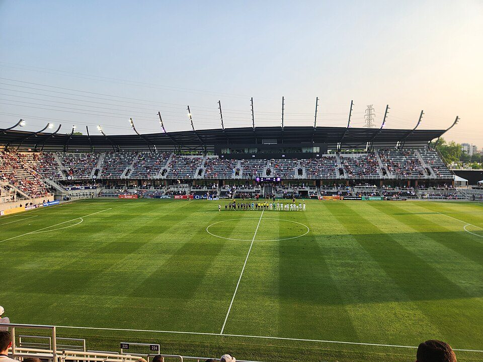
8 mi Stadium & arenaLynn Family Stadium
12 mi Theme parkKentucky Kingdom
8 mi Stadium & arenaKFC Yum! Center
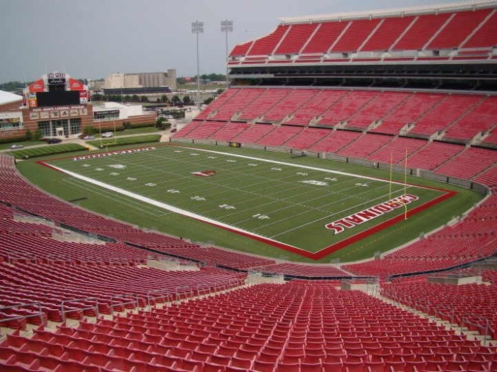
12 mi Stadium & arenaL&N Federal Credit Union StadiumUnited States Bullion Depository: Work permit Original author=Cliff, CC BY-SA 4.0 · Lynn Family Stadium: Bpluke01, CC BY-SA 4.0 · Kentucky Kingdom: Stevietheman at English Wikipedia, CC BY-SA 3.0 · KFC Yum! Center: Jamesmac96, CC BY 3.0 · L&N Federal Credit Union Stadium: Perthsider, CC BY-SA 3.0
Who provides power, water and the rest in Utica Township, and how to reach them.
EPA SDWIS (Oct 9, 2026) · HIFLD + EIA-861 2025 · Census 2020 ZCTAs · NCES 2024–25 · registration: vote.gov, updated Nov 18, 2024.
Ordered by what stands out in Utica Township.
Utica Township has more 90° days than almost anywhere else in Indiana and draws workers from Jeffersonville and beyond, but it trails even towns with similar incomes on health.
Utica Township’s trail density is 0.6 miles per square mile, against 0.2 in Indiana’s towns and 0.4 across U.S. towns.
| Biggest places to walk | Trails | Acres |
|---|---|---|
| 1. Chapel Lake Park | 0.1 mi | 82 |
| 2. Charlestown State Park | — | 62 |
| 3. Carol Thierman Community Park | — | 1 |
Trails & parks © OpenStreetMap contributors · Conserved land: USGS PAD-US
Its public schools are run by the Greater Clark County Schools. Its one school is below.
| School | Level | Students | Letter |
|---|---|---|---|
| Utica Elementary SchoolLargest public elementary schoolGrades PK–5 | Grades PK–5 | 608 | A |
NCES · EDFacts · graded within IN on state tests and graduation
14,069 jobs are based in Utica Township, 3 for every working resident, so most of the people who work here commute in. 34% of working residents cross a state line to work, Louisville among the top destinations.
Most working residents leave Utica Township for work: only 10% work in town. 4% of residents live below the poverty line in Utica Township. Jobs based in Utica Township grew to 14,069 in 2023, 5,829 more than in 2013.
| Utica Township | Indiana towns | U.S. towns | |
|---|---|---|---|
| Work from home | 17% | 7.8% | 11% |
| Median household income | $103,000 | $71,000 | $80,000 |
| Below the poverty line | 4% | 10% | 9.6% |
| Average trip to work | 21 minutes | 24 minutes | 25 minutes |
Census LEHD 2023 · ACS
Against the 8,141 U.S. towns with household incomes like Utica Township’s, it is less healthy than 91%, so it trails even them.
45% of Utica Township adults have obesity. Utica Township beats the Indiana average on 0 of 32 CDC measures and trails it on 1. 40% of Utica Township adults have high blood pressure.
| Utica Township | Indiana towns | U.S. towns | |
|---|---|---|---|
| Obesity (CDC PLACES) | 45% | 39% | 35% |
| High blood pressure (CDC PLACES) | 40% | 39% | 35% |
| Depression (CDC PLACES) | 26% | 26% | 23% |
| Smoke cigarettes (CDC PLACES) | 17% | 17% | 14% |
| What stands out | Utica Township | IN |
|---|---|---|
| More adults with obesity | 44.6% | 38.4% |
CDC PLACES 2025 · modeled estimates for adults · CMS · HRSA
The Louisville Mcalpine weather station, 8 miles away, records that about 46 days a year reach 90°, the #2 highest of 1,978 Indiana places with climate records. The Louisville Mcalpine weather station, 8 miles away, records that the frost-free season runs about 225 days, the highest of 1,978 Indiana places with climate records.
Utica Township has chilly winters and warm summers, with plenty of rain. The July high in Utica Township is 88°F.
NOAA U.S. Climate Normals, 1991–2020
Utica Township’s median rent is $1,336 a month. The typical Utica Township home is worth about $235,000, up 0.7% in a year, 9% below the Indiana typical home.
| Utica Township | Indiana towns | U.S. towns | |
|---|---|---|---|
| Households that own their home | 85% | 76% | 73% |
| Median rent | $1,336 a month | $946 a month | $1,185 a month |
Census ACS, 2020–24 · Zillow Home Value Index · Redfin Data Center
Expected storm and flood damage is lower than in 57% of U.S. communities. Since 1997, 61 flood insurance claims have been paid out in Utica Township.
FEMA flood insurance claims · FEMA National Risk Index · OpenFEMA
11 within 15 miles of the center of Utica Township
About 4 of every 100 Utica Township residents are enrolled in college, against 6 across Indiana.
Where Utica Township’s working residents go each day. Line width shows the share.
Census LEHD 2023
Town in Indiana, United States
Utica is a town in Utica Township, Clark County, Indiana, United States. It lies adjacent to major infrastructure: the Interstate 265 bridge across the Ohio (opened in 2016), the nearby Port of Indiana – Jeffersonville, and the River Ridge Commerce Center. These developments shape its land-use environment and limit the town's potential for large-scale growth. Between 1990 and 2020 the population of Utica more than doubled. In this period several new residential subdivisions emerged in the area. Although the town is geographically constrained, the influx of new housing helped fuel the population increase.
From Wikipedia, licensed CC BY-SA 4.0 · facts via Wikidata (CC0)
7 towns share a border with Utica Township.
All 5 graded towns on its borders grade higher than its C+; Jeffersonville Township (C+) is closest.
| Town | IN rank | Overall | Cost | Safety | Schools | Health |
|---|---|---|---|---|---|---|
| Utica Township | #424 | C+ | C+ | — | B− | C |
| Charlestown Township | #261 | B | A− | — | B− | C+ |
| Jeffersonville | #346 | B− | B | — | B− | C |
| Silver Creek Township | #157 | A− | B | — | B+ | B |
| Jeffersonville Township | #410 | C+ | B | — | B− | C− |
| Utica | — | — | B+ | — | B− | C+ |
| Charlestown | #297 | B | B+ | — | B− | C+ |
Utica has fewer than 2,500 residents, so it gets subject grades but no overall grade. Utica Township, Charlestown Township, Jeffersonville, Silver Creek Township, Jeffersonville Township, Utica and Charlestown report no FBI crime data of their own. Compare Utica Township with a neighbor →
Short answers, built from the data on this page.
Utica Township grades C+ overall, better than 43% of U.S. towns and #424 of 585 in Indiana. It grades C for health and B− for schools.
Cost of living, which also weighs rents, property taxes and how many households pay 30% or more of their income for housing, grades C+.