
Springfield Township VFD LaPorte County, 2026
Springfield Township’s story
Springfield Township in pictures
The archive holds 1 old photo or paper going back to 2026 and 3 maps from 1958 on.
Explore the history →Each edition grades its towns against each other only.
A town of 3,731.
Springfield Township grades C− overall, 560th among Indiana's 585 graded towns, with clear strengths and some subjects that lag. The median household earns $85K. On the other side, CDC estimates put its residents' health behind 79% of the country. Only 75 of Indiana’s 1,096 towns score lower on cost of living. Most errands need a car: it is less walkable than 92% of U.S. towns. The biggest place to walk is Ambler Flatwoods Nature Preserve, 290 acres with 2.8 miles of trail.
Where Springfield Township’s working residents go each day. Line width shows the share.
Census LEHD 2023
Each subject compared with towns across the country (schools within Indiana), ordered by how far Springfield Township is from typical.
How TownRatings grades towns →
The archive holds 1 old photo or paper going back to 2026 and 3 maps from 1958 on.
Explore the history →Museums, parks, gardens and other places to visit around Springfield Township. Close and well known come first.
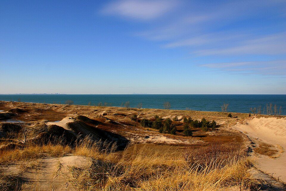 8 mi National ParkIndiana Dunes National Park2.6M visitors a year
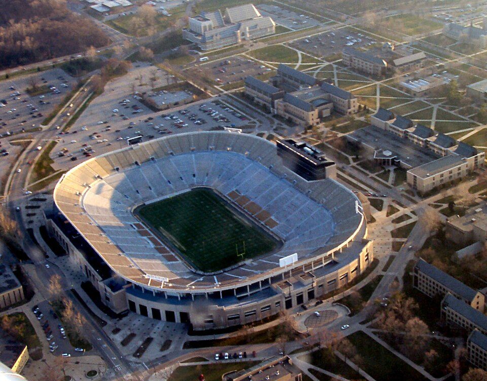 Big draw27 mi Stadium & arenaNotre Dame Stadium
 38 mi MuseumMascot Hall of Fame
 27 mi CaveGrotto of Our Lady of Lourdes, Notre Dame
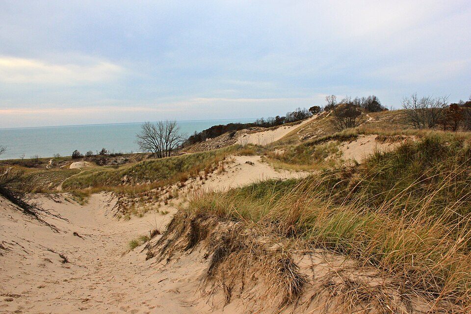 16 mi State parkWarren Dunes State Park
 27 mi Ancient siteFort St. Joseph
Indiana Dunes National Park: J. Crocker, Attribution · Notre Dame Stadium: Tysto, Public domain · Mascot Hall of Fame: No machine-readable author provided. JGlover assumed (based on copyright claims), CC BY-SA 2.5 · Grotto of Our Lady of Lourdes, Notre Dame: Know1one1, CC BY-SA 3.0 · Warren Dunes State Park: hakkun, CC BY-SA 3.0 · Fort St. Joseph: Chris Light (talk), CC BY-SA 3.0
Who provides power, water and the rest in Springfield Township, and how to reach them.
EPA SDWIS (Oct 9, 2026) · HIFLD + EIA-861 2025 · Census 2020 ZCTAs · NCES 2024–25 · registration: vote.gov, updated Nov 18, 2024.
Ordered by what stands out in Springfield Township.
Springfield Township gets more snow than almost anywhere else in Indiana and has added a third more jobs in ten years.
36% of adults feel lonely in Springfield Township, against 32% in Indiana’s towns and 33% across U.S. towns. 16% of adults have diabetes in Springfield Township. Springfield Township beats the Indiana average on 0 of 32 CDC measures and trails it on 15.
| Springfield Township | Indiana towns | U.S. towns | |
|---|---|---|---|
| Feel lonely (CDC PLACES) | 36% | 32% | 33% |
| Diabetes (CDC PLACES) | 16% | 13% | 12% |
| High blood pressure (CDC PLACES) | 42% | 39% | 35% |
| Binge drink (CDC PLACES) | 15% | 16% | 16% |
| What stands out | Springfield Township | IN |
|---|---|---|
| More adults facing a utility shut-off | 10.3% | 8.4% |
| More adults facing food insecurity | 17.7% | 14.7% |
| More adults with diabetes | 15.5% | 13% |
CDC PLACES 2025 · modeled estimates for adults · CMS · HRSA
Its public schools are run by the Michigan City Area Schools. Two of its 3 schools are below, each with why it’s listed.
| School | Level | Students | Letter |
|---|---|---|---|
| Springfield Elementary SchoolLargest public elementary schoolGrades PK–6 | Grades PK–6 | 312 | C |
| La Lumiere School PrivateLargest high schoolGrades 9–12 | Grades 9–12 | 169 | – |
NCES · EDFacts · graded within IN on state tests and graduation
Jobs based here grew from 421 in 2013 to 586.
Most working residents leave Springfield Township for work: only 3% work in town. Since 2013, Springfield Township has added 165 jobs, to 586 in 2023. Springfield Township’s average trip to work is 28 minutes, where Indiana’s towns sit at 24 minutes and U.S. towns at 25 minutes.
| Springfield Township | Indiana towns | U.S. towns | |
|---|---|---|---|
| Average trip to work | 28 minutes | 24 minutes | 25 minutes |
| Working residents who work in town | 2.8% | 11% | 8% |
| Below the poverty line | 7.2% | 10% | 9.6% |
| Median household income | $85,000 | $71,000 | $80,000 |
Census LEHD 2023 · ACS
4.8 miles of trail in 2 parks and preserves.
| Springfield Township | Indiana towns | U.S. towns | |
|---|---|---|---|
| Miles of trail per square mile | 0.1 miles per square mile | 0.2 | 0.4 |
| Conserved land | 1.5% | 1.9% | 4.3% |
| Biggest places to walk | Trails | Acres |
|---|---|---|
| 1. Ambler Flatwoods Nature Preserve | 2.8 mi | 290 |
| 2. Flora Richardson Preserve | 1.8 mi | 117 |
Trails & parks © OpenStreetMap contributors · Conserved land: USGS PAD-US
The Laporte weather station, 8 miles away, records that 65 inches of snow fall in a normal winter, the highest of 1,972 Indiana places with climate records.
Springfield Township has chilly, snowy winters and pleasant summers. Only 10 of the 593 Indiana towns we compare have a lower July high than Springfield Township.
NOAA U.S. Climate Normals, 1991–2020
Expected storm and flood damage is lower than in 67% of U.S. communities. One flood insurance claim has been paid in Springfield Township since 2008.
FEMA flood insurance claims · FEMA National Risk Index · OpenFEMA
Springfield Township’s median age is 51.2 years. Adults 18 to 34 are 17% of residents (23% statewide); adults 35 to 64 are 43% of residents (37% statewide). 23% of Springfield Township residents are 65 or older.
| Springfield Township | Indiana towns | U.S. towns | |
|---|---|---|---|
| Median age | 51.2 years | 39.4 years | 40.5 years |
| Aged 65 or older | 23% | 18% | 18% |
| Bachelor’s degree or more, 25+ | 24% | 22% | 29% |
51% women, 49% men
That’s an even split within the survey’s margin of ±4.1 points. Across Indiana, 50.4% of residents are women.
| Springfield Township | IN | U.S. | |
|---|---|---|---|
| Under 10 | 7% | 12.4% | 11.6% |
| 10 to 17 | 10.7% | 10.9% | 10.3% |
| 18 to 24 | 3% | 9.6% | 9.1% |
| 25 to 34 | 13.7% | 13.1% | 13.7% |
| 35 to 44 | 12% | 12.7% | 13.2% |
| 45 to 54 | 13.5% | 12% | 12.2% |
| 55 to 64 | 17.6% | 12.5% | 12.7% |
| 65 to 74 | 15.5% | 10.1% | 10.2% |
| 75 and older | 7.1% | 6.7% | 7% |
| No diploma | 9% | 9.6% | 10.4% |
| High school | 37.9% | 32.5% | 26% |
| Some college | 15.6% | 19.3% | 19.1% |
| Associate’s | 13.5% | 9.1% | 8.8% |
| Bachelor’s | 15.6% | 18.7% | 21.6% |
| Graduate | 8.4% | 10.8% | 14.1% |
U.S. Census Bureau · ACS 2020-2024 5-year estimates · in a town of 3,700, single groups can be off by several points
None within 15 miles of Springfield Township; the nearest are
About 3 of every 100 Springfield Township residents are enrolled in college, against 6 across Indiana.
Township in Indiana, United States
Springfield Township is one of twenty-one townships in LaPorte County, Indiana. As of the 2020 census, its population was 3,770 (down from 4,045 at 2010) and it contained 1,574 housing units. Springfield Township was established in 1835.
From Wikipedia, licensed CC BY-SA 4.0 · facts via Wikidata (CC0)
6 towns share a border with Springfield Township.
All 3 graded towns on its borders grade higher than its C−; Michigan City (C−) is closest.
| Town | IN rank | Overall | Cost | Safety | Schools | Health |
|---|---|---|---|---|---|---|
| Springfield Township | #560 | C− | C+ | — | C | C− |
| Galena Township | — | — | A− | — | A | C+ |
| Michigan Township | #496 | C | B+ | — | C | D |
| Michigan City | #558 | C− | B+ | C | C | D |
| Center Township | #320 | B | A− | — | B− | C |
Galena Township has fewer than 2,500 residents, so it gets subject grades but no overall grade. Springfield Township, Galena Township, Michigan Township and Center Township report no FBI crime data of their own. Compare Springfield Township with a neighbor →
Short answers, built from the data on this page.
Springfield Township grades C− overall, better than 16% of U.S. towns and #560 of 585 in Indiana. It grades C− for health and C for schools. Walkability is its weak spot, with a D.
Cost of living, which also weighs rents, property taxes and how many households pay 30% or more of their income for housing, grades C+.


