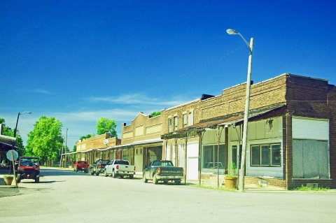
Russellville was laid out in 1828. The town took its name from Russell Township. A post office has been in operation at Russellville since 1832. Russellville was incorporated in the 1880s when the railroad was extended to that point.
Passages that mention Russellville, cut from the printed page as they were published.
Weik's history of Putnam County, Indiana1910 · page 733Read the page →
Read the text
After returning home Mr. Graham began trading in and shipping stock at Russellville, his brother George becoming his partner. In 1867 they began buving land in Brown township, Montgomery county, one and one-halt miles from Russellville Station, starting out with eighty acres. They made monev rapidlv farming and shipping from Russellville and \^-aveland, keepinwell posted in the dailv markets, being constantly buying or in the market, shippintwo hundred cars of livestnck m .me year. Mr. Graham was also accustomed to buving horses in large numbers, which he kept on his larm
Text read by machine from the scan; it may contain errors.
Weik's history of Putnam County, Indiana1910 · page 159Read the page →
Read the text
and operated it from 1826 to 1830. This factory gave employment to all who were not otherwise employed, in digging "sang." which fountl a ready market. Jesse Blake, also, had an interest in this factor}-. The first church was built at Russellville in 1830. When the town was laid out in iSj8. arrangements were made for the erection of a church, which was completed two years later. The first Fourth of July celebration was held on the farm of John Dougherty, near Portland ]\lills. in 1S28. Gen. George K. Steele acting as marshal of the day. Drs. James B. Clark. Copeland. Winslow.
Text read by machine from the scan; it may contain errors.
Scans and text from the Internet Archive. Books published in 1930 or earlier, which are in the public domain.
Timeline
Russellville, 1832 to 1955
Woven from the archive, old maps, post office records, the National Register and the people born here.
Founding dates: Wikidata, Wikipedia, the U.S. post office records of Blevins & Helbock (CC0) and the Census. Homes by year built: Census ACS 2020–24. National Register of Historic Places: National Park Service (list of May 22, 2026). Old photos, postcards and papers: Wikimedia Commons, the Library of Congress and other public archives, credited on each item’s page. Maps: U.S. Geological Survey historical topographic maps (via Esri) and Sanborn fire-insurance maps (Library of Congress). History text and census tables: Wikipedia (CC BY-SA 4.0). Places that used to be: USGS Geographic Names Information System (2021). How TownRatings grades history →
From Wikimedia Commons (3), the National Register of Historic Places (1), Wikipedia, U.S. Geological Survey historical maps, U.S. Census counts (via Wikipedia), the US Post Offices dataset (Blevins & Helbock), the USGS Geographic Names Information System and old county and town histories (Internet Archive). Archive images are copied here with their credits and licenses, shown on each photo’s page. Refreshed monthly.


 2020
 2020
 2020


