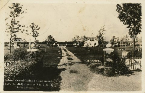
Most of Rolling Prairie was built recently: 0.0% of its homes predate 1940 and the median home dates from 1993. Below: 1 old photo or paper, maps from 1958 on, and old-book passages.
The first cabin was built here in 1831 by Ezekiel Provolt. More settlers arrived, built cabins and named the settlement "Nauvoo". On November 26, 1853, the village was platted by J. W. Walker and named "Portland". The name of "Rolling Prairie", descriptive of the undulating terrain, was later adopted by one of the railroad companies operating through the town.
Rolling Prairie had a stop on the South Shore Line until 1994, when it was closed along with several other flag stops with low ridership.
Passages that mention Rolling Prairie, cut from the printed page as they were published.
A Twentieth Century History and Biographical Record of Laporte County Indiana1904 · page 196Read the page →
Read the text
Coplin bought the sawmill at Rolling Prairie in 1857 and in the next year added gristing ma¬ chinery, Luke or Wallace Francis of Galena township being connected with it some time later. The history of the mill has been told in the section devoted to sawmills. It is now owned and operated as a first-class flouring mill by Will¬ iam Strutz and Christopher Reinke, under the
Text read by machine from the scan; it may contain errors.
A Twentieth Century History and Biographical Record of Laporte County Indiana1904 · page 192Read the page →
Read the text
Bowell, who lived and died on section 16, in this township, had a small sawmill and cider mill for a few years about 1880. Shaw & Johnson had a steam sawmill near Rolling Prairie which had been set there by W. H. Whitehead some time prior to 1874, and in that summer moved it to section 32, near Lamb’s chapel, in Galena town¬ ship, where its. remains yet stand on the farm of
Text read by machine from the scan; it may contain errors.
Scans and text from the Internet Archive. Books published in 1930 or earlier, which are in the public domain.
By decade
Rolling Prairie, decade by decade
One decade in the archive so far: the 1830s. Scroll each row; tap a photo for its story.
Every edition of the U.S. Geological Survey’s map of Rolling Prairie. Tap a year, or press play to watch the town change.
1958New Carlisle sheet · 1:24,000
U.S. Geological Survey historical topographic maps (public domain), via Esri’s collection of the scans. The red ring marks the center of Rolling Prairie.
Then & now
Stand where they stood
No then-and-now pairs yet. Take a photo from the same spot as an old one and they appear here side by side.
Retake this viewHigh School, Rolling Prairie, Indiana (NBY 5646), 1830
Find the spot, match the angle, and add your photo. It becomes the first then-and-now pair on Rolling Prairie’s page.
Founding dates: Wikidata, Wikipedia, the U.S. post office records of Blevins & Helbock (CC0) and the Census. Homes by year built: Census ACS 2020–24. National Register of Historic Places: National Park Service (list of May 22, 2026). Old photos, postcards and papers: Wikimedia Commons, the Library of Congress and other public archives, credited on each item’s page. Maps: U.S. Geological Survey historical topographic maps (via Esri) and Sanborn fire-insurance maps (Library of Congress). History text and census tables: Wikipedia (CC BY-SA 4.0). Places that used to be: USGS Geographic Names Information System (2021). How TownRatings grades history →
From Wikimedia Commons (2), Wikipedia, U.S. Geological Survey historical maps and old county and town histories (Internet Archive). Archive images are copied here with their credits and licenses, shown on each photo’s page. Refreshed monthly.


 1830
 2022


