Guest, Sign inJoin

Post to Rockfield

We’ll email a one-tap link to publish your post. No password, and nothing is public until you click it.
Already a member? Sign in
–Not graded
History · Rockfield

Rockfield dates to 1856, and 25% of its homes were built before 1940

Below: maps from 1962 on and old-book passages.

1856founded
0on the National Register
25%homes built before 1940
Quick answers

How Rockfield began

When was Rockfield founded?

1856

Rockfield dates its founding to 1856 (Wikipedia’s history). Its post office opened in 1857.

2020 census: 211170 years
Founding year: Wikipedia. First post office: 1857.The full story ↓

What stands out about Rockfield’s past

Read from the archive, the National Register and the record. The page puts what stands out first.

★ What stands out · Help out

Start Rockfield’s collection

The first neighbors to add old photos shape how Rockfield’s history is told.

Decades since 1900 with photos
00s10s20s30s40s50s60s70s80s90s
0 of 10 decades. The empty ones are waiting for someone’s album.
The story

How Rockfield came to be

From Wikipedia’s history of Rockfield.

Read it all →

Rockfield was platted in 1856. The Rockfield post office was established in 1857.

District School No. 3 was listed on the National Register of Historic Places in 1988.

Text from Wikipedia, licensed CC BY-SA 4.0.

From the old history books

What they wrote about Rockfield in 1916

Passages that mention Rockfield, cut from the printed page as they were published.

The town of Rockfield is located in this township, also the town of Burrows. The Wabash railroad runs through this township, and the towns mentioned are situate on this line of railway and on the Ft. Wayne and Northern Indiana traction road. Rockfield has a bank, as has also the town of Burrows. A …
History of Carroll County Indiana1916 · page 86Read the page →
Read the text

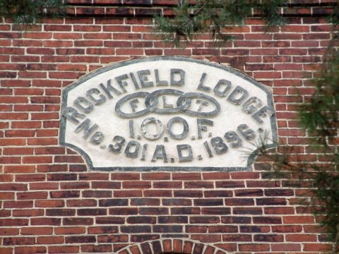
The town of Rockfield is located in this township, also the town of Burrows. The Wabash railroad runs through this township, and the towns mentioned are situate on this line of railway and on the Ft. Wayne and Northern Indiana traction road. Rockfield has a bank, as has also the town of Burrows. A fine school building is located in Rockfield. The Independ¬ ent Order of Odd Fellows Lodge No. 301 is located in Rockfield and the Independent Order of Odd Fellows Lodge No. 495 is located in Burrows.

Text read by machine from the scan; it may contain errors.
The Rockfield Bank was organized on February 19, 1913, and com¬ menced business on July 30, 1915. The bank is located in a brick building in the town of Rockfield. The present officers are : C. L. Million, presi¬ dent; Fred Miller, vice-president; F. C. Sanderson, cashier. Directors, C.
History of Carroll County Indiana1916 · page 203Read the page →
Read the text

The Rockfield Bank was organized on February 19, 1913, and com¬ menced business on July 30, 1915. The bank is located in a brick building in the town of Rockfield. The present officers are : C. L. Million, presi¬ dent; Fred Miller, vice-president; F. C. Sanderson, cashier. Directors, C.

Text read by machine from the scan; it may contain errors.

Scans and text from the Internet Archive. Books published in 1930 or earlier, which are in the public domain.

By decade

Rockfield, decade by decade

On the map

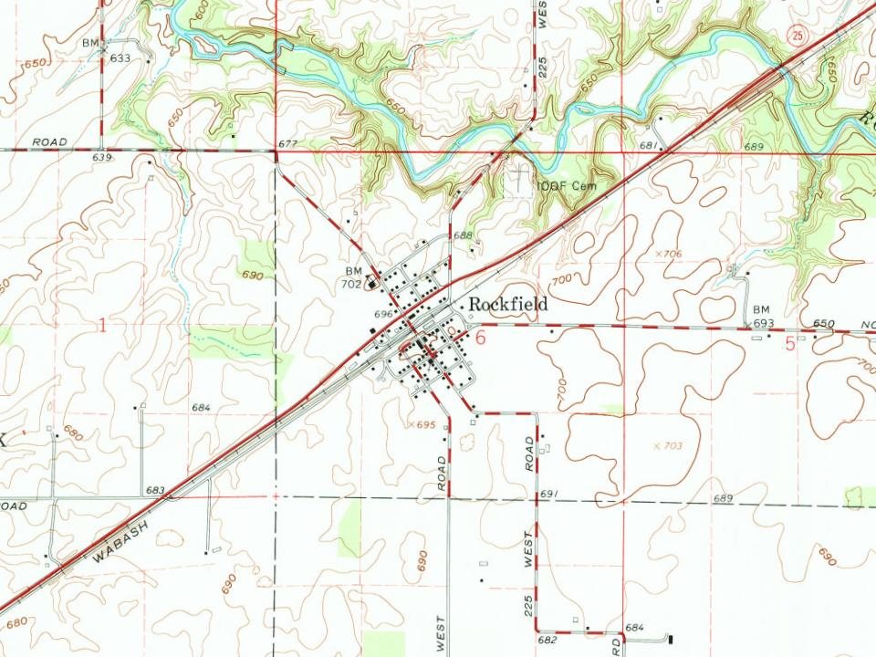
Rockfield on the map in 1962

The U.S. Geological Survey’s map of Rockfield.

Rockfield on the 1962 USGS map1962Burrows sheet · 1:24,000

U.S. Geological Survey historical topographic maps (public domain), via Esri’s collection of the scans. The red ring marks the center of Rockfield.

Questions about Rockfield’s history

What year was Rockfield founded?

In 1856, according to Wikipedia’s history of the town. Rockfield’s post office opened in 1857.

Memory lane

What the archives can’t tell you, neighbors can.

Town Square →
Start a conversation
Sources

Where this page comes from

Founding dates: Wikidata, Wikipedia, the U.S. post office records of Blevins & Helbock (CC0) and the Census. Homes by year built: Census ACS 2020–24. National Register of Historic Places: National Park Service (list of May 22, 2026). Old photos, postcards and papers: Wikimedia Commons, the Library of Congress and other public archives, credited on each item’s page. Maps: U.S. Geological Survey historical topographic maps (via Esri) and Sanborn fire-insurance maps (Library of Congress). History text and census tables: Wikipedia (CC BY-SA 4.0). Places that used to be: USGS Geographic Names Information System (2021). How TownRatings grades history →

From Wikimedia Commons (3), Wikipedia, U.S. Geological Survey historical maps and old county and town histories (Internet Archive). Archive images are copied here with their credits and licenses, shown on each photo’s page. Refreshed monthly.