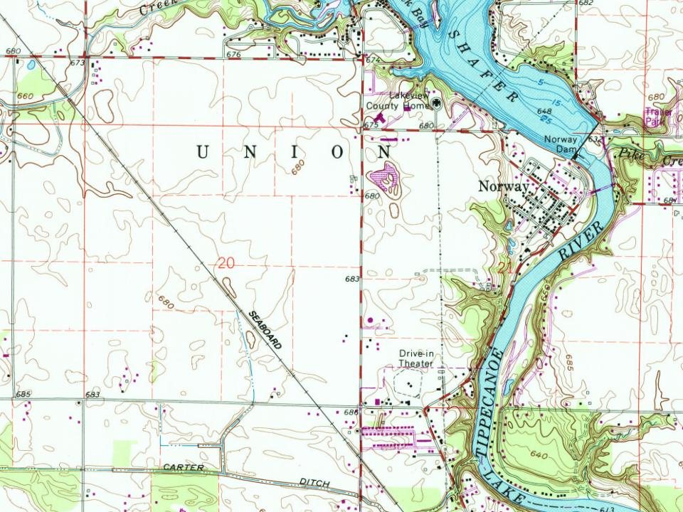
Norway was originally called Mt. Walleston, and under the latter name was laid out in 1845 by John Armstrong. A large share of the early settlers being natives of Norway caused the present name to be selected. A post office was established at Norway in 1898, but was soon discontinued, in 1899.
Passages that mention Norway, cut from the printed page as they were published.
Centennial history of Norway, Oxford County, Maine, 1786-1886, including an account of the early grants and purchases, sketches of the grantees, early settlers, and prominent residents, etc., with genealogical registers, and an appendix1886 · page 30Read the page →
Read the text
Sec. I Be it enacted by the Senate and House of Representatives in Legislature assembled, That the tract or gore of land lying between the towns of Norway, Otisfield, Harrison and Waterford, with the inhabitants thereon be and the same is hereby annexed and incorporated with the town of Norway, and vested with all the privileges, and subject to all the duties and requisitions of other inhabitants of said town of Norway.
Text read by machine from the scan; it may contain errors.
Centennial history of Norway, Oxford County, Maine, 1786-1886, including an account of the early grants and purchases, sketches of the grantees, early settlers, and prominent residents, etc., with genealogical registers, and an appendix1886 · page 10Read the page →
Read the text
The lands bordering on the east, south, and west of wh-at is now the town of Norway were granted and confirmed several years before any of the tracts which compose this town were granted, the only exceptions being the three tiers taken from Waterford, and the gore lying south of these three tiers. The town of Waterford, once called Waterford Plantation, including the three tiers incorporated with Norway, was granted to John Gardner and others in 1774, in -lieu of a township granted to John Whitman and others in 1735, for services rendered by
Text read by machine from the scan; it may contain errors.
If one will examine the map of the town of Norway he will see that its eastern line near the southern end is not straight but makes a considerable bend to the east. A part of Norway village is in the tract inclosed by this bent line, which was once a part of the town of Paris. It is a portion of lots six, seven and eight in the first range of lots in Paris, and Norway people owned so much of the land in them and it would be so much more convenient at that period for those who built upon it to belong to Norway Village than to South Paris,
Text read by machine from the scan; it may contain errors.
It was provided in the act, incorporating the town of Norway, that Waterford, which had a few days before been incorporated as a town, should be entitled to four-fifths of all the public lots on the Three Tiers. There were four public lots on this tract. Lot 15, Range 14 was a ministerial lot. It afterwards sold for $51. Lot 9, Range 16, was a school lot, and two were college lots.
Text read by machine from the scan; it may contain errors.
Scans and text from the Internet Archive. Books published in 1930 or earlier, which are in the public domain.
By decade
No old photos in the archives yet
Weddings on Main Street, storms, parades, school pictures, the old store. If it’s in your family album, it belongs here.
Be the first to add onePhotograph a print flat, in daylight, no flash.
Founding dates: Wikidata, Wikipedia, the U.S. post office records of Blevins & Helbock (CC0) and the Census. Homes by year built: Census ACS 2020–24. National Register of Historic Places: National Park Service (list of May 22, 2026). Old photos, postcards and papers: Wikimedia Commons, the Library of Congress and other public archives, credited on each item’s page. Maps: U.S. Geological Survey historical topographic maps (via Esri) and Sanborn fire-insurance maps (Library of Congress). History text and census tables: Wikipedia (CC BY-SA 4.0). Places that used to be: USGS Geographic Names Information System (2021). How TownRatings grades history →
From Wikipedia, U.S. Geological Survey historical maps and old county and town histories (Internet Archive). Archive images are copied here with their credits and licenses, shown on each photo’s page. Refreshed monthly.