The above plat accompanies papers in suit of Hopestill Potter, of Newport, carter, vs. .John Morris, of Newport, mariner, and Major Fairehild, of Newport, butcher, in an appeal from the Inferior Court of "last Tuesday in May, 1733, to next Superior Court, held Sept., 1733." Case of trespass and ejectment "for unjustly withholding from plaintiff, a certain lot of land in Newport (being a garden and yard), with a dwelling house and shop thereon standing, containing from north to south, in front on Thames
Text read by machine from the scan; it may contain errors.
"Newport, &c— To the hon'ble the Inferior Court of Comon pleas to be he'd at Newport^ within and for the county of Ntwport, on ye third Tuesday of November, Anno Dom 1744. Nathaniel Potter, Daniel Levatt and Silas Cooke, all of Newport, in the county of Newport, merchants and owners of three-quarterparts of the sloop called the Kecruit, complain of Henry Taggart, of the same Newport, mariner, owner of the other quarter part of the said sloop, and late master thereof, in the custody of the sheriff,
Text read by machine from the scan; it may contain errors.
3. — Malbone to Malbone. — Evan Malbone late of Newport, R. I., now of Norwich, Conn., in consideration of eight hundred Spanish milled dollars, conveys to Evan Malbone, Jr., late of Newport, R. 1., but now of Norwich, Conn., "a certain tract of land consisting of eight acres and sixteen rods, situate in ye town of Newport, butted and bounded as follows, viz: Northerly on land partly on John Wanton and partly on a highway ; Easterly on a
Text read by machine from the scan; it may contain errors.
have an important bearing on an entry found in the Sandwich, Mass., records : From Portsmouth, B. L, Becords.— "Elizabeth Bull, the wife of Henry Bull, of Newport, she dyed the first day of the eighth month, in .the year 1665, and was buried in said town of Newport.''' * 'Hester Bull dyed the 26th day of ye 1st Mo., 1676."
Text read by machine from the scan; it may contain errors.
Scans and text from the Internet Archive. Books published in 1930 or earlier, which are in the public domain.
Timeline
Newport, 1820 to 1955
Woven from the archive, old maps, post office records, the National Register and the people born here.
Nothing in the archives for these yearsWeddings on Main Street, storms, parades, school pictures, the old store. If it’s in your family album, it belongs here.
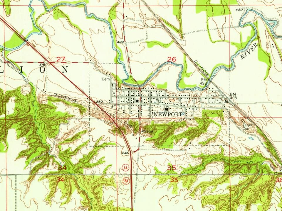
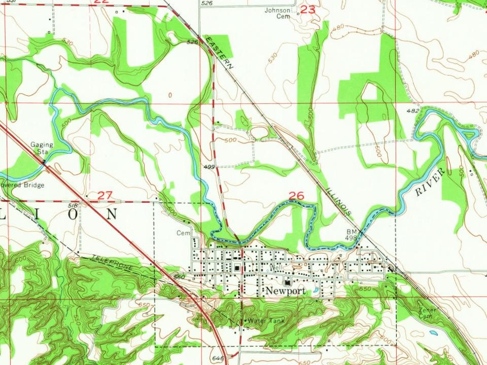
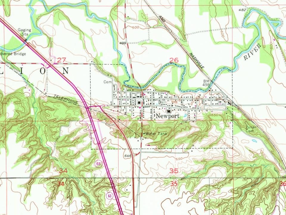
Every edition of the U.S. Geological Survey’s map of Newport. Tap a year, or press play to watch the town change.
1955Newport sheet · 1:24,000
U.S. Geological Survey historical topographic maps (public domain), via Esri’s collection of the scans. The red ring marks the center of Newport.
Every building
Newport, building by building, 1905–1910
Fire insurance maps drew every building, what it was made of and what it was used for, so insurers could price the risk of fire. Pick a year, then a sheet.
1905Sheet 1 of 1
Edition
Sheets
BrickWoodStone
Sanborn Map Company, via the Library of Congress. Editions published in 1930 or earlier, which are in the public domain.
Then & now
Stand where they stood
No then-and-now pairs yet. Take a photo from the same spot as an old one and they appear here side by side.
Retake this viewVermillion County Courthouse 1868 to 1923, 1913
Find the spot, match the angle, and add your photo. It becomes the first then-and-now pair on Newport’s page.
Founding dates: Wikidata, Wikipedia, the U.S. post office records of Blevins & Helbock (CC0) and the Census. Homes by year built: Census ACS 2020–24. National Register of Historic Places: National Park Service (list of May 22, 2026). Old photos, postcards and papers: Wikimedia Commons, the Library of Congress and other public archives, credited on each item’s page. Maps: U.S. Geological Survey historical topographic maps (via Esri) and Sanborn fire-insurance maps (Library of Congress). History text and census tables: Wikipedia (CC BY-SA 4.0). Places that used to be: USGS Geographic Names Information System (2021). How TownRatings grades history →
From Wikimedia Commons (4), the National Register of Historic Places (1), Wikipedia, U.S. Geological Survey historical maps, U.S. Census counts (via Wikipedia), the US Post Offices dataset (Blevins & Helbock), the USGS Geographic Names Information System, Sanborn fire insurance maps (Library of Congress) and old county and town histories (Internet Archive). Archive images are copied here with their credits and licenses, shown on each photo’s page. Refreshed monthly.


 2012
 2012
 2012