New Castle dates to 1822, and 28% of its homes were built before 1940
More historic than 92% of U.S. towns · #126 of 593 in Indiana. What drives it
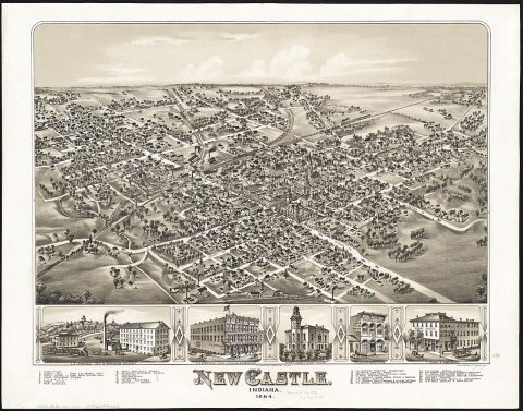
3 places in town are on the National Register, among them a historic district with 64 buildings. Below: 3 old photos and papers, maps from 1886 on, and the census since 1850.
Founding year: Wikidata. First post office: 1823.The full story ↓
History grade
What drives New Castle’s History grade
On its age, its old homes and the National Register, New Castle is more historic than 92% of U.S. towns, #126 of 593 in Indiana. All 3 inputs are above most U.S. towns; its share of homes from before 1940 ranks highest and its age lowest.
A
HistoryA character grade: shown, never part of New Castle’s overall grade.
Indiana towns list more on the Register than most of the country (a typical Indiana town has 7.9 per 10,000 residents, the U.S. 2.4), so New Castle’s 38.0 sits above most of its state (72% of Indiana towns have fewer) while its 66 historic buildings outnumber those of 87% of U.S. towns.
How sure. Graded on any two of the three inputs instead, the letter would range from A− to A. The pre-1940 share is a Census survey estimate (±3.6 points). Two sources give 1822.
Founding year: Wikidata (other dates in Quick answers). Homes: Census ACS 2020–24. National Register: National Park Service, May 2026 list; each listing counted once (boundary changes and added documentation belong to their listing), and a historic district counts its contributing buildings. How TownRatings grades history →
What stands out about New Castle’s past
Read from the archive, the National Register and the record. The page puts what stands out first.
New Castle was platted in 1823, and named after New Castle, Kentucky. A post office was established at New Castle in 1823.
The town was quickly established as the seat of Henry County upon the county's organization in 1823, cementing its importance as a center for trade and government in the region. The Maxwell automobile factory, later owned and operated by Chrysler Motor Corp. was, at the time of construction (1907), the largest automotive manufacturing plant in the nation.
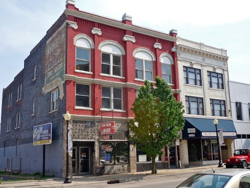
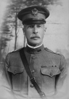
The Chrysler Enclosure, Gen. William Grose House, Henry County Courthouse, and New Castle Commercial Historic District are listed on the National Register of Historic Places.
It is entitled “An Act for Vesting the State House and Other Buildings with the lot of ground whereon the same are erected, together with other ground, situated in the town of New Castle, in trustees for the uses therein particularly mentioned.” Each section has a preamble. The first preamble recites, “Whereas the lot of land, situate in the square, called the Market Square, in the center of the town of New Castle, and contained within the bounds follow-
Text read by machine from the scan; it may contain errors.
20th century history of New Castle and Lawrence County, Pennsylvania1908 · page 347Read the page →
Read the text
One wooden bridge, known as the "Black Bridge" (at the point), connects the township with the city of New Castle. This is one of the last wooden-covered bridges left in the county. Another crosses the Mahoning at Mahoningtown (Seventh Ward) on the road leading to Mount Jackson. A modern iron bridge recently built serves to
Text read by machine from the scan; it may contain errors.
20th century history of New Castle and Lawrence County, Pennsylvania1908 · page 60Read the page →
Read the text
The first bridge over the Shenango was erected in 1815, subscription papers being circulated among the citizens of New Castle in December, 1814, for the purpose of raising funds to build the same, the sum of $705 being raised. 'What the total cost of the bridge was, we have no means of knowing. It was also a wooden trestle bridge,
Text read by machine from the scan; it may contain errors.
Scans and text from the Internet Archive. Books published in 1930 or earlier, which are in the public domain.
Timeline
New Castle, 1822 to 1970
Woven from the archive, old maps, post office records, the National Register and the people born here.
Nothing in the archives for these yearsWeddings on Main Street, storms, parades, school pictures, the old store. If it’s in your family album, it belongs here.
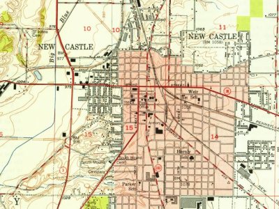
Every edition of the U.S. Geological Survey’s map of New Castle. Tap a year, or press play to watch the town change.
1950New Castle East sheet · 1:24,000
U.S. Geological Survey historical topographic maps (public domain), via Esri’s collection of the scans. The red ring marks the center of New Castle.
Every building
New Castle, building by building, 1886–1924
Fire insurance maps drew every building, what it was made of and what it was used for, so insurers could price the risk of fire. Pick a year, then a sheet.
Lost post offices, old corners and burying grounds
New Castle’s post office has been open since 1823. Another post office, Newcastle, opened and closed inside today’s town.
New Castle
1823–today
Newcastle
1894–1938
18201920today
Hamlets and corners on the map
Belmont
2cemeteries and burying grounds inside New Castle
ElliottSouth Mound
US Post Offices dataset (Blevins & Helbock, CC0). Places and cemeteries from the USGS Geographic Names Information System (2021).
Questions about New Castle’s history
What year was New Castle founded?
In 1822, according to Wikidata. New Castle’s post office opened in 1823, and the census of 1850 counted 666 people here.
How does New Castle rank for history?
New Castle is more historic than 92% of U.S. towns, #126 of 593 in Indiana. The History grade combines the town’s founding era, the share of homes built before 1940 and its National Register listings. It’s a character grade, so it isn’t part of the overall grade. How it works.
What is on the National Register in New Castle?
Three places: the Henry County Courthouse (listed 1981), the Gen. William Grose House (1983) and the New Castle Commercial Historic District (1991).
How old are the homes in New Castle?
28% of New Castle’s homes were built before 1940 (Census estimate, ±3.6 points), against a typical 14% for an Indiana town; the median home was built in 1956.
Founding dates: Wikidata, Wikipedia, the U.S. post office records of Blevins & Helbock (CC0) and the Census. Homes by year built: Census ACS 2020–24. National Register of Historic Places: National Park Service (list of May 22, 2026). Old photos, postcards and papers: Wikimedia Commons, the Library of Congress and other public archives, credited on each item’s page. Maps: U.S. Geological Survey historical topographic maps (via Esri) and Sanborn fire-insurance maps (Library of Congress). History text and census tables: Wikipedia (CC BY-SA 4.0). Places that used to be: USGS Geographic Names Information System (2021).
From Wikimedia Commons (11), the National Register of Historic Places (3), Wikipedia, Wikidata and Wikipedia for famous people, U.S. Geological Survey historical maps, U.S. Census counts (via Wikipedia), the US Post Offices dataset (Blevins & Helbock), the USGS Geographic Names Information System, Sanborn fire insurance maps (Library of Congress) and old county and town histories (Internet Archive). Archive images are copied here with their credits and licenses, shown on each photo’s page. Refreshed monthly.







 Date?
 Date?
 2011
 2011
 2011
 2009
 2008
 2008
 2007
 2006


