The inland part of Michiana Shores was the site of the logging town of Corymbo in the 1860s and 1870s. Corymbo, located on the Michigan Central railroad, was home to a mixture of lumbermen and railroad employees. A post office was established there in 1861, but had been discontinued by 1880. The land was owned by the local Burgwald family, which sold it in the 1920s to the Long Beach Land Company.
The modern-day beach community began to be developed in the 1930s, when developers Orphie Gotto and Clarence Mathias began to build it as a log cabin town for vacationers. Many of the early residents were schoolteachers from Chicago. The town was incorporated in 1947.
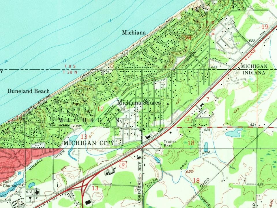
Every edition of the U.S. Geological Survey’s map of Michiana Shores. Tap a year, or press play to watch the town change.
1970New Buffalo West sheet · 1:24,000
U.S. Geological Survey historical topographic maps (public domain), via Esri’s collection of the scans. The red ring marks the center of Michiana Shores.
Famous people
Famous people close to Michiana Shores
Nobody well known was born in Michiana Shores itself, so here are the best known from just nearby.
Founding dates: Wikidata, Wikipedia, the U.S. post office records of Blevins & Helbock (CC0) and the Census. Homes by year built: Census ACS 2020–24. National Register of Historic Places: National Park Service (list of May 22, 2026). Old photos, postcards and papers: Wikimedia Commons, the Library of Congress and other public archives, credited on each item’s page. Maps: U.S. Geological Survey historical topographic maps (via Esri) and Sanborn fire-insurance maps (Library of Congress). History text and census tables: Wikipedia (CC BY-SA 4.0). Places that used to be: USGS Geographic Names Information System (2021). How TownRatings grades history →
From Wikipedia, U.S. Geological Survey historical maps, U.S. Census counts (via Wikipedia) and the USGS Geographic Names Information System. Archive images are copied here with their credits and licenses, shown on each photo’s page. Refreshed monthly.