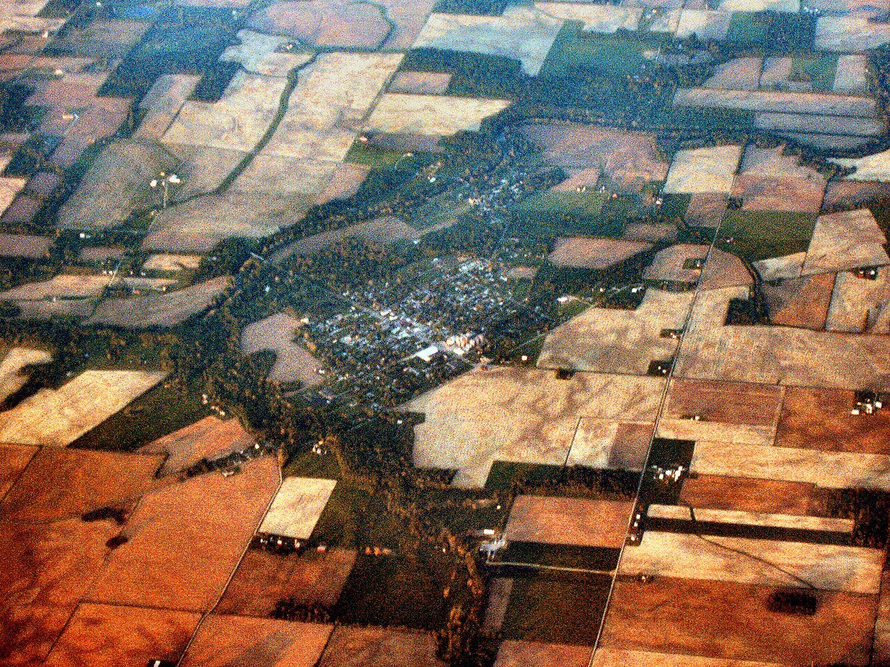
Matthews was founded in 1895 and named in honor of then-governor Claude Matthews. Founders located the town near the center of the Trenton Gas Field, and it was hoped that this geographically central location could become the future capital of Indiana, moving it from Indianapolis, which had been laid out for that specific reason less than one hundred years earlier in 1825. The plan was abandoned in 1903 when the gas field was depleted, leaving the town with a main street unusually wide for its size.
Passages that mention Matthews, cut from the printed page as they were published.
The making of a township, being an account of the early settlement and subsequent development of Fairmount Township, Grant County, Indiana, 1829 to 1917, based upon data secured by personal interviews, from numerous communications and various other reliab1917 · page 421Read the page →
Read the text
my brother Ancil and I surveyed and platted the first addition to the town. I was also head chain man in the surveying gang that run the prospective line for the C. I. & E. Railroad under the engineer, Sam Houston. One branch we surveyed from Matthews to Red Key, and the other to Muncie from Matthews, or rather the old town of New Cumberland, as it was then. I don't feel old, but when I look back and think of the many changes that have taken place since my boyhood days around Fairmount, I begin
Text read by machine from the scan; it may contain errors.
Centennial History of Grant County Indiana1914 · page 987Read the page →
Read the text
with other members of the family to Delaware county. Their home was on a farm in Delaware county until 1905, when they retired, and selected a home situated on five lots of land at the corner of Massachu¬ setts Avenue and Fourth Street in the village of Matthews. There Mrs. Miller still lives, and she is also owner of the farm of forty-two acres in Delaware county. Mrs. Miller is a fine type of the old-fashioned woman, a true lady, and possessed of the graces and the courtesies of the heart and mind which are so characteristic of the older generation.
Text read by machine from the scan; it may contain errors.
Centennial History of Grant County Indiana1914 · page 988Read the page →
Read the text
Ruphas C. Nottingham. On section thirty-three of Jefferson town¬ ship, not far from the little city of Matthews, is a fine home and farm, and its proprietor, Mr. Nottingham, has a record which in many ways identifies him with Grant county, and his interest in the history of this locality is due not only to his own long residence, but to the fact that his family has lived here since the days of early settlement.
Text read by machine from the scan; it may contain errors.
The making of a township, being an account of the early settlement and subsequent development of Fairmount Township, Grant County, Indiana, 1829 to 1917, based upon data secured by personal interviews, from numerous communications and various other reliab1917 · page 332Read the page →
Read the text
The Chicago, Indiana & Eastern Railroad was built from Matthews to Fairmoiint in the year 1892. In 1901 the line was extended from Matthews to Muncie. In 1898 it was extended from Fairmount to Swayzee; in 1899, from Swayzee to Converse, where connection was established with the Pennsylvania line to Chicago. In 1907 the road
Text read by machine from the scan; it may contain errors.
Scans and text from the Internet Archive. Books published in 1930 or earlier, which are in the public domain.
Founding dates: Wikidata, Wikipedia, the U.S. post office records of Blevins & Helbock (CC0) and the Census. Homes by year built: Census ACS 2020–24. National Register of Historic Places: National Park Service (list of May 22, 2026). Old photos, postcards and papers: Wikimedia Commons, the Library of Congress and other public archives, credited on each item’s page. Maps: U.S. Geological Survey historical topographic maps (via Esri) and Sanborn fire-insurance maps (Library of Congress). History text and census tables: Wikipedia (CC BY-SA 4.0). Places that used to be: USGS Geographic Names Information System (2021). How TownRatings grades history →
From Wikimedia Commons (3), Wikipedia, the US Post Offices dataset (Blevins & Helbock), the USGS Geographic Names Information System and old county and town histories (Internet Archive). Archive images are copied here with their credits and licenses, shown on each photo’s page. Refreshed monthly.



 Date?
 2016
 2005


