La Porte dates to 1832, and 30% of its homes were built before 1940
More historic than 95% of U.S. towns · #74 of 593 in Indiana. What drives it
7 places in town are on the National Register, among them two historic districts with 293 buildings between them. Below: 18 old photos and papers, maps from 1958 on, and the census since 1850.
Founding year: Wikidata; Wikipedia’s history section gives the same year. First post office: 1873.The full story ↓
History grade
What drives La Porte’s History grade
On its age, its old homes and the National Register, La Porte is more historic than 95% of U.S. towns, #74 of 593 in Indiana. All 3 inputs are above most U.S. towns; its National Register listings ranks highest and its age lowest.
A
HistoryA character grade: shown, never part of La Porte’s overall grade.
Indiana towns list more on the Register than most of the country (a typical Indiana town has 7.9 per 10,000 residents, the U.S. 2.4), so La Porte’s 138 sits above most of its state (84% of Indiana towns have fewer) while its 310 historic buildings outnumber those of 95% of U.S. towns.
How sure. Graded on any two of the three inputs instead, the letter would still be A. The pre-1940 share is a Census survey estimate (±4.2 points). Two sources give 1832.
Founding year: Wikidata (other dates in Quick answers). Homes: Census ACS 2020–24. National Register: National Park Service, May 2026 list; each listing counted once (boundary changes and added documentation belong to their listing), and a historic district counts its contributing buildings. How TownRatings grades history →
What stands out about La Porte’s past
Read from the archive, the National Register and the record. The page puts what stands out first.
Nothing in the archives for these yearsWeddings on Main Street, storms, parades, school pictures, the old store. If it’s in your family album, it belongs here.
Nothing in the archives for these yearsWeddings on Main Street, storms, parades, school pictures, the old store. If it’s in your family album, it belongs here.
The settlement of La Porte was established in July 1832. Abraham P. Andrew, one of the purchasers of the site, constructed the first sawmill in that year. The first settler arrived in October, building a permanent cabin just north of what would become the courthouse square.
After the US extinguished land claims by the Potowatomi and other historic tribes of the area by treaty and removal to Indian Territory, in 1833, a federal land office was established in La Porte. People came to this office from newly established surrounding counties to buy land from the government, including Solon Robinson, founder of Crown Point. The office was moved to Winamac in 1839.
Passages that mention La Porte, cut from the printed page as they were published.
History of La Porte County, Indiana1880 · page 627Read the page →
Read the text
State of Indiana, ) La Porte County, f We, the undersigned, President and Clerk of an election held at the house of Robert S. Morrison, in the town of La Porte, in the county of La Porte and State of Indiana, for the purpose of electing Trustees for the several wards or districts in the corporation of the town of La Porte, do certify that (after we were appointed President and Clerk of and for said election, agreeable to the statute in such case made and provided) Amzi Clark was duly elected Trustee for Dis-
Text read by machine from the scan; it may contain errors.
History of La Porte County, Indiana1880 · page 594Read the page →
Read the text
the following will testify: The pioneer saw-mill, as far as we have been able to ascertain, was one built in the year 1830, by Captain Andrew, near the present city of La Porte. It was at this mill that the slabs out of which the house of George Thomas was built, one of the first two houses built on the present site of the city of La Porte, were sawed.
Text read by machine from the scan; it may contain errors.
History of La Porte County, Indiana1880 · page 620Read the page →
Read the text
Baptist Church. — The first Baptist Church of the city of La Porte was organized in 1838. The Rev. Benjamin Sawin came to La Porte in 1838 and held prayermeetings at his house, resulting in great good, leading many to seek the consolations of “ Christian faith.” In 1839 the Church was received into the Northern Indiana Digitized by LjOOQle
Text read by machine from the scan; it may contain errors.
Scans and text from the Internet Archive. Books published in 1930 or earlier, which are in the public domain.
Timeline
La Porte, 1832 to 1988
Woven from the archive, old maps, post office records, the National Register and the people born here.
In 1832, according to Wikidata and Wikipedia’s history of the town. La Porte’s post office opened in 1873, and the census of 1850 counted 1,824 people here.
How does La Porte rank for history?
La Porte is more historic than 95% of U.S. towns, #74 of 593 in Indiana. The History grade combines the town’s founding era, the share of homes built before 1940 and its National Register listings. It’s a character grade, so it isn’t part of the overall grade. How it works.
What is on the National Register in La Porte?
7 listings: 5 buildings and 2 historic districts, the Downtown LaPorte Historic District and the Indiana and Michigan Avenues Historic District, with 293 contributing buildings. 310 historic buildings in all.
How old are the homes in La Porte?
30% of La Porte’s homes were built before 1940 (Census estimate, ±4.2 points), against a typical 14% for an Indiana town; the median home was built in 1957.
Founding dates: Wikidata, Wikipedia, the U.S. post office records of Blevins & Helbock (CC0) and the Census. Homes by year built: Census ACS 2020–24. National Register of Historic Places: National Park Service (list of May 22, 2026). Old photos, postcards and papers: Wikimedia Commons, the Library of Congress and other public archives, credited on each item’s page. Maps: U.S. Geological Survey historical topographic maps (via Esri) and Sanborn fire-insurance maps (Library of Congress). History text and census tables: Wikipedia (CC BY-SA 4.0). Places that used to be: USGS Geographic Names Information System (2021).
From Wikimedia Commons (8), the Library of Congress (10), the National Register of Historic Places (7), Wikipedia, Wikidata and Wikipedia for famous people, U.S. Geological Survey historical maps, U.S. Census counts (via Wikipedia), the US Post Offices dataset (Blevins & Helbock), the USGS Geographic Names Information System and old county and town histories (Internet Archive). Archive images are copied here with their credits and licenses, shown on each photo’s page. Refreshed monthly.

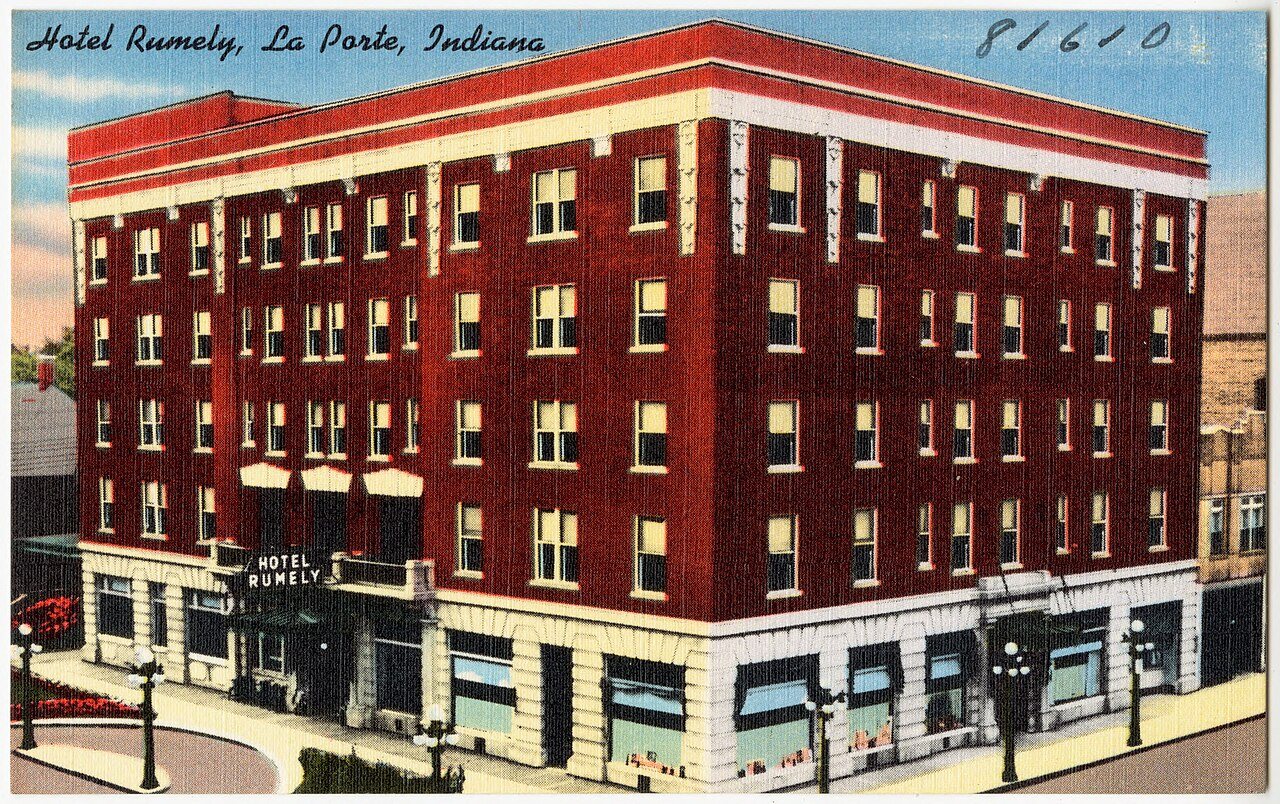


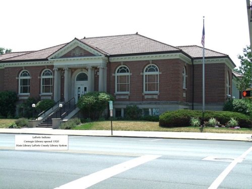


 1904
 1912
 1912
 1912
 1912
 1912
 1912
 1912
 1917
 1917
 1917
 c. 1930
 c. 1930
 1980
 1980
 1980
 1980
 1980


