Kokomo’s post office opened in 1845, and 20% of its homes were built before 1940
More historic than 90% of U.S. towns · #153 of 593 in Indiana. What drives it
12 places in town are on the National Register, among them three historic districts with 317 buildings between them. Below: 6 old photos and papers, maps from 1885 on, and the census since 1850.
The Kokomo post office opened in 1845, the earliest record of the town by name. Wikidata gives 1855. Another post office, Alto (1848), opened inside today’s city and later closed.
First census: 378 in 18502020 census: 59,604181 years
How historic is Kokomo?
A
More historic than 90% of U.S. towns, on its age, its old homes and the National Register.
Founding year: the first Kokomo post office (Blevins & Helbock, CC0). Wikidata: 1855.The full story ↓
History grade
What drives Kokomo’s History grade
On its age, its old homes and the National Register, Kokomo is more historic than 90% of U.S. towns, #153 of 593 in Indiana. All 3 inputs are above most U.S. towns; its National Register listings ranks highest and its share of homes from before 1940 lowest.
A
HistoryA character grade: shown, never part of Kokomo’s overall grade.
Indiana towns list more on the Register than most of the country (a typical Indiana town has 7.9 per 10,000 residents, the U.S. 2.4), so Kokomo’s 55.5 sits above most of its state (76% of Indiana towns have fewer) while its 328 historic buildings outnumber those of 96% of U.S. towns.
How sure. Graded on any two of the three inputs instead, the letter would range from A− to A. The pre-1940 share (±1.6 points) is firm at this size. The founding year is the first post office, not a stated founding date; Wikidata gives 1855.
Founding year: the first post office (other dates in Quick answers). Homes: Census ACS 2020–24. National Register: National Park Service, May 2026 list; each listing counted once (boundary changes and added documentation belong to their listing), and a historic district counts its contributing buildings. How TownRatings grades history →
What stands out about Kokomo’s past
Read from the archive, the National Register and the record. The page puts what stands out first.
National Park Service, National Register of Historic Places. Photos from Wikimedia Commons, credited on each place’s page.
Every building
Kokomo, building by building, 1885–1916
Fire insurance maps drew every building, what it was made of and what it was used for, so insurers could price the risk of fire. Pick a year, then a sheet.
The city of Kokomo was named after the Miami man Ma-Ko-Ko-Mo, said to have been one of the four sons of Chief Richardville, last of the chiefs of the Miami people. Kokomo is thought to have been born in 1775 and died in 1838. The only documentary proof of his existence is a trading post record of a purchase of a barrel of flour for $12 for his "squaw." His remains (with those of others) were reportedly discovered during the construction of a saw mill in 1848 and re-interred in the "north-east corner" of the Pioneer Cemetery. The tradition of the Peru Miami is that the town was named after a Thorntown Miami named Ko-kah-mah, whose name is rendered Co-come-wah in the Treaty at the Forks of the Wabash in 1834. That name was translated as "the diver" (an animal that could swim under water).
Passages that mention Kokomo, cut from the printed page as they were published.
History of Howard County, Indiana1909 · page 420Read the page →
Read the text
Kokomo's commercial prosperity was further advanced and enhanced by the construction of a street railway line, which has developed into the Kokomo, Marion & Western Interurban Railroad Company, with a line from Kokomo to Marion, a profitable property, while a line between Kokomo, Lafayette and Terre Haute iis in its incipiency, but a certain thing of the future in all probability.
Text read by machine from the scan; it may contain errors.
History of Howard County, Indiana1909 · page 329Read the page →
Read the text
January 9, 1864, the Jay & Dolman grain elevators, situated just above the depot of the Peru & Indianapolis depot, burned. This was an exciting time in the histoi-y of the town of Kokomo. The intense heat of the burning structure was minimized when the wheat, released from the bins in which it was confined, snKithered the flames. The problem was to save the S. Rosenthal storage rooms and the Howard flouring mills, removed but a sin irt tlistance from the elevator, but this object was accomplished. However, cm the
Text read by machine from the scan; it may contain errors.
Scans and text from the Internet Archive. Books published in 1930 or earlier, which are in the public domain.
Timeline
Kokomo, 1845 to 1971
Woven from the archive, old maps, post office records, the National Register and the people born here.
The Kokomo post office opened in 1845, the earliest record of the town by name (U.S. post office records). Wikidata gives 1855.
How does Kokomo rank for history?
Kokomo is more historic than 90% of U.S. towns, #153 of 593 in Indiana. The History grade combines the town’s founding era, the share of homes built before 1940 and its National Register listings. It’s a character grade, so it isn’t part of the overall grade. How it works.
What is on the National Register in Kokomo?
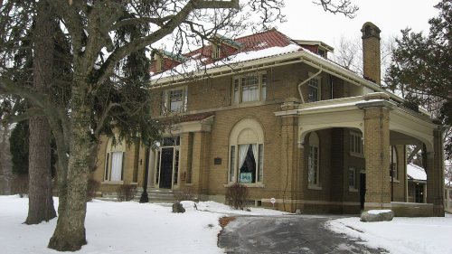
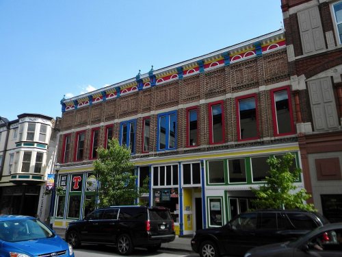
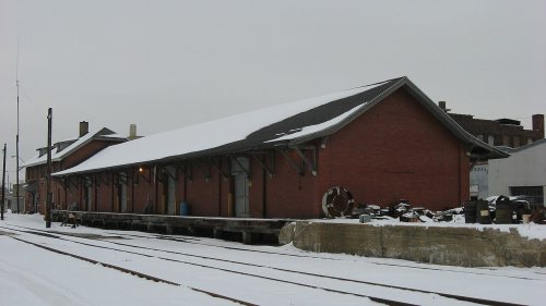
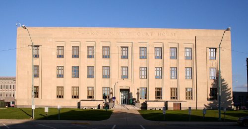
12 listings: 8 buildings, among them the Seiberling Mansion (listed 1971, the first), 3 historic districts, the Lake Erie and Western Depot Historic District, the Kokomo Courthouse Square Historic District and the Old Silk Stocking Historic District, with 317 contributing buildings, and 1 site. 328 historic buildings in all.
How old are the homes in Kokomo?
20% of Kokomo’s homes were built before 1940 (Census estimate, ±1.6 points), against a typical 14% for an Indiana town; the median home was built in 1967.
Founding dates: Wikidata, Wikipedia, the U.S. post office records of Blevins & Helbock (CC0) and the Census. Homes by year built: Census ACS 2020–24. National Register of Historic Places: National Park Service (list of May 22, 2026). Old photos, postcards and papers: Wikimedia Commons, the Library of Congress and other public archives, credited on each item’s page. Maps: U.S. Geological Survey historical topographic maps (via Esri) and Sanborn fire-insurance maps (Library of Congress). History text and census tables: Wikipedia (CC BY-SA 4.0). Places that used to be: USGS Geographic Names Information System (2021).
From the Library of Congress (6), Wikidata (3), the National Register of Historic Places (12), Wikipedia, Wikidata and Wikipedia for famous people, U.S. Geological Survey historical maps, U.S. Census counts (via Wikipedia), the US Post Offices dataset (Blevins & Helbock), the USGS Geographic Names Information System, Sanborn fire insurance maps (Library of Congress) and old county and town histories (Internet Archive). Archive images are copied here with their credits and licenses, shown on each photo’s page. Refreshed monthly.






 1865
 1865
 1865
 1865
 Date?


