Franklin dates to 1823, and 11% of its homes were built before 1940
More historic than 79% of U.S. towns · #235 of 593 in Indiana. What drives it
12 places in town are on the National Register, among them four historic districts with 72 buildings between them. Below: 3 old photos and papers, maps from 1886 on, and the census since 1850.
On its age, its old homes and the National Register, Franklin is more historic than 79% of U.S. towns, #235 of 593 in Indiana. Its National Register listings hold the grade up; its share of homes from before 1940 pulls it down.
A−
HistoryA character grade: shown, never part of Franklin’s overall grade.
Indiana towns list more on the Register than most of the country (a typical Indiana town has 7.9 per 10,000 residents, the U.S. 2.4), so Franklin’s 31.0 sits above most of its state (70% of Indiana towns have fewer) while its 81 historic buildings outnumber those of 88% of U.S. towns.
How sure. Graded on any two of the three inputs instead, the letter would range from B to A−. The pre-1940 share (±1.8 points) is firm at this size. Two sources give 1823.
Founding year: Wikipedia (other dates in Quick answers). Homes: Census ACS 2020–24. National Register: National Park Service, May 2026 list; each listing counted once (boundary changes and added documentation belong to their listing), and a historic district counts its contributing buildings. How TownRatings grades history →
What stands out about Franklin’s past
Read from the archive, the National Register and the record. The page puts what stands out first.
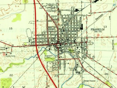
Fire insurance maps drew every building, what it was made of and what it was used for, so insurers could price the risk of fire. Pick a year, then a sheet.
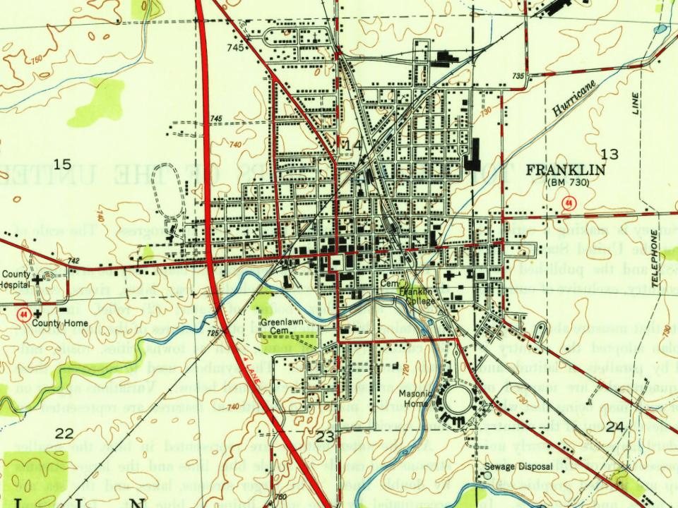
Franklin was platted in 1823. It was named after Benjamin Franklin. The Franklin post office was established in 1824. Franklin was incorporated as a city in 1861.
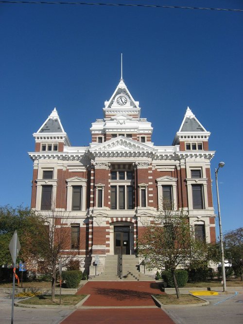
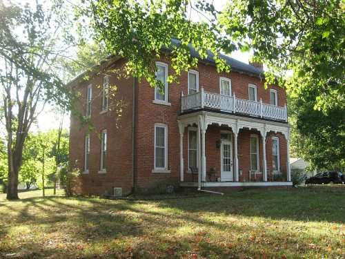
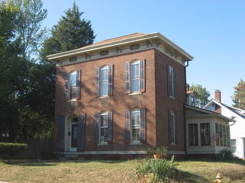
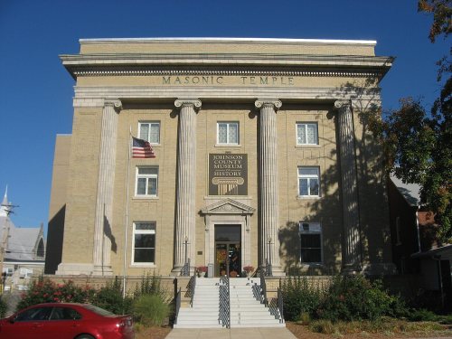
Bethel African Methodist Episcopal Church, Franklin College Library (Shirk Hall), Franklin College-Old Main, Franklin Commercial Historic District, Franklin Senior High School, Greenlawn Cemetery, Herriott House, Johnson County Courthouse Square, Martin Place Historic District, Masonic Temple, and August Zeppenfeld House are listed on the National Register of Historic Places.
Passages that mention Franklin, cut from the printed page as they were published.
History of Clinton and Franklin Counties, New York1880 · page 438Read the page →
Read the text
This town is situated in the northeastern part of Franklin County, and is bounded on the north by the towns of Chateaugay and Burke, both in Franklin County; on the south by the town of Franklin, which it formerly included ; on the east by the towns of Ellenburgh, Dannemora, and Saranac, in Clinton County ; and on the west by the towns of M alone and Duane, Franklin County. It embraces an area of 89,009 acres, and by the census of 1875 had a
Text read by machine from the scan; it may contain errors.
History of Clinton and Franklin Counties, New York1880 · page 376Read the page →
Read the text
"And be it further enacted : That all those parts of the towns of Peru and Plattsburgh, lying within the county of Franklin, west of the old military townships, be annexed to the town of Harrison ; that all those parts of the said towns of Peru and Plattsburgh, in the said county of Franklin, within the old military townships, be annexed to the town of Chateaugay ; and that all that part of the town of Chateaugay remaining in the county of Clinton be annexed to the town of Mooers, in said county of Clinton ; and the supervisors of the towns o^
Text read by machine from the scan; it may contain errors.
Centennial history of Columbus and Franklin County, Ohio1909 · page 54Read the page →
Read the text
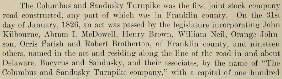
The Columbus and Sandusky Turnpike was the first joint stock company road constructed, any part of which was in Franklin county. On the 31st day of January, 1826, an act was passed by the legislature incorporating John Kilbourne, Abram I. McDowell, Henry Brown, William Neil, Orange Johnson, Orris Parish and Robert Brotherton, of Franklin county, and nineteen others, named in the act and residing along the line of the road in and about Delaware, Bucyrus and Sandusky, and their associates, by the name of "The Columbus and Sandusky Turnpike company," with a capital of one hundred
Text read by machine from the scan; it may contain errors.
Centennial history of Columbus and Franklin County, Ohio1909 · page 46Read the page →
Read the text
"Ordered, that all that part of Franklin county contained within the following limits and boundaries, to-wit : Beginning on the east bank of the Scioto river, at the intersection of the sectional line between the sections number ■eight and seventeen, in the fourth township and twenty-second range ; running thence with the said sectional line east, to the line between the counties of Fairfield and Franklin ; thence north with said line, and from the point of beginning, with the Scioto, to the northerly boundary of Franklin county, do constitute and make the fourth Township in Franklin county and be called Lib-
Text read by machine from the scan; it may contain errors.
Scans and text from the Internet Archive. Books published in 1930 or earlier, which are in the public domain.
Timeline
Franklin, 1823 to 1968
Woven from the archive, old maps, post office records, the National Register and the people born here.
In 1823, according to Wikipedia’s history of the town. Franklin’s post office opened in 1824, and the census of 1850 counted 882 people here.
How does Franklin rank for history?
Franklin is more historic than 79% of U.S. towns, #235 of 593 in Indiana. The History grade combines the town’s founding era, the share of homes built before 1940 and its National Register listings. It’s a character grade, so it isn’t part of the overall grade. How it works.
What is on the National Register in Franklin?
12 listings: 7 buildings, among them the Franklin College Library (Shirk Hall) (listed 1975, the first), 4 historic districts with 72 contributing buildings, and 1 site. 81 historic buildings in all.
How old are the homes in Franklin?
11% of Franklin’s homes were built before 1940 (Census estimate, ±1.8 points), against a typical 14% for an Indiana town; the median home was built in 1994.
Founding dates: Wikidata, Wikipedia, the U.S. post office records of Blevins & Helbock (CC0) and the Census. Homes by year built: Census ACS 2020–24. National Register of Historic Places: National Park Service (list of May 22, 2026). Old photos, postcards and papers: Wikimedia Commons, the Library of Congress and other public archives, credited on each item’s page. Maps: U.S. Geological Survey historical topographic maps (via Esri) and Sanborn fire-insurance maps (Library of Congress). History text and census tables: Wikipedia (CC BY-SA 4.0). Places that used to be: USGS Geographic Names Information System (2021).
From Wikimedia Commons (12), Wikidata (2), the National Register of Historic Places (12), Wikipedia, Wikidata and Wikipedia for famous people, U.S. Geological Survey historical maps, U.S. Census counts (via Wikipedia), the US Post Offices dataset (Blevins & Helbock), the USGS Geographic Names Information System, Sanborn fire insurance maps (Library of Congress) and old county and town histories (Internet Archive). Archive images are copied here with their credits and licenses, shown on each photo’s page. Refreshed monthly.










 Date?
 2026
 2022
 2022
 2013
 2010
 2009
 2008
 2006
 2006