Founding year: Wikipedia. First post office: 1853.The full story ↓
History grade
What drives Farmland’s History grade
On its age, its old homes and the National Register, Farmland is more historic than 82% of U.S. towns. Its share of homes from before 1940 holds the grade up; its age pulls it down.
A−
HistoryA character grade: shown, never part of Farmland’s overall grade.
Indiana towns list more on the Register than most of the country (a typical Indiana town has 7.9 per 10,000 residents, the U.S. 2.4), so Farmland’s 204 sits above most of its state (88% of Indiana towns have fewer) while its 26 historic buildings outnumber those of 81% of U.S. towns.
How sure. Graded on any two of the three inputs instead, the letter would range from B to A. The pre-1940 share is a Census survey estimate (±4.2 points). Two sources give 1852.
Founding year: Wikipedia (other dates in Quick answers). Homes: Census ACS 2020–24. National Register: National Park Service, May 2026 list; each listing counted once (boundary changes and added documentation belong to their listing), and a historic district counts its contributing buildings. How TownRatings grades history →
What stands out about Farmland’s past
Read from the archive, the National Register and the record. The page puts what stands out first.
Fire insurance maps drew every building, what it was made of and what it was used for, so insurers could price the risk of fire. Pick a year, then a sheet.
1893Sheet 1 of 1
Edition
Sheets
BrickWoodStone
Sanborn Map Company, via the Library of Congress. Editions published in 1930 or earlier, which are in the public domain.
On the National Register
1 listing protects 26 historic buildings
The country’s official list of buildings and places worth saving.
The Randolph County location has rolling hills, glacial features, and the Cabin Creek Raised Bog. Farmland was platted in 1852 when the railroad was extended to that point. The town most likely was so named on account of its fertile soil. A post office has been in operation at Farmland since 1853. Farmland was incorporated as a town in 1867.
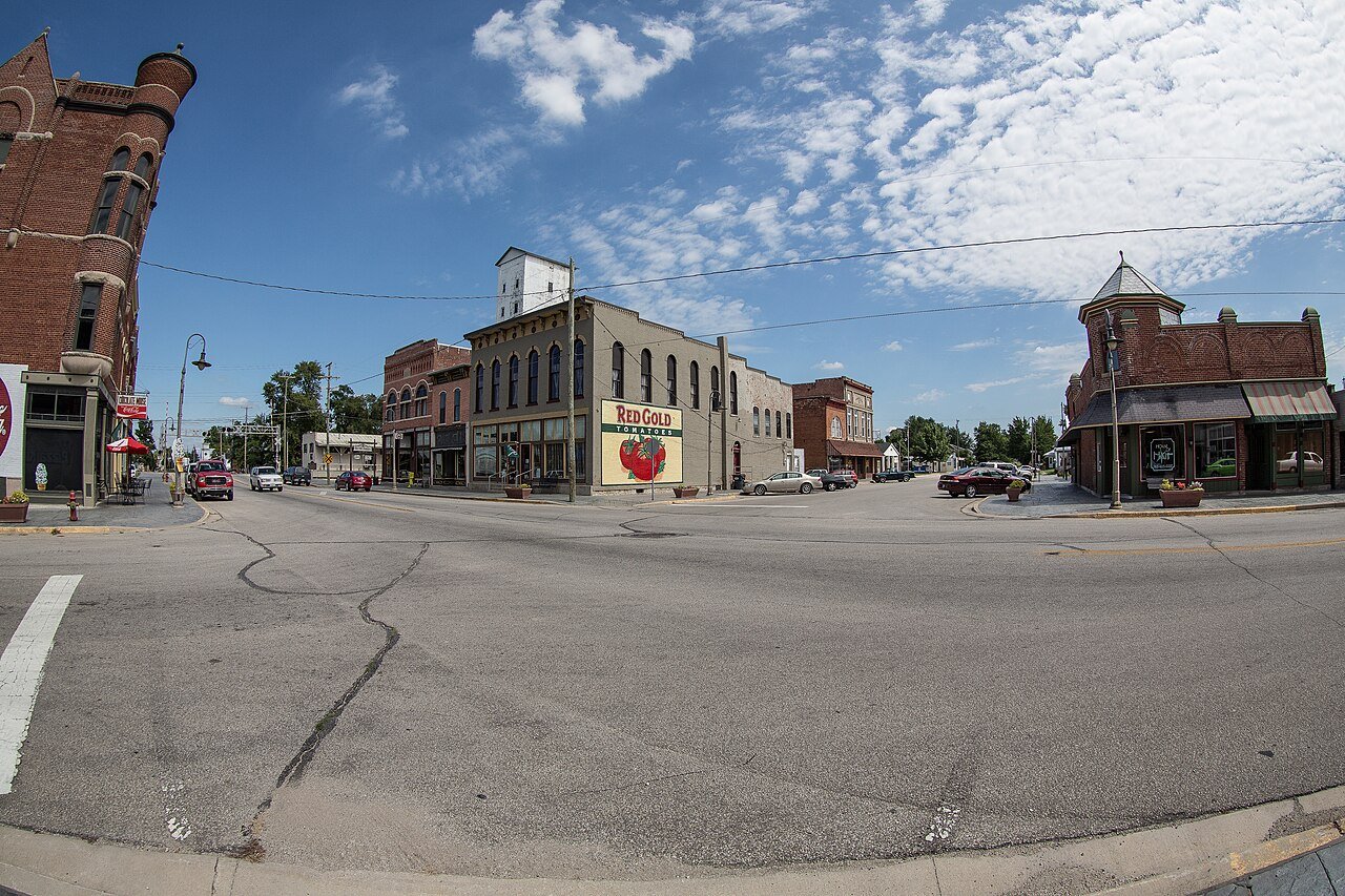
The Farmland Downtown Historic District was listed on the National Register of Historic Places in 1994.
A sign posted by the state highway department welcomes people to Farmland and notes that it is "The Home of Ansel Toney, The Kite Man".
Passages that mention Farmland, cut from the printed page as they were published.
History of Randolph County Indiana1882 · page 507Read the page →
Read the text
route of the railroad through the wilderness on the north side of owners were quick to reap their advantages therefrom. Three towns were laid out on the route of the railroad in that region— Morristown, Farmland and Royston. The latter was just one mile east of Farmland, and the success of Farmland was of course the doom of Royston. Royston never saw the light.
Text read by machine from the scan; it may contain errors.
HISTORY RANDOLPH COUNTY, INDIANA, Illustrations and Biographical Sketches WITH OF SOME OF ITS PROMINENT MEN AND PIONEERS, TO WHICH ARE APPENDED MAPS OF ITS SEVERAL TOWNSHIPS.1882 · page 64Read the page →
Read the text
There is a bridge across White River east of Winchester, and one on each of the pikes leading thence to Union City, one across White River northwest of Winchester, one still west of that, one south of Farmland, and one near Parker. ‘There is a large bridge across Stony Creek east of Windsor on the Winchester Pike. There are, of course, bridges innumerable across the several creeks that course through the county in various directions.
Text read by machine from the scan; it may contain errors.
HISTORY RANDOLPH COUNTY, INDIANA, Illustrations and Biographical Sketches WITH OF SOME OF ITS PROMINENT MEN AND PIONEERS, TO WHICH ARE APPENDED MAPS OF ITS SEVERAL TOWNSHIPS.1882 · page 511Read the page →
Read the text
Miss Mercy Shaw, daughter of Jonathan ani Elizabeth Shaw, of Wayne County, Ind., and again engaged in the pursuit of farming, which he-continued until after the close of the war. In 1866, he sold his farm and moved to the town of Farmland, where for the next ten years, he was associated with the firm of Robbins & Stanley. In 1877, he retired from active business life, except that he atill conducts a profitable insurance business, and discharges the duties of the office of Notary Public.
Text read by machine from the scan; it may contain errors.
History of Randolph County Indiana1882 · page 508Read the page →
Read the text
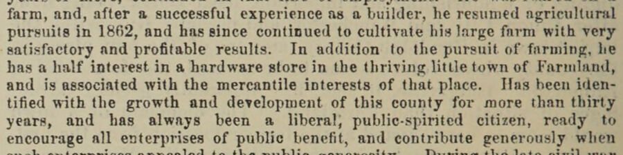
farm, and, after a successful experience as a builder, he resumed agricultural pursuits in 1862, and has since continued to cultivate his large farm with very satisfactory and profitable results. In addition to the pursuit of farming, he has a half interest in a hardware store in the thriving little town of Farmland, and is associated with the mercantile interests of that place. Has been identified with the growth and development of this county for more than thirty years, and has always been a liberal) public-spirited citizen, ready to encourage all enterprises of public benefit, and contribute generously when
Text read by machine from the scan; it may contain errors.
Scans and text from the Internet Archive. Books published in 1930 or earlier, which are in the public domain.
Timeline
Farmland, 1852 to 1952
Woven from the archive, old maps, post office records, the National Register and the people born here.
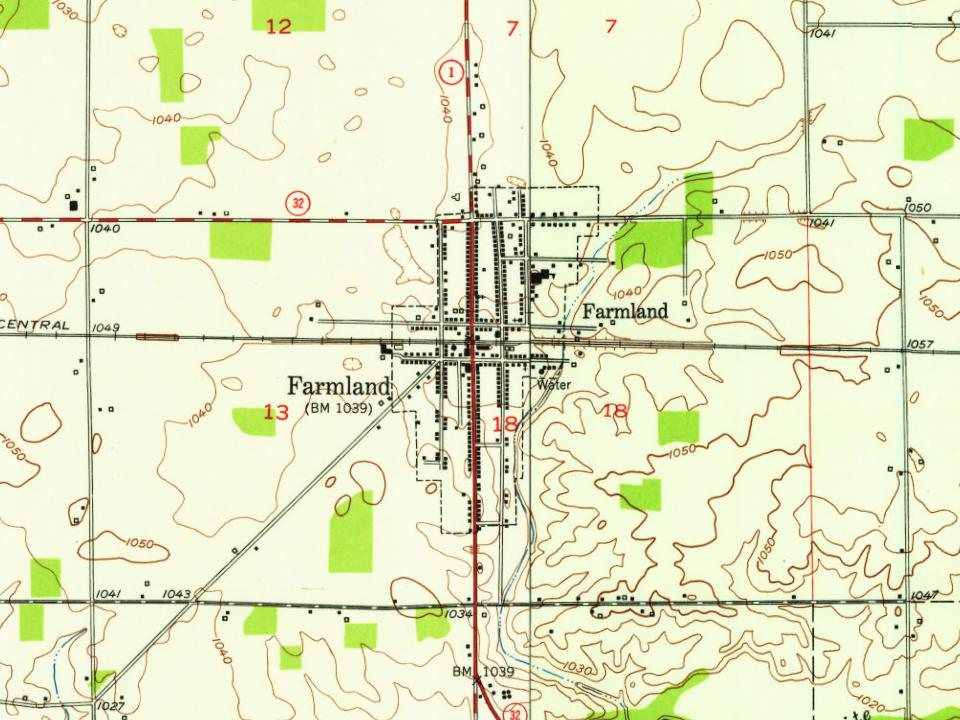
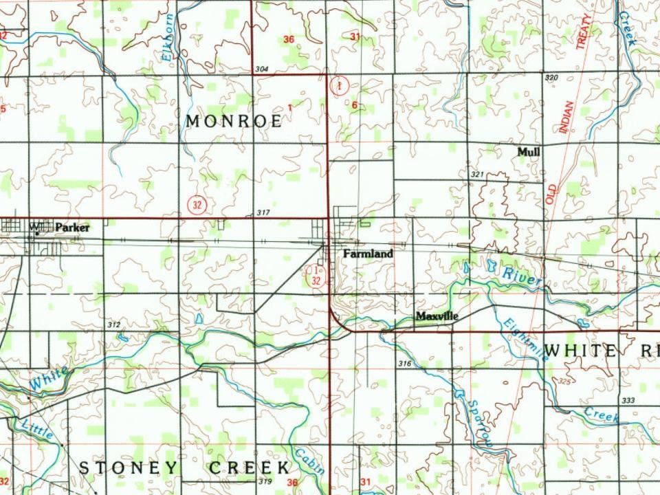
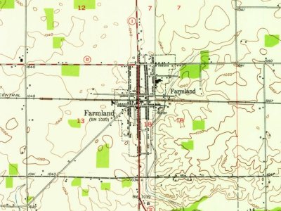
Every edition of the U.S. Geological Survey’s map of Farmland. Tap a year, or press play to watch the town change.
1952Farmland sheet · 1:24,000
U.S. Geological Survey historical topographic maps (public domain), via Esri’s collection of the scans. The red ring marks the center of Farmland.
People over time
Farmland, census by census
Between 532 and 1,560 people in every census since 1870.
16 censuses, 1870–2020.
U.S. Census Bureau decennial counts, from the census table on Farmland’s Wikipedia page.
Questions about Farmland’s history
What year was Farmland founded?
In 1852, according to Wikipedia’s history of the town. Farmland’s post office opened in 1853, and the census of 1870 counted 532 people here.
How does Farmland rank for history?
Farmland is more historic than 82% of U.S. towns. The History grade combines the town’s founding era, the share of homes built before 1940 and its National Register listings. It’s a character grade, so it isn’t part of the overall grade. How it works.
What is on the National Register in Farmland?
One place: the Farmland Downtown Historic District (listed 1994).
How old are the homes in Farmland?
34% of Farmland’s homes were built before 1940 (Census estimate, ±4.2 points), against a typical 14% for an Indiana town; the median home was built in 1959.
Founding dates: Wikidata, Wikipedia, the U.S. post office records of Blevins & Helbock (CC0) and the Census. Homes by year built: Census ACS 2020–24. National Register of Historic Places: National Park Service (list of May 22, 2026). Old photos, postcards and papers: Wikimedia Commons, the Library of Congress and other public archives, credited on each item’s page. Maps: U.S. Geological Survey historical topographic maps (via Esri) and Sanborn fire-insurance maps (Library of Congress). History text and census tables: Wikipedia (CC BY-SA 4.0). Places that used to be: USGS Geographic Names Information System (2021).
From Wikimedia Commons (1), the National Register of Historic Places (1), Wikipedia, Wikidata and Wikipedia for famous people, U.S. Geological Survey historical maps, U.S. Census counts (via Wikipedia), the US Post Offices dataset (Blevins & Helbock), the USGS Geographic Names Information System, Sanborn fire insurance maps (Library of Congress) and old county and town histories (Internet Archive). Archive images are copied here with their credits and licenses, shown on each photo’s page. Refreshed monthly.


 2016