Evansville dates to 1600, and 22% of its homes were built before 1940
More historic than 94% of U.S. towns · #80 of 593 in Indiana. What drives it
90 places in town are on the National Register, among them nine historic districts with 1,925 buildings between them. Below: 15 old photos and papers, maps from 1895 on, and the census since 1820.
Founding year: Wikipedia. First post office: 1818.The full story ↓
History grade
What drives Evansville’s History grade
On its age, its old homes and the National Register, Evansville is more historic than 94% of U.S. towns, #80 of 593 in Indiana. All 2 inputs are above most U.S. towns; its National Register listings ranks highest and its share of homes from before 1940 lowest.
A
HistoryA character grade: shown, never part of Evansville’s overall grade.
Among the 400 U.S. cities of 100,000 or more, Evansville ranks #47 on History.
Indiana towns list more on the Register than most of the country (a typical Indiana town has 7.9 per 10,000 residents, the U.S. 2.4), so Evansville’s 174 sits above most of its state (86% of Indiana towns have fewer) while its 2,020 historic buildings outnumber those of 99% of U.S. towns.
NoteThe founding year comes from Wikipedia alone; no second source gives 1600.
How sure. Graded on two of the three inputs, so a change in either one moves the letter more than it would with three. The pre-1940 share (±1.3 points) is firm at this size.
Founding year: Wikipedia (other dates in Quick answers). Homes: Census ACS 2020–24. National Register: National Park Service, May 2026 list; each listing counted once (boundary changes and added documentation belong to their listing), and a historic district counts its contributing buildings. How TownRatings grades history →
What stands out about Evansville’s past
Read from the archive, the National Register and the record. The page puts what stands out first.
There has been a continuous human presence in the area that became Evansville from at least 8000 BC by Paleo-Indians. Archaeologists have identified several archaic and ancient sites in and near Evansville, with the most complex at Angel Mounds. This was built and occupied from about AD 900 to about 1600, just before the arrival of Europeans to North America.
Passages that mention Evansville, cut from the printed page as they were published.
A history of Evansville and Vanderburgh County, Indiana1897 · page 68Read the page →
Read the text
Elisha Harrison as the first legislator from the said county. The .state legislature met at the town of Corydon, Ind., which was at that time the seat ot government of the state, and at this session of the legislature Mr. Harrison procured a charter for the town of Evansville. The first meeting of the trustees of the town of Evansville was held on Saturday, March 20, 1819, and the board of trustees consisted of the following names, to-wit : Hugh McGary, president ; Isaac Fairchild, Everton Kennerley, Alanson Warner, Francis J. Bfentley, Elisha
Text read by machine from the scan; it may contain errors.
Scans and text from the Internet Archive. Books published in 1930 or earlier, which are in the public domain.
By decade
Evansville, decade by decade
4 decades in the archive, from the 1860s to the 1900s. Scroll each row; tap a photo for its story.
Nothing in the archives for these yearsWeddings on Main Street, storms, parades, school pictures, the old store. If it’s in your family album, it belongs here.
Every edition of the U.S. Geological Survey’s map of Evansville. Tap a year, or press play to watch the town change.
1916Henderson sheet · 1:62,500
U.S. Geological Survey historical topographic maps (public domain), via Esri’s collection of the scans. The red ring marks the center of Evansville.
Every building
Evansville, building by building, 1895–1910
Fire insurance maps drew every building, what it was made of and what it was used for, so insurers could price the risk of fire. Pick a year, then a sheet.
Lost post offices, old corners, places now gone and burying grounds
Evansville’s post office has been open since 1818. Two other post offices opened and closed inside today’s town.
Evansville
1818–today
Mechanicsville
1829–1879
Zipp
1881–1902
18101920today
Hamlets and corners on the map
Country Club MeadowsForest HillHarwoodHighlandKratzvilleLakewood HillsMud CenterRed BankSmytheStringtown
Gone or out of use
Executive Inn AirportairportHoward Roosa Elementary and Junior High SchoolschoolHoward Roosa SchoolschoolKnight Township Fire Department Company 6buildingRex Mundi High SchoolschoolWelborn Memorial Baptist Hospital Airportairport
6cemeteries and burying grounds inside Evansville
Locust HillMount CarmelOak Hill Cemetery and ArboretumOates Memorial ParkPark LawnRose Hill
US Post Offices dataset (Blevins & Helbock, CC0). Places and cemeteries from the USGS Geographic Names Information System (2021).
Help out
Finish Evansville’s story
Most archives stop around 1920. The photos from after that are in family albums, not libraries.
Decades since 1900 with photos
00s10s20s30s40s50s60s70s80s90s
1 of 10 decades. The empty ones are waiting for someone’s album.
In 1600, according to Wikipedia’s history of the town. Evansville’s post office opened in 1818, and the census of 1820 counted 993 people here.
How does Evansville rank for history?
Evansville is more historic than 94% of U.S. towns, #80 of 593 in Indiana. The History grade combines the town’s founding era, the share of homes built before 1940 and its National Register listings. It’s a character grade, so it isn’t part of the overall grade. How it works.
What is on the National Register in Evansville?
90 listings: 79 buildings, among them the Old Vanderburgh County Courthouse (listed 1970, the first), 9 historic districts with 1,925 contributing buildings, 2 sites, and 2 structures. 2,020 historic buildings in all.
How old are the homes in Evansville?
22% of Evansville’s homes were built before 1940 (Census estimate, ±1.3 points), against a typical 14% for an Indiana town; the median home was built in 1961.
Founding dates: Wikidata, Wikipedia, the U.S. post office records of Blevins & Helbock (CC0) and the Census. Homes by year built: Census ACS 2020–24. National Register of Historic Places: National Park Service (list of May 22, 2026). Old photos, postcards and papers: Wikimedia Commons, the Library of Congress and other public archives, credited on each item’s page. Maps: U.S. Geological Survey historical topographic maps (via Esri) and Sanborn fire-insurance maps (Library of Congress). History text and census tables: Wikipedia (CC BY-SA 4.0). Places that used to be: USGS Geographic Names Information System (2021).
From Wikimedia Commons (11), the Library of Congress (4), Wikidata (3), the National Register of Historic Places (92), Wikipedia, Wikidata and Wikipedia for famous people, U.S. Geological Survey historical maps, U.S. Census counts (via Wikipedia), the US Post Offices dataset (Blevins & Helbock), the USGS Geographic Names Information System, Sanborn fire insurance maps (Library of Congress) and old county and town histories (Internet Archive). Archive images are copied here with their credits and licenses, shown on each photo’s page. Refreshed monthly.


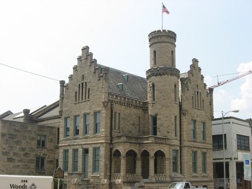


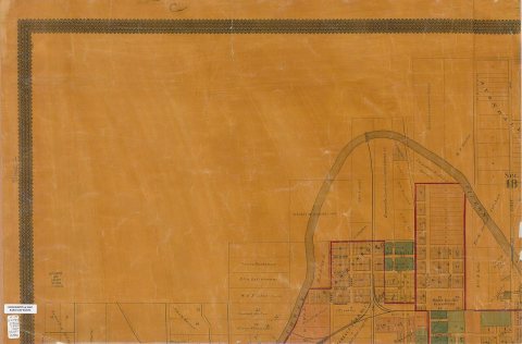


 1880
 1884
 1884
 1888
 1890
 1890
 1890
 1899
 1899
 1907
 1907


