The original plat of the town of Elizabeth was recorded on April 17, 1812. It was witnessed by Sheriff John Tipton. The land for the town was donated by Capt. Jacob Zenor and wife Suzannah Muchendorffer Zenor. The town is named after Jacob's daughter-in-law Elizabeth Lemmon Zenor wife of George Zenor.
Rose Hill Cemetery, the second-largest cemetery in the county, is located on the west side of the town. The land for the cemetery was donated by Jacob Zenor and wife, with the only rule being that burial be made available regardless of the religious denomination of the deceased.
Passages that mention Elizabeth, cut from the printed page as they were published.
History of Hampton and Elizabeth City County, Virginia1922Read the page →
Read the text
The commercial and religious interests of Elizabeth City County were not the only ones which suffered by war. After peace was made in 1783, the ancient schools of Syms and Eaton were much neglected, for, under the changed state of affairs, the ministers and churchwardens fo Elizabeth City parish, and even the justices, doubted their true succession as incorporators. Thus the lands were again wasted, and the schools much impaired. At length, in
Text read by machine from the scan; it may contain errors.
History of Hampton and Elizabeth City County, Virginia1922Read the page →
Read the text
The Church Steeple and Bell In 1760, Alexander Kennedy devised land to the poor of Elizabeth City County, and the sum of 40 pds. sterling towards purchasing out of England a bell for the church of Elizabeth City Parish, provided ''the vestry and church wardens will undertake a belfry within twelve months after my decease." A vestry book tells of the contracts awarded for building and painting the Belfry, and no doubt the bell
Text read by machine from the scan; it may contain errors.
Scans and text from the Internet Archive. Books published in 1930 or earlier, which are in the public domain.
Timeline
Elizabeth, 1812 to 1983
Woven from the archive, old maps, post office records, the National Register and the people born here.
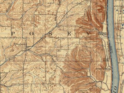
Founding dates: Wikidata, Wikipedia, the U.S. post office records of Blevins & Helbock (CC0) and the Census. Homes by year built: Census ACS 2020–24. National Register of Historic Places: National Park Service (list of May 22, 2026). Old photos, postcards and papers: Wikimedia Commons, the Library of Congress and other public archives, credited on each item’s page. Maps: U.S. Geological Survey historical topographic maps (via Esri) and Sanborn fire-insurance maps (Library of Congress). History text and census tables: Wikipedia (CC BY-SA 4.0). Places that used to be: USGS Geographic Names Information System (2021). How TownRatings grades history →
From Wikimedia Commons (3), Wikipedia, Wikidata and Wikipedia for famous people, U.S. Geological Survey historical maps, U.S. Census counts (via Wikipedia), the US Post Offices dataset (Blevins & Helbock), the USGS Geographic Names Information System and old county and town histories (Internet Archive). Archive images are copied here with their credits and licenses, shown on each photo’s page. Refreshed monthly.


 2016
 2016
 2016