28% of Deer Creek Township’s homes were built before 1940
More historic than 98% of U.S. towns · #20 of 593 in Indiana. What drives it
19 places in town are on the National Register, among them two historic districts with 47 buildings between them. Below: maps from 1962 on and old-book passages.
On its age, its old homes and the National Register, Deer Creek Township is more historic than 98% of U.S. towns, #20 of 593 in Indiana. All 2 inputs are above most U.S. towns; its National Register listings ranks highest and its share of homes from before 1940 lowest.
A+
HistoryA character grade: shown, never part of Deer Creek Township’s overall grade.
Indiana towns list more on the Register than most of the country (a typical Indiana town has 7.9 per 10,000 residents, the U.S. 2.4), so Deer Creek Township’s 819 sits above most of its state (98% of Indiana towns have fewer) while its 380 historic buildings outnumber those of 96% of U.S. towns.
How sure. Graded on two of the three inputs, so a change in either one moves the letter more than it would with three. The pre-1940 share is a Census survey estimate (±6.8 points).
Founding year: our sources. Homes: Census ACS 2020–24. National Register: National Park Service, May 2026 list; each listing counted once (boundary changes and added documentation belong to their listing), and a historic district counts its contributing buildings. How TownRatings grades history →
What stands out about Deer Creek Township’s past
Read from the archive, the National Register and the record. The page puts what stands out first.
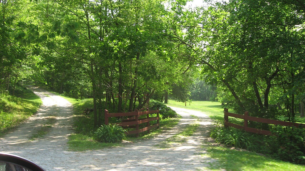
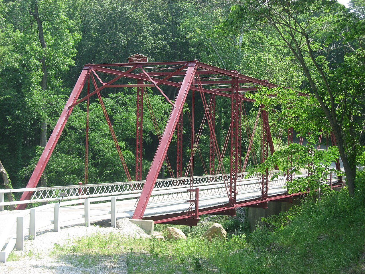
The Baum-Shaeffer Farm, Carrollton Bridge, Deer Creek Valley Rural Historic District, Delphi Lime Kilns, Lock No. 33 Lock Keeper's House, and Wabash and Erie Canal Lock No. 33, Fred and Minnie Raber Farm, Sunset Point, and Wilson Bridge are listed on the National Register of Historic Places.
Passages that mention Deer Creek Township, cut from the printed page as they were published.
History of Carroll County, Indiana1882 · page 148Read the page →
Read the text
Outside of what is now Deer Creek Township, the first schools and schoolhouses in the county were, probably, in the Paint Creek and Bachelors' Run settlements, within the present geographical limits of Jackson Township. It it? stated upon good authority, that, about the year 1831, a respectable hewedlog house was constructed on Paint Creek, and used for the double purpose of a meeting-house for the Paint Creek Baptist (Jhiu'ch, and for a schoolhouse, also. Not far from the same period, the patrons of
Text read by machine from the scan; it may contain errors.
History of Carroll County, Indiana1882 · page 259Read the page →
Read the text
Again, in 1810. he removed his family to what has since become Wayne County. State of Indiana, and finally, in 1825. to the Wabash Valley, locating upon the farm now owned by John D. Wilson & Bros., of Deer Creek Township, this county. Death robbed him of his companion May 20. 1826, and he departed this life April 17, 1845, at the home of his son-in-law, Isaac Jackson, also of Deer Creek Township.
Text read by machine from the scan; it may contain errors.
Scans and text from the Internet Archive. Books published in 1930 or earlier, which are in the public domain.
Every edition of the U.S. Geological Survey’s map of Deer Creek Township. Tap a year, or press play to watch the town change.
1962Flora sheet · 1:24,000
U.S. Geological Survey historical topographic maps (public domain), via Esri’s collection of the scans. The red ring marks the center of Deer Creek Township.
Famous people
Famous people close to Deer Creek Township
Nobody well known was born in Deer Creek Township itself, so here are the best known from just nearby.
Deer Creek Township is more historic than 98% of U.S. towns, #20 of 593 in Indiana. The History grade combines the town’s founding era, the share of homes built before 1940 and its National Register listings. It’s a character grade, so it isn’t part of the overall grade. How it works.
What is on the National Register in Deer Creek Township?
19 listings: 2 buildings, 2 historic districts, the Fred and Minnie Raber Farm and the Deer Creek Valley Rural Historic District, with 47 contributing buildings, 1 site, and 2 structures. 380 historic buildings in all.
How old are the homes in Deer Creek Township?
28% of Deer Creek Township’s homes were built before 1940 (Census estimate, ±6.8 points), against a typical 14% for an Indiana town; the median home was built in 1972.
Founding dates: Wikidata, Wikipedia, the U.S. post office records of Blevins & Helbock (CC0) and the Census. Homes by year built: Census ACS 2020–24. National Register of Historic Places: National Park Service (list of May 22, 2026). Old photos, postcards and papers: Wikimedia Commons, the Library of Congress and other public archives, credited on each item’s page. Maps: U.S. Geological Survey historical topographic maps (via Esri) and Sanborn fire-insurance maps (Library of Congress). History text and census tables: Wikipedia (CC BY-SA 4.0). Places that used to be: USGS Geographic Names Information System (2021).
From Wikimedia Commons (2), the National Register of Historic Places (7), Wikipedia, U.S. Geological Survey historical maps, the USGS Geographic Names Information System and old county and town histories (Internet Archive). Archive images are copied here with their credits and licenses, shown on each photo’s page. Refreshed monthly.





 2013
 2009


