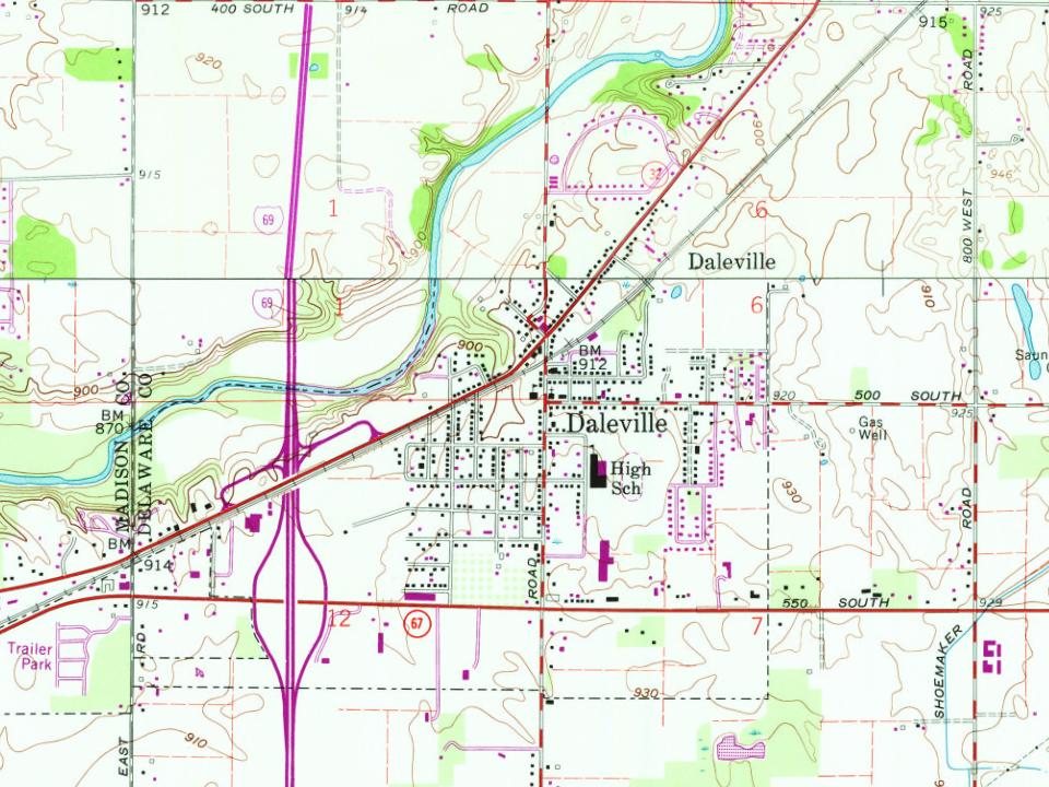
Founding year: Wikipedia. First post office: 1857.The full story ↓
History grade
What drives Daleville’s History grade
On its age, its old homes and the National Register, Daleville is more historic than 57% of U.S. towns. Its age holds the grade up; its National Register listings pull it down.
B
HistoryA character grade: shown, never part of Daleville’s overall grade.
Indiana towns list more on the Register than most of the country (a typical Indiana town has 7.9 per 10,000 residents, the U.S. 2.4), so Daleville’s 0.0 sits below most of its state (22% of Indiana towns have fewer) while its 0 listings outnumber those of 23% of U.S. towns.
How sure. Graded on any two of the three inputs instead, the letter would range from C+ to A−. The pre-1940 share is a Census survey estimate (±5.3 points). Two sources give 1838.
Founding year: Wikipedia (other dates in Quick answers). Homes: Census ACS 2020–24. National Register: National Park Service, May 2026 list; each listing counted once (boundary changes and added documentation belong to their listing), and a historic district counts its contributing buildings. How TownRatings grades history →
What stands out about Daleville’s past
Read from the archive, the National Register and the record. The page puts what stands out first.
Passages that mention Daleville, cut from the printed page as they were published.
A twentieth century history of Delaware County, Indiana1908 · page 98Read the page →
Read the text
The village of Daleville takes its name from the Dale family. Campbell Dale had entered land in that locality in 1827, and his sons platted the village. Where the principal north and south street of the village crosses the Muncie road, a two story frame building had been erected about 1845 and used for a tavern by Abraham Pugsley. One or two mercantile enterprises had been started here at an earlier date, but the town had no real permanence until the railroad was built in the early fifties.
Text read by machine from the scan; it may contain errors.
A twentieth century history of Delaware County, Indiana1908 · page 440Read the page →
Read the text
The early history of Daleville Methodism in Daleville and vicinity belongs with the Mount Zion, Yorktown and other congregations of that vicinity. The Daleville M. E. church was organized August 16, 1894, at the home of J. C. Dale. Strong opposition tried to defeat the purposes of those whose hearts were set on this church, but since its organization the church has been prosperous. At the first meeting H. N. Herrick was presiding elder, and Rev. Thomas Petty, a local preacher, was presiding pastor. The first members, all of whom are living, were Mrs. Allie Dale, Mrs. Julia
Text read by machine from the scan; it may contain errors.
Scans and text from the Internet Archive. Books published in 1930 or earlier, which are in the public domain.
In 1838, according to Wikipedia’s history of the town. Daleville’s post office opened in 1857, and the census of 1880 counted 297 people here.
How does Daleville rank for history?
Daleville is more historic than 57% of U.S. towns. The History grade combines the town’s founding era, the share of homes built before 1940 and its National Register listings. It’s a character grade, so it isn’t part of the overall grade. How it works.
How old are the homes in Daleville?
17% of Daleville’s homes were built before 1940 (Census estimate, ±5.3 points), against a typical 14% for an Indiana town; the median home was built in 1964.
Founding dates: Wikidata, Wikipedia, the U.S. post office records of Blevins & Helbock (CC0) and the Census. Homes by year built: Census ACS 2020–24. National Register of Historic Places: National Park Service (list of May 22, 2026). Old photos, postcards and papers: Wikimedia Commons, the Library of Congress and other public archives, credited on each item’s page. Maps: U.S. Geological Survey historical topographic maps (via Esri) and Sanborn fire-insurance maps (Library of Congress). History text and census tables: Wikipedia (CC BY-SA 4.0). Places that used to be: USGS Geographic Names Information System (2021).
From Wikimedia Commons (3), Wikipedia, Wikidata and Wikipedia for famous people, U.S. Geological Survey historical maps, U.S. Census counts (via Wikipedia), the US Post Offices dataset (Blevins & Helbock), the USGS Geographic Names Information System and old county and town histories (Internet Archive). Archive images are copied here with their credits and licenses, shown on each photo’s page. Refreshed monthly.




 Date?
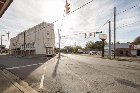 2016
 2012