Cynthiana was named for Cynthiana, Kentucky, from whence on September 25, 1815, a group of 44 settlers had come. More settlers from the same area continued to migrate to the area over the following several years. On March 6, 1817, the town was laid out by William Davis, with the plat being recorded on March 17, 1817. It was not until April 22, 1896, that the town incorporated.
On September 23, 1815, Thomas Duncan had made a land entry for the SE 1/4 of Section 11, Township 4 South, Range 11 West of the Second Principal Meridian, receiving a patent to the land on December 20, 1817. It was on March 24, 1818, that he sold the 58½ acres for the townsite of Cynthiana to William Davis.
Passages that mention Cynthiana, cut from the printed page as they were published.
History of Posey County, Indiana1913 · page 117Read the page →
Read the text
The town of Cynthiana was laid out March 6, 1817, by William Davis, who, with about forty others, came from the vicinity of Cynthiana, Ky. Almost the entire colony settled in the neighborhood. It was laid out with a public square which still remains unoccupied, as the conditions were that it shall remain to the public so long as kept for public purposes exclusively. The growth of the town was very slow, a great many of the original lots remaining unimproved sixty years later.
Text read by machine from the scan; it may contain errors.
History of Posey County, Indiana1886 · page 407Read the page →
Read the text
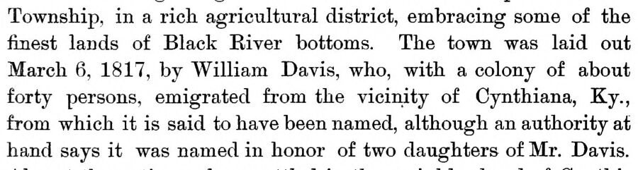
Township, in a rich agricultural district, embracing some of the finest lands of Black Eiver bottoms. The town was laid out March 6, 1817, by William Davis, who, with a colony of about forty persons, emigrated from the vicinity of Cynthiana, Ky., from which it is said to have been named, although an authority at hand says it was named in honor of two daughters of Mr. Davis.
Text read by machine from the scan; it may contain errors.
History of Posey County, Indiana1886 · page 284Read the page →
Read the text
the coat as a memento of the event, and it is regarded as a great curiosity. On the 25th of September, 1815, the settlement of the township received quite an impetus by the arrival of a colony of forty-four persons from the vicinity of Cynthiana, Ky. They located about one mile from Poseyville, near the site of the famous Sulphur Springs waters, which it may be remarked parenthetically, though they bring not immortal youth, are fast becoming recognized as a powerful remedial agent in the cure of
Text read by machine from the scan; it may contain errors.
History of Posey County, Indiana1913 · page 279Read the page →
Read the text
C, Virginia, John H. and Elias W. Enoch Beal Bixler was reared on the home farm in Vanderburg county and acquired his education in its district schools and in Cynthiana, being a pupil in the first school house erected in that town. Subsequently he engaged in teaching. He was engaged in this profession for eight years, six in Armstrong township, Vanderburg county, and two in Smith township, Posey county. He next engaged in farming and stock raising, an occupation in which he has been signally successful. His eight years as a teacher has had much
Text read by machine from the scan; it may contain errors.
Scans and text from the Internet Archive. Books published in 1930 or earlier, which are in the public domain.
Timeline
Cynthiana, 1817 to 1980
Woven from the archive, old maps, post office records, the National Register and the people born here.
Founding dates: Wikidata, Wikipedia, the U.S. post office records of Blevins & Helbock (CC0) and the Census. Homes by year built: Census ACS 2020–24. National Register of Historic Places: National Park Service (list of May 22, 2026). Old photos, postcards and papers: Wikimedia Commons, the Library of Congress and other public archives, credited on each item’s page. Maps: U.S. Geological Survey historical topographic maps (via Esri) and Sanborn fire-insurance maps (Library of Congress). History text and census tables: Wikipedia (CC BY-SA 4.0). Places that used to be: USGS Geographic Names Information System (2021). How TownRatings grades history →
From Wikimedia Commons (1), Wikipedia, Wikidata and Wikipedia for famous people, U.S. Geological Survey historical maps, U.S. Census counts (via Wikipedia), the US Post Offices dataset (Blevins & Helbock), the USGS Geographic Names Information System and old county and town histories (Internet Archive). Archive images are copied here with their credits and licenses, shown on each photo’s page. Refreshed monthly.




 2016