Crawfordsville’s post office opened in 1820, and 30% of its homes were built before 1940
More historic than 95% of U.S. towns · #70 of 593 in Indiana. What drives it
13 places in town are on the National Register, among them 2 National Historic Landmarks and two historic districts with 242 buildings between them. Below: 3 old photos and papers, maps from 1887 on, and the census since 1840.
Founding year: the first Crawfordsville post office (Blevins & Helbock, CC0).The full story ↓
History grade
What drives Crawfordsville’s History grade
On its age, its old homes and the National Register, Crawfordsville is more historic than 95% of U.S. towns, #70 of 593 in Indiana. All 3 inputs are above most U.S. towns; its National Register listings ranks highest and its age lowest.
A
HistoryA character grade: shown, never part of Crawfordsville’s overall grade.
Indiana towns list more on the Register than most of the country (a typical Indiana town has 7.9 per 10,000 residents, the U.S. 2.4), so Crawfordsville’s 155 sits above most of its state (85% of Indiana towns have fewer) while its 255 historic buildings outnumber those of 95% of U.S. towns.
How sure. Graded on any two of the three inputs instead, the letter would still be A. The pre-1940 share is a Census survey estimate (±4.2 points). The founding year is the first post office, not a stated founding date.
Founding year: the first post office (other dates in Quick answers). Homes: Census ACS 2020–24. National Register: National Park Service, May 2026 list; each listing counted once (boundary changes and added documentation belong to their listing), and a historic district counts its contributing buildings. How TownRatings grades history →
What stands out about Crawfordsville’s past
Read from the archive, the National Register and the record. The page puts what stands out first.
In 1813, Williamson Dunn, Henry Ristine, and Major Ambrose Whitlock, U.S. Army, noted that the site of present-day Crawfordsville was ideal for settlement, surrounded by deciduous forest and potentially arable land, with water provided by a nearby creek, later named Sugar Creek, that was a southern tributary of the Wabash River. They returned a decade later to find at least one cabin had been built in the area. In 1821, William and Jennie Offield had built a cabin on a little creek, later to be known as Offield Creek, four miles (6.4 km) southwest of the future site of Crawfordsville.
Passages that mention Crawfordsville, cut from the printed page as they were published.
History of Montgomery county, Indiana1911 · page 246Read the page →
Read the text
Fred B. Robinson was educated in the Crawfordsville schools, and when a young man he learned photography under Willis, completing the same in 1889, having become ah expert in this line, which he followed with much success in Crawfordsville and Veedersburg, Indiana, and Champaign and Galesburg, Illinois. Returning to Crawfordsville in 1905, he took a position with the Crawfordsville Water & Gas Company, which he filled with credit and satisfaction until 1909, when he was elected city clerk, taking office on January I, 1910, and is now serving a four-year term, giving the utmost satis-
Text read by machine from the scan; it may contain errors.
tinued his work in the church. At the state meeting held at Connersville, in June, 1842, he was one of four who were appointed to labor throughout the state in behalf of this church, but he was later forced to resign on account of failing health. In the spring of 1844 he located at Crawfordsville, Montgomery county, and resumed the practice of medicine in connection with preaching. For years past he had devoted his leisure hours to the improvement of his education — especially to the study of natural science; and his residence in Crawfordsville he made equivalent to a regular course in college.
Text read by machine from the scan; it may contain errors.
Scans and text from the Internet Archive. Books published in 1930 or earlier, which are in the public domain.
Timeline
Crawfordsville, 1820 to 2023
Woven from the archive, old maps, post office records, the National Register and the people born here.
Nothing in the archives for these yearsWeddings on Main Street, storms, parades, school pictures, the old store. If it’s in your family album, it belongs here.
The U.S. Geological Survey’s map of Crawfordsville.
1984Lafayette sheet · 1:100,000
U.S. Geological Survey historical topographic maps (public domain), via Esri’s collection of the scans. The red ring marks the center of Crawfordsville.
Every building
Crawfordsville, building by building, 1887–1913
Fire insurance maps drew every building, what it was made of and what it was used for, so insurers could price the risk of fire. Pick a year, then a sheet.
Crawfordsville’s post office has been open since 1820.
Hamlets and corners on the map
AmesFiskville
3cemeteries and burying grounds inside Crawfordsville
CalvaryIndependent Order of Odd FellowsOld Town
US Post Offices dataset (Blevins & Helbock, CC0). Places and cemeteries from the USGS Geographic Names Information System (2021).
Questions about Crawfordsville’s history
What year was Crawfordsville founded?
The Crawfordsville post office opened in 1820, the earliest record of the town by name (U.S. post office records).
How does Crawfordsville rank for history?
Crawfordsville is more historic than 95% of U.S. towns, #70 of 593 in Indiana. The History grade combines the town’s founding era, the share of homes built before 1940 and its National Register listings. It’s a character grade, so it isn’t part of the overall grade. How it works.
What is on the National Register in Crawfordsville?
13 listings, 2 of them National Historic Landmarks: 11 buildings, among them the Montgomery County Jail and Sheriff's Residence (a National Historic Landmark since 2023) and the Wallace, Gen. Lew, Study (listed 1976, the first), and 2 historic districts, the Crawfordsville Commercial Historic District and the Elston Grove Historic District, with 242 contributing buildings. 255 historic buildings in all.
How old are the homes in Crawfordsville?
30% of Crawfordsville’s homes were built before 1940 (Census estimate, ±4.2 points), against a typical 14% for an Indiana town; the median home was built in 1964.
Founding dates: Wikidata, Wikipedia, the U.S. post office records of Blevins & Helbock (CC0) and the Census. Homes by year built: Census ACS 2020–24. National Register of Historic Places: National Park Service (list of May 22, 2026). Old photos, postcards and papers: Wikimedia Commons, the Library of Congress and other public archives, credited on each item’s page. Maps: U.S. Geological Survey historical topographic maps (via Esri) and Sanborn fire-insurance maps (Library of Congress). History text and census tables: Wikipedia (CC BY-SA 4.0). Places that used to be: USGS Geographic Names Information System (2021).
From Wikimedia Commons (6), the National Register of Historic Places (13), Wikipedia, Wikidata and Wikipedia for famous people, U.S. Geological Survey historical maps, U.S. Census counts (via Wikipedia), the US Post Offices dataset (Blevins & Helbock), the USGS Geographic Names Information System, Sanborn fire insurance maps (Library of Congress) and old county and town histories (Internet Archive). Archive images are copied here with their credits and licenses, shown on each photo’s page. Refreshed monthly.


 ★ Landmark
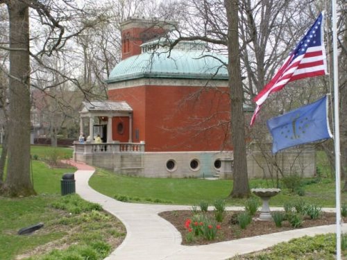 ★ Landmark


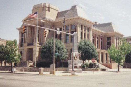


 2009
 2007
 2007


